System and method for quickly establishing geographic information data application
A technology of geographic information data and geographic information, which is applied in the field of rapidly building geographic information data applications, and can solve problems such as application systems that cannot meet application requirements
- Summary
- Abstract
- Description
- Claims
- Application Information
AI Technical Summary
Problems solved by technology
Method used
Image
Examples
Embodiment Construction
[0033] Specific embodiments of the present invention will be further described in detail below in conjunction with the accompanying drawings.
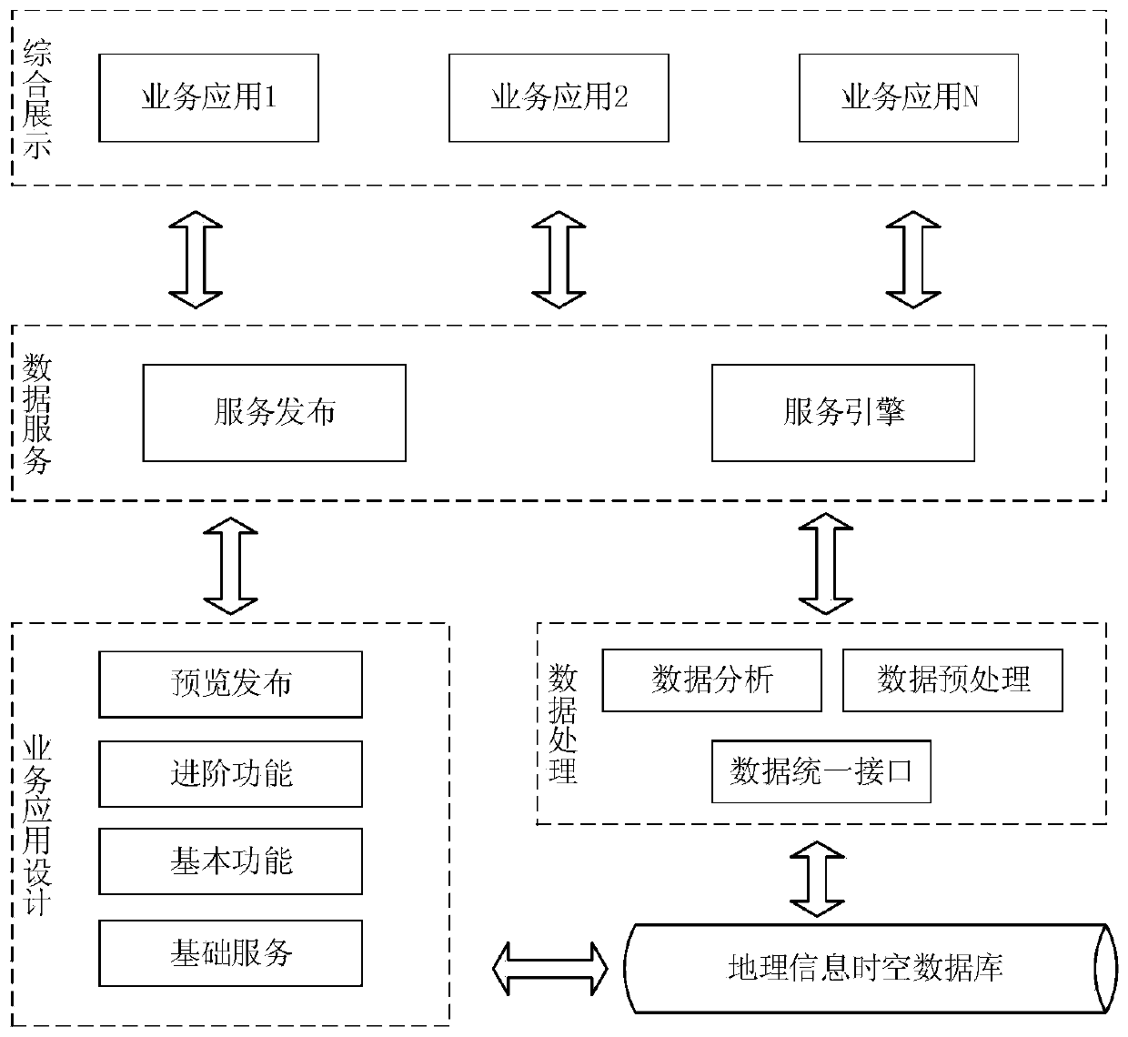
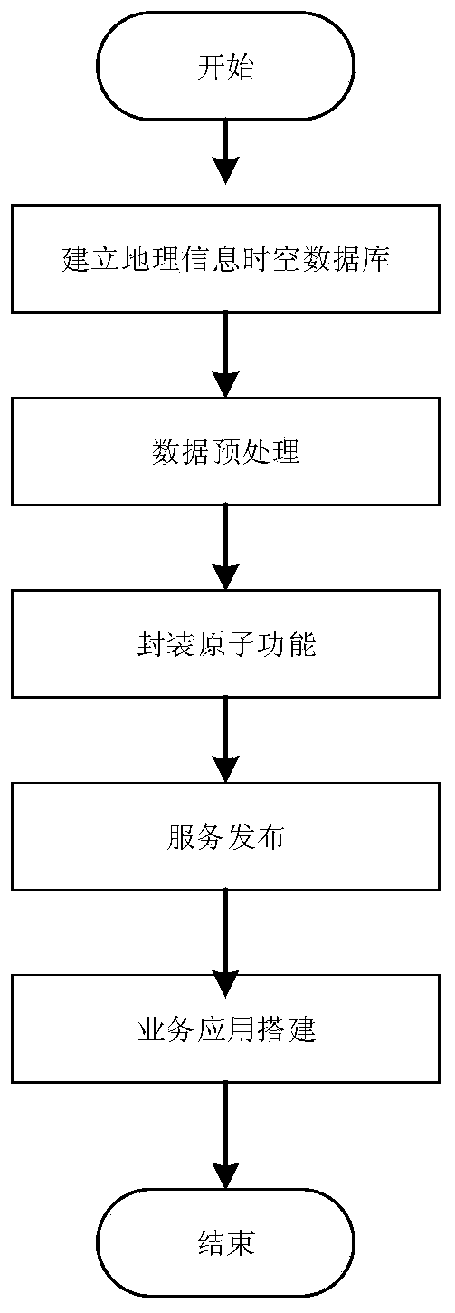
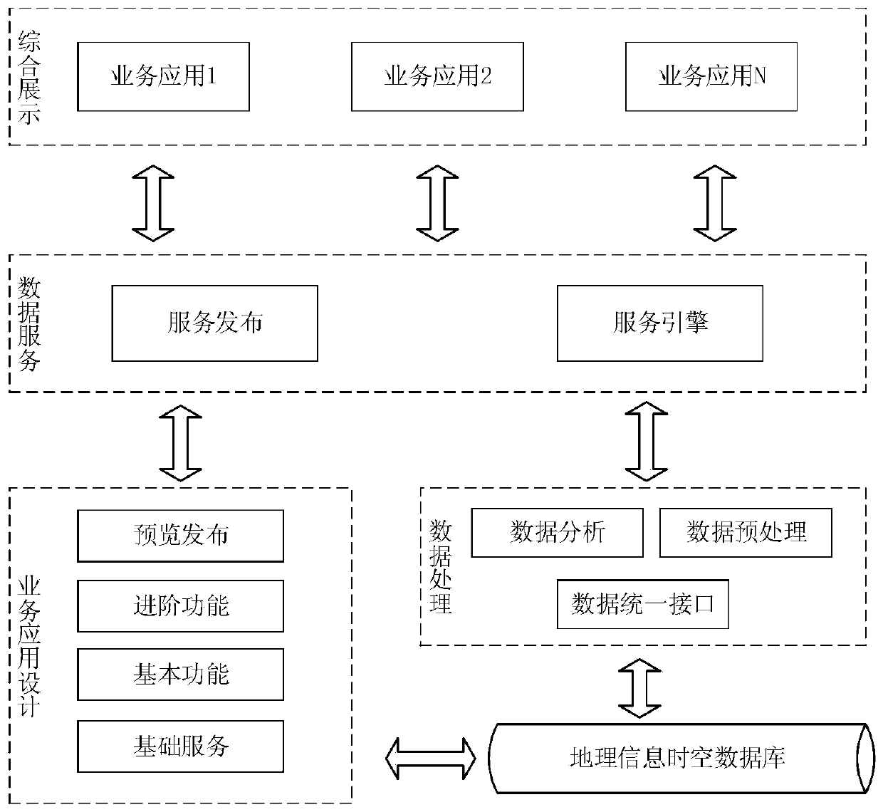
[0034] Such as figure 1 As shown, a system for quickly building geographic information data applications includes geographic information spatiotemporal database, data processing module, data service module, business application design module, and comprehensive display module. Based on the WEB architecture, it can be customized independently on the basis of the general display framework to realize different business application display functions and user interfaces.
[0035] 1. Spatio-temporal database of geographic information
[0036] It is used to store all kinds of original electronic map data based on location information.
[0037] The original electronic map data includes aerial images, satellite images, panoramic images, lidar data, vector maps and three-dimensional models.
[0038] 2. Data processing module
[0039] Preproce...
PUM
 Abstract
Description
Claims
Application Information
 - R&D
- Intellectual Property
- Life Sciences
- Materials
- Tech Scout
- Unparalleled Data Quality
- Higher Quality Content
- 60% Fewer Hallucinations
Browse by: Latest US Patents, China's latest patents, Technical Efficacy Thesaurus, Application Domain, Technology Topic, Popular Technical Reports.
© 2025 PatSnap. All rights reserved.Legal|Privacy policy|Modern Slavery Act Transparency Statement|Sitemap|About US| Contact US: help@patsnap.com


