Self-stabilization type high-precision sediment bed load measuring system and measuring method
A measurement system and measurement method technology, applied in the direction of measurement devices, machine/structural component testing, flow characteristics, etc., can solve problems such as large disturbance, poor fixation of measuring instruments, lack of automation, real-time digitalization, etc.
- Summary
- Abstract
- Description
- Claims
- Application Information
AI Technical Summary
Problems solved by technology
Method used
Image
Examples
Embodiment 1
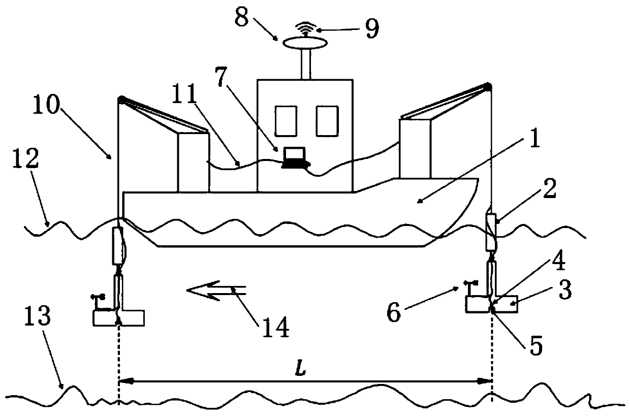
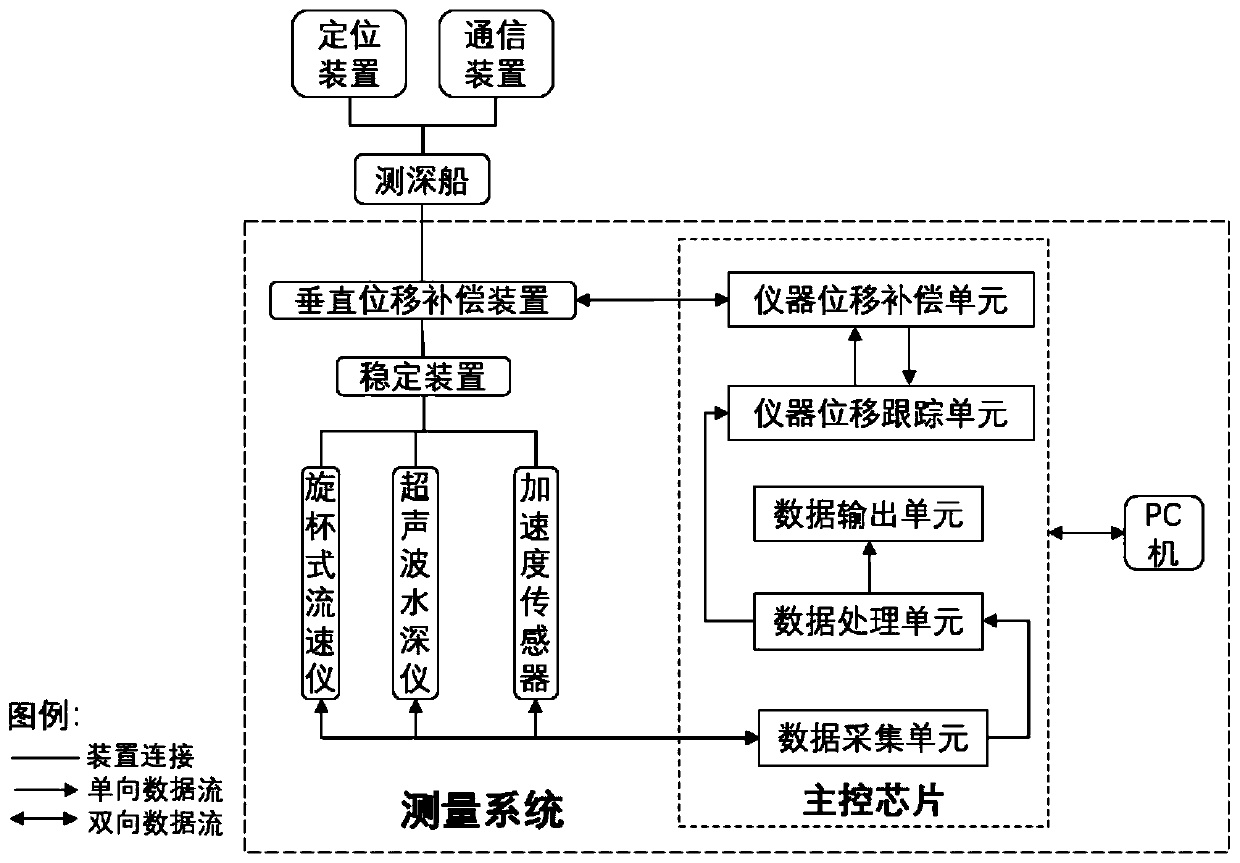
[0090] figure 2 As shown, it is the main structure involved in the preferred embodiment 1 of the present application, including the measurement system and the main control chip, figure 1 As shown, the main control chip is placed on the PC 7 at the control end, and the PC 7 is installed on the sounding ship 1, and a positioning device 8 and a communication device 9 are also set on the sounding ship 1;
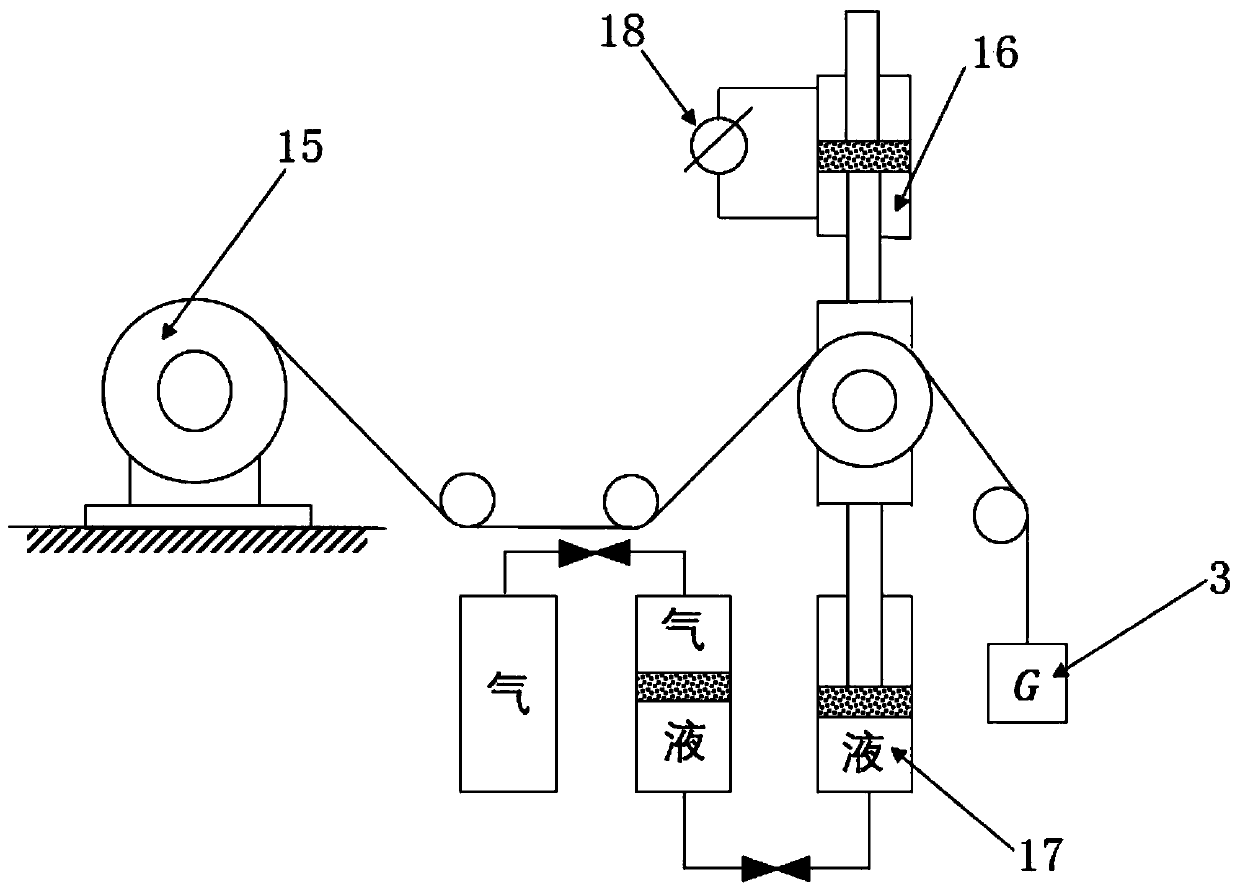
[0091] Among them, the measurement system includes a rotary cup flow meter 6, an ultrasonic water depth meter 5, an acceleration sensor 4, a stabilization device 3, and a vertical displacement compensation device 2. The main control chip includes a data acquisition unit, a data processing unit, a data output unit, and an instrument displacement tracking unit. The unit and the instrument displacement compensation unit, the rotary cup flow meter 6, the ultrasonic water depth meter 5 and the acceleration sensor 4 are installed on the stabilization device 3, the stabilization devic...
Embodiment 2
[0098] Adopt the measuring method that embodiment 1 carries out, as Image 6 As shown, it mainly includes the following main steps, determining the surveying river section, selecting the surveying section, planning the position of the sounding ship 1, placing the sounding ship 1 in place, preparing for the survey, starting the survey at two points at the same time, and processing the original data And calculate and output the result, the specific steps are as follows:
[0099] Step 1: Select the river section to be measured according to the actual engineering conditions.
[0100] Step 2: Set the section to be measured and the position of the sounding ship 1 in the selected river section to be measured.
[0101] third step: Figure 5 As shown, the sounding ship 1 uses the positioning device 8 to travel to the selected river section, and at the same time, ensure that the bow direction of the sounding ship 1 is consistent with the water flow direction 14, and the tail anchor 19...
PUM
 Abstract
Description
Claims
Application Information
 - R&D
- Intellectual Property
- Life Sciences
- Materials
- Tech Scout
- Unparalleled Data Quality
- Higher Quality Content
- 60% Fewer Hallucinations
Browse by: Latest US Patents, China's latest patents, Technical Efficacy Thesaurus, Application Domain, Technology Topic, Popular Technical Reports.
© 2025 PatSnap. All rights reserved.Legal|Privacy policy|Modern Slavery Act Transparency Statement|Sitemap|About US| Contact US: help@patsnap.com


