
Aerial remote sensing image splicing method based on feature optimization and optimal splicing seam

An aerial remote sensing and feature optimization technology, applied in the field of image processing, can solve the problems of reducing information processing efficiency, labor-intensive participation, obvious stitching seams, etc., and achieve the effects of protecting prominent targets, improving efficiency, and high stitching accuracy

Active Publication Date: 2021-02-26
PLA AIR FORCE AVIATION UNIVERSITY
View PDF3 Cites 2 Cited by
  • Summary
  • Abstract
  • Description
  • Claims
  • Application Information

AI Technical Summary

Problems solved by technology

[0004] At present, image processing software is generally used for manual stitching in the stitching of multi-strip linear array push-broom images, linear array sweep images, and panoramic images, although manual operations can ensure the clarity and integrity of important objects in the stitching results. , but it takes a lot of manpower to participate, which greatly reduces the efficiency of information processing
[0005] Therefore, in the stitching work of aerial remote sensing images, due to the richness of ground objects and the difference in lighting conditions during the shooting process, the traditional stitching method is very prone to problems such as target dislocation, ghosting, and obvious stitching seams in the overlapping areas of the stitching map. How to achieve Fast, accurate and natural image stitching is a key issue in the research of automatic image stitching technology

Method used


Image

  • Aerial remote sensing image splicing method based on feature optimization and optimal splicing seam
  • Aerial remote sensing image splicing method based on feature optimization and optimal splicing seam
  • Aerial remote sensing image splicing method based on feature optimization and optimal splicing seam

Examples


Embodiment Construction

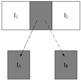
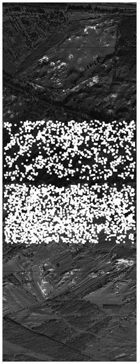
[0062] The aerial remote sensing image mosaic method of the present invention based on feature optimization and optimal stitching seam. The image mosaic method of the present invention first uses the improved SURF algorithm to detect and roughly match the image feature points, and then uses the feature points based on normal distribution to fine-tune The matching method calculates the transformation matrix of the optimized feature point set, transforms the target image into the coordinate system of the reference image, and completes the registration of the image; extracts the overlapping parts of the image to be stitched, and uses the graph cut method for stitching The seam search work adds the consideration of the gradient value and the saliency target weight to the data item and the smooth item in the graph cut energy function to obtain the optimal splicing line; finally, the Gaussian layered image of the overlapping area is constructed to build a pyramid structure. The fusio...


PUM


Abstract

The invention discloses an aerial remote sensing image splicing method based on feature optimization and an optimal splicing seam, and belongs to the technical field of image processing. The inventionaims to provide an aerial remote sensing image splicing method based on feature optimization and an optimal splicing seam. The aerial remote sensing image splicing method is used for automatically splicing remote sensing images shot by an aerial reconnaissance camera. The method comprises the following steps: carrying out rough matching on image feature points by utilizing an improved SURF algorithm, and carrying out image fusion by utilizing feature point fine matching based on normal distribution. According to the invention, manual participation is not needed, and automatic splicing of panoramic images can be realized according to the types of the image files. The splicing method provided by the invention has the characteristics of high processing speed and high splicing precision, thefeature point detection efficiency is improved by pre-defining the feature detection area, a feature point screening method is provided and can be used for calculating a more accurate transformation matrix, more accurate registration is realized. The provided splicing seam searching method can effectively protect the salient target of the overlapping region and ensure the integrity of the target.

Description

technical field [0001] The invention belongs to the technical field of image processing. Background technique [0002] Image stitching technology is an image processing technology that stitches multiple images with overlapping areas into a panoramic image with a large field of view. Under normal circumstances, due to the limited performance of imaging equipment, it is impossible to obtain large-area regional images. Therefore, it is necessary to use image stitching technology to stitch and display the sequence of remote sensing images acquired in real time, so as to ensure that ground experts can fully grasp the situation of ground targets and make correct decisions. decision. [0003] Image stitching needs to search and match the same image content in the overlapping area of ​​two adjacent images, so as to determine the positional relationship between the two images and realize the docking processing of two adjacent images. From the method of mosaic implementation, image ...

Claims


Application Information

Patent Timeline
IPC IPC(8): G06T3/40G06T5/50G06K9/62
CPCG06T3/4038G06T5/50G06T2200/32G06T2207/10032G06T2207/20221G06F18/22Y02T10/40
Inventor 刘宇孙商文孙晓锐吴迪白新伟尤金凤陈健顾子侣
Owner PLA AIR FORCE AVIATION UNIVERSITY
Learn More