Fine wind field simulation method based on spatial correlation and monitoring data
A technology for spatial correlation and wind field simulation, applied in the fields of meteorology and wind engineering, can solve problems such as inaccurate precision, and achieve the effect of improving simulation results, improving wind speed accuracy, and accurate numerical simulation results.
- Summary
- Abstract
- Description
- Claims
- Application Information
AI Technical Summary
Problems solved by technology
Method used
Image
Examples
Embodiment 1
[0041] Such as figure 1 As shown, a fine wind field simulation method based on spatial correlation and monitoring data, the fine wind field simulation method includes the following steps:
[0042] Step 1: Obtain the spatial correlation coefficient field, which is obtained by WRF simulation without combining observation data;
[0043] Step 2: Obtain observational data from traditional observations and non-traditional observations;
[0044] Step 3: Combined with the numerical simulation module of the observation data in step 2, consider fluid dynamics control equations and multi-physics processes, and obtain accurate space field data by running the WRF core module ARW in step 1. Both spatial and temporal scales of impact need to be considered.
[0045] Further, the step 1 specifically includes the following steps:
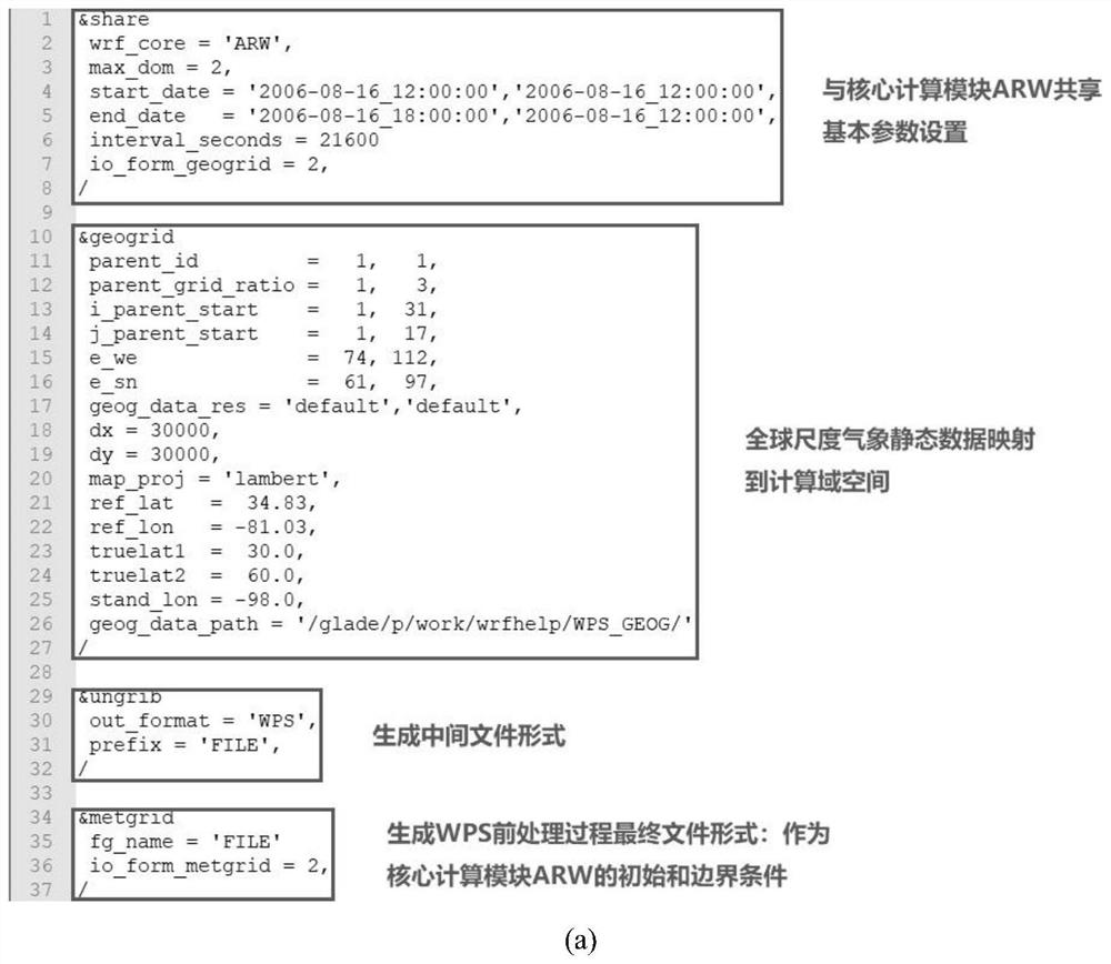
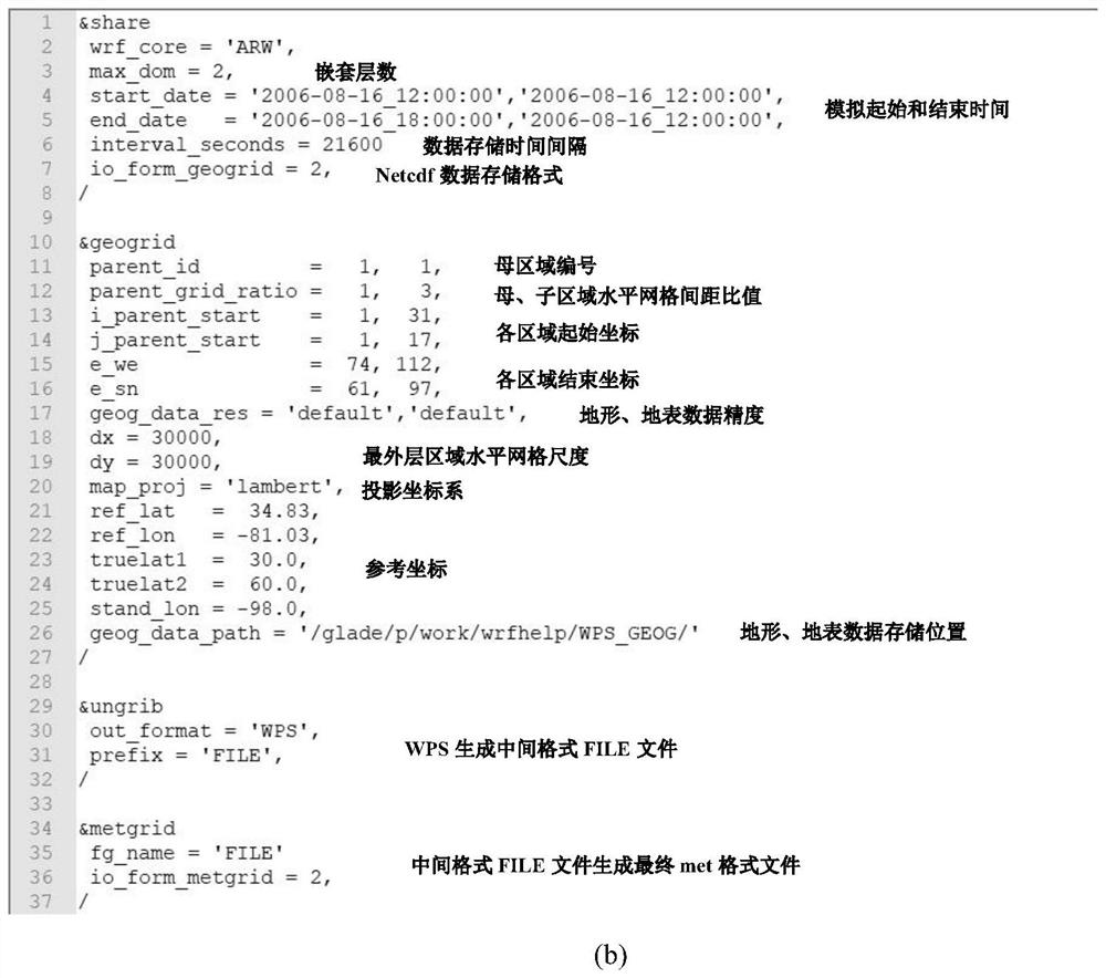
[0046] Step 1.1: WPS, the WRF pre-processing module, processes the terrain and the initial data field;
[0047] Step 1.2: ARW numerical simulation of WRF core ca...
Embodiment 2
[0063] Introduction to the WRF observation-nudging method based on spatial correlation:
[0064] The basic control equations of WRF are shown in equations (1)-(9):
[0065]
[0066]
[0067]
[0068]
[0069]
[0070]
[0071]
[0072]
[0073] μ=p hs -p ht (9)
[0074] The weight function expression in the original observation-nudging method is shown in formula (10):
[0075]
[0076] Physically, the weight function in the observation-nudging method represents the influence strength of the observation data on the surrounding space points, or it can be regarded as the correlation between the observation data and the surrounding space points. From this point of view, it can be found that the weight function in the current WRF is unreasonable for simulating the complex terrain wind field. The specific reason is that in the field of meteorology, the first consideration is a large scale, at least on the order of a few kilometers, so the impact of mo...
Embodiment 3
[0088] In order to verify the advantages of the proposed WRF observation-nudging method based on spatial correlation, the present invention conducts a comparative study of three methods. Case-0, WRF simulation without observation-nudging method; Case-1, original WRF observation-nudging method, using 10-minute time interval observation data and 1-minute time window; Case-2, WRF observation based on spatial correlation -nudging method, using 10-minute interval observation data and 1-minute time window.
[0089] For all simulation examples, the standard parameterization schemes are as follows: Yonsei University boundary layer scheme (YSU), WRF Single-Moment 5-class microphysics scheme (WSM5), Grell-Freitas ensemble cumulus scheme (GF), Rapid Radiative Transfer Model Longwave Radiation Scheme (RRTM), Rapid Radiative TransferModel for General Circulation Models Shortwave Radiation Scheme (RRTMG), and UnifiedNoah Surface Model (Noah). Table 1 and Table 2 show the basic parameters o...
PUM
 Abstract
Description
Claims
Application Information
 - R&D
- Intellectual Property
- Life Sciences
- Materials
- Tech Scout
- Unparalleled Data Quality
- Higher Quality Content
- 60% Fewer Hallucinations
Browse by: Latest US Patents, China's latest patents, Technical Efficacy Thesaurus, Application Domain, Technology Topic, Popular Technical Reports.
© 2025 PatSnap. All rights reserved.Legal|Privacy policy|Modern Slavery Act Transparency Statement|Sitemap|About US| Contact US: help@patsnap.com


