
Indoor positioning method based on RSSI ranging

An indoor positioning and distance technology, applied in the field of wireless positioning, can solve problems such as multiple obstacles and multiple interferences, and achieve the effects of excellent smoothness, good robustness, and low power consumption

Pending Publication Date: 2022-04-22
NANJING UNIV OF SCI & TECH
View PDF0 Cites 1 Cited by
  • Summary
  • Abstract
  • Description
  • Claims
  • Application Information

AI Technical Summary

Problems solved by technology

[0003] Due to the complexity of the indoor environment layout, multiple obstacles, and multiple interferences, the indoor positioning technology based on location services should be subject to many restrictions.

Method used


Image

  • Indoor positioning method based on RSSI ranging
  • Indoor positioning method based on RSSI ranging
  • Indoor positioning method based on RSSI ranging

Examples


Embodiment Construction

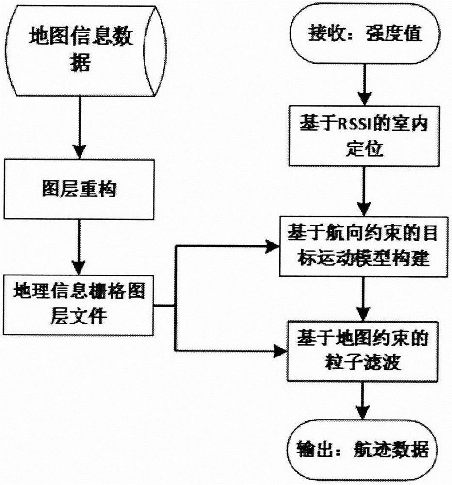
[0022] Such as figure 1 The invention provides an indoor positioning method based on RSSI ranging, comprising the following steps:

[0023] Step 1, build a map, establish a geographic information layer according to the type of road area, and store it as a geographic information layer file in a fixed format;

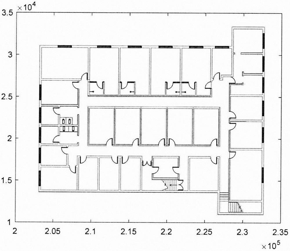
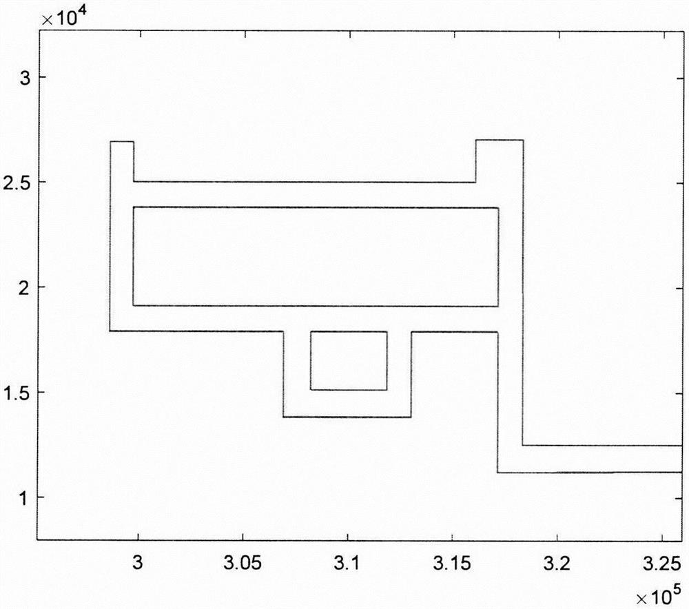
[0024] Through the regional CAD map obtained in advance, the CAD is converted into a map with point-line-area as the basic elements, and road information is extracted, such as figure 2 , the road information is described by a closed loop composed of multiple two-dimensional coordinate lists, and the area where the particle is located can be judged more quickly by using a convex quadrilateral to segment the map area described by the positioning environment.

[0025] Rasterize the graphics by dividing the x-coordinates of the map into n equal intervals x Parts, the y coordinate coordinates are equally spaced and divided into n y copies, the map road information data is ...


PUM


Abstract

The invention provides an RSSI (Received Signal Strength Indicator) distance measurement-based indoor positioning method, which comprises the following steps of: 1, constructing a map, establishing a geographic information map layer according to a road area type, and storing the geographic information map layer as a geographic information map layer file according to a fixed format; 2, the distance between a signal transmitting end and a reference node is known, the RSSI value of the position where the reference node is located is actually measured, the position coordinates of a target node to be measured are obtained through a wireless positioning algorithm based on distance measurement according to a logarithmic path loss model, and therefore indoor positioning based on RSSI distance measurement is achieved; 3, according to the type of a road area where the target is located, the geographic information of the road is taken as a constraint condition to be substituted into a corresponding Kalman filtering equation, and a target motion model based on course constraint is constructed; 4, according to the type of the road area where the target is located, the geographic information of the road serves as a constraint condition to be substituted into a corresponding Kalman filtering equation, and particle filtering based on map constraint is carried out.

Description

technical field [0001] The invention belongs to the technical field of wireless positioning, in particular to an indoor positioning method based on RSSI ranging. Background technique [0002] Since GPS is limited by application and energy consumption in indoor positioning, compared with it, WIFI technology is more widely used in indoor environments, and it does not need to lay additional hardware equipment, which reduces the cost of use. At the same time, WIFI is used to transmit information. The speed is also faster, which is an ideal positioning technology that can be applied to indoor environments. Indoor positioning environments such as shopping malls are equipped with a large number of routers and other WIFI signal sending devices. Through wireless receiving devices such as mobile phones that can receive WIFI signals, more accurate location information can be achieved through distance measurement after measuring RSSI, without the need for outdoor satellite systems and s...

Claims


Application Information

Patent Timeline
IPC IPC(8): H04W4/33H04W64/00H04B17/318H04B17/391G01S5/10
CPCH04W4/33H04W64/00H04B17/318H04B17/3911G01S5/10
Inventor 古雪菲桂林卿
Owner NANJING UNIV OF SCI & TECH
Learn More