Agricultural application integrating system for earth observation technique and its method

A technology of earth observation and integrated system, applied in the direction of color/spectral characteristic measurement, etc., can solve the problem that it is difficult to identify a variety of crop types

Inactive Publication Date: 2005-10-05
REMOTE SENSING APPLIED INST CHINESE ACAD OF SCI
View PDF0 Cites 31 Cited by
  • Summary
  • Abstract
  • Description
  • Claims
  • Application Information

AI Technical Summary

Problems solved by technology

Difficulty identifyin

Method used


Image

  • Agricultural application integrating system for earth observation technique and its method
  • Agricultural application integrating system for earth observation technique and its method
  • Agricultural application integrating system for earth observation technique and its method

Examples


Embodiment Construction

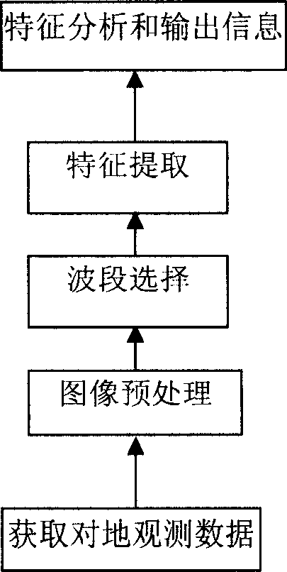
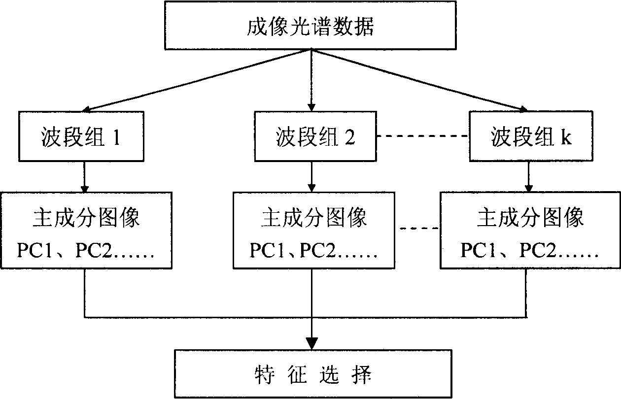
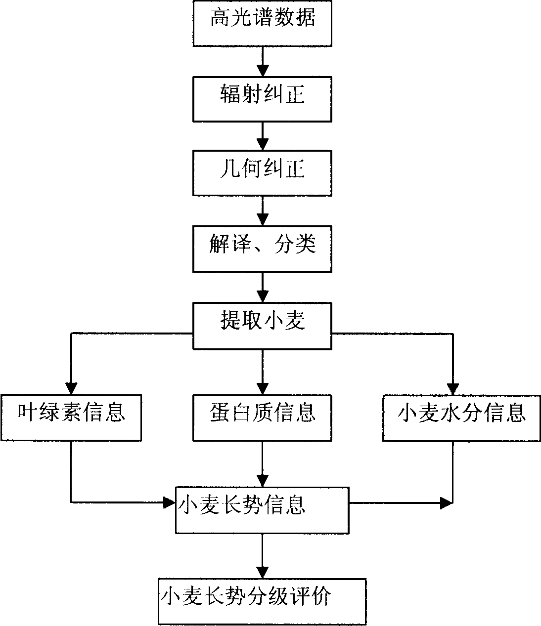
[0024] Such as figure 1 As shown, the present invention provides a method for the agricultural application of earth observation technology, including: acquiring hyperspectral data; processing the obtained hyperspectral data; performing data band selection on the hyperspectral data; extracting the Agricultural parameters in hyperspectral data, displaying relevant agricultural information.

[0025] In the preferred embodiment of the present invention, spectral data, basic data and remote sensing data are required to be used.

[0026] Spectral data refers to the spectral curves of different crops or ground objects, that is, the curves formed by the reflectivity of crops or ground objects to electromagnetic waves in different bands, which are obtained through spectral measurement and remote sensing images of airborne imaging spectrometers.

[0027] It should be noted that the real spectrum of ground features is obtained by using the spectrometer to measure the reflectance on the ...


PUM


Abstract

The invention discloses an agricultural application system and technique for surveying the soil. Above system comprises: data storing unit including spectrum database, remote database, basal database; module unit including parameter selecting module base, agriculture conversion module base; control and calculating processing unit which is for processing figure data with the module in base; and information processing unit for displaying or output in other ways the agriculture information according to the gathered parameter. The invention is able to perform a accurate modern management to the agriculture with the aid of advanced soil survey technique. The technique includes : gather high spectrum data, process the gathered data; select the data by wave band; feature abstract the selected data and obtain the parameter according to which the system output corresponding information.

Description

technical field [0001] The present invention relates to the application technology of information resources, in particular to the application technology of providing auxiliary information for agricultural applications such as agricultural experiments, crop type identification and agricultural condition diagnosis by using information obtained by imaging spectrum technology. Background technique [0002] Imaging spectroscopy technology is currently the cutting-edge technology in the field of earth observation. Since it can acquire continuous spectra of surface vegetation, soil, water bodies and other ground objects for analyzing their physical and chemical processes, it has great application potential in agricultural applications. [0003] The civil aerospace remote sensors that have been in operation, such as Landsat TM, SPOT and NOAA, generally only have 5-6 bands, and the spectral resolution is above 50nm. It is difficult to identify multiple crop types. The peak width of...

Claims


Application Information

Patent Timeline
IPC IPC(8): G01N21/25
Inventor 王长耀牛铮
Owner REMOTE SENSING APPLIED INST CHINESE ACAD OF SCI
Why Eureka
Try Eureka