

Method based on filter of self-adapting closed loop for modifying navigator combined between big dipper double star and strapping inertial guidance
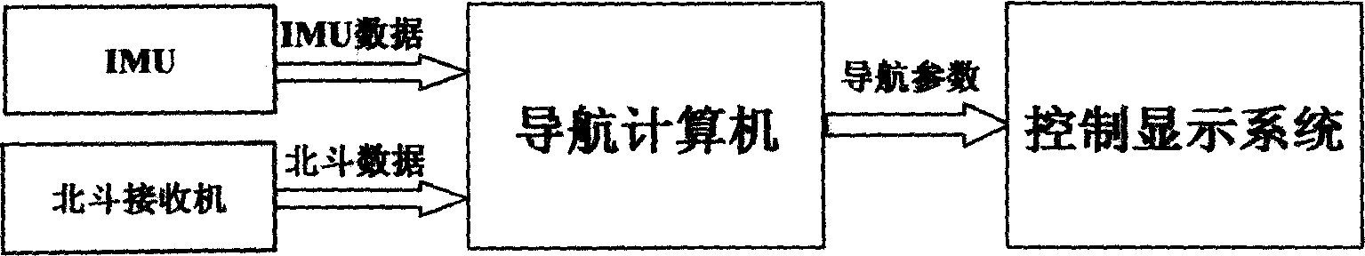
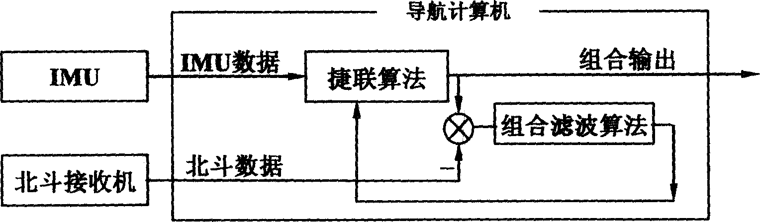
An integrated navigation system and strapdown inertial navigation technology, which is applied in the field of correction of the Beidou dual-star/strapdown inertial navigation system based on the adaptive closed-loop H∞ filter, which can solve the problem of the short construction time and data jump of the Beidou navigation system. Problems such as many change points and imperfect receiver error model
- Summary
- Abstract
- Description
- Claims
- Application Information
AI Technical Summary
Problems solved by technology
Method used
Image

Examples
Embodiment 1
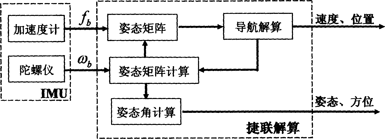
[0084] This example uses adaptive H ∞ Sports car test of filter-corrected Beidou / SINS integrated navigation system. Sports car time: the morning of November 19, 2005; sports car route: Depart from the southern suburbs of Xi'an, arrive at Hu County via Xihu Expressway, and then return to the origin along Xifeng Highway, which lasts about 90 minutes. The sports car route is as follows: Figure 13 shown. In this example, the IMU of the strapdown inertial navigation system is composed of a flexible gyroscope with medium and low precision and a quartz piezoelectric accelerometer. The nominal accuracy is: gyroscope 0.2 degrees / hour, accelerometer 10 -4 g.
[0085] In order to effectively illustrate the correction effect of this method on navigation errors, the original data of Beidou and IMU were recorded during the sports car, so that the dynamic data of the sports car can be used for multiple reading file calculations afterwards, and different algorithms can be performed on the ...
PUM
 Abstract
Description
Claims
Application Information