

Damage detection and repair system and method using enhanced geolocation
a technology of damage detection and repair system, applied in the field of aircraft repair system, can solve problems such as difficult communication, generating costly returns, delays, and errors, and achieve the effects of slow repair process, reduced service life, and improved service li
- Summary
- Abstract
- Description
- Claims
- Application Information
AI Technical Summary
Benefits of technology
Problems solved by technology
Method used
Image

Examples
Embodiment Construction
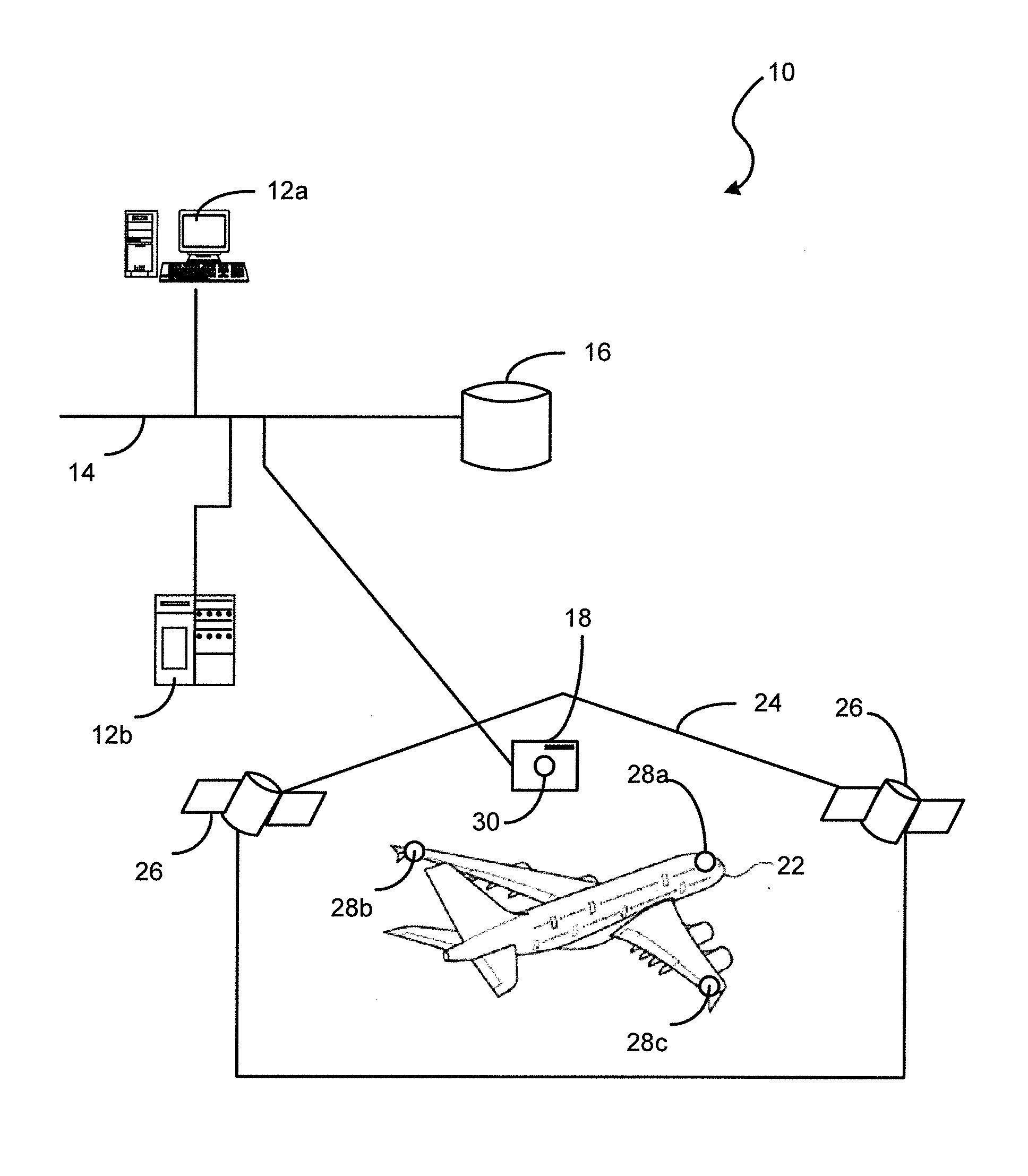
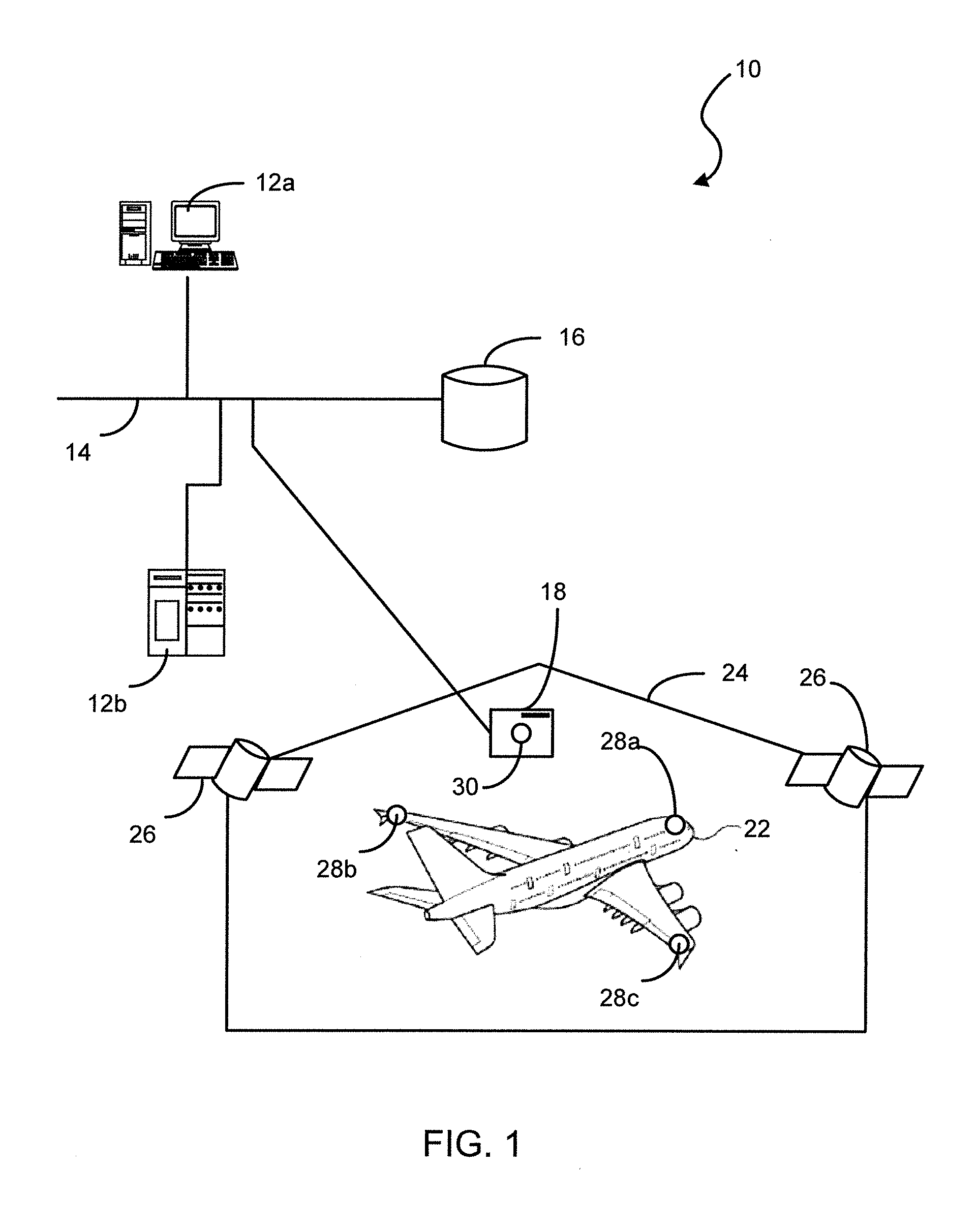
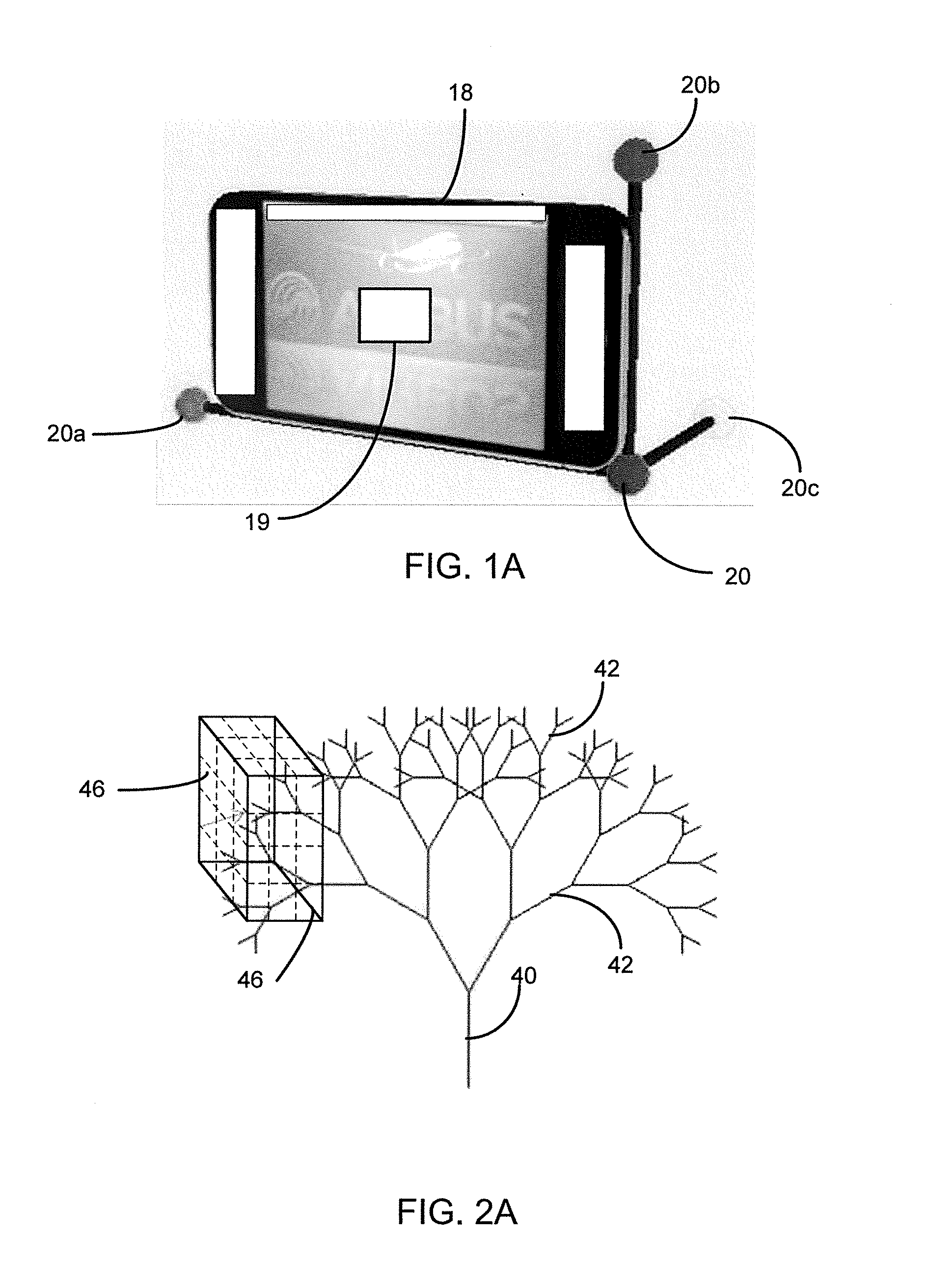
[0020]Preferred embodiments of the present disclosure are described below by way of example only, with reference to the accompanying drawings. Further, the following description is merely exemplary in nature and is in no way intended to limit the disclosure, its application, or uses.
[0021]As used herein, the term “module,” or “unit” may refer to, be part of, or include an Application Specific Integrated Circuit (ASIC), an electronic circuit, a processor (shared, dedicated, or group) and / or memory (shared, dedicated, or group) that execute one or more software or firmware programs, a combinational logic circuit, and / or other suitable components that provide the described functionality. Although children modules residing in their respective parent modules are shown, the broad teachings of the present system can be implemented in a variety of forms. Thus, while this disclosure includes particular examples and arrangements of the modules, the scope of the present system should not be so...
PUM
 Abstract
Description
Claims
Application Information