Determining the position of a mobile device in a geographical area

a mobile device and geographical area technology, applied in surveying and navigation, instruments, navigation instruments, etc., can solve the problems of not always available gps data, no system has become predominant, all systems so far proposed have drawbacks, etc., to increase the accuracy of positioning, save energy, and reduce energy consumption

Active Publication Date: 2017-03-16
OXFORD UNIV INNOVATION LTD
View PDF4 Cites 9 Cited by
  • Summary
  • Abstract
  • Description
  • Claims
  • Application Information

AI Technical Summary

Benefits of technology

[0018]The map may be 2-dimensional or 3-dimensional. The map may for example cover several floors of a building. In the case the map is of a building, for example, features such as stairs and elevators can be identified, providing more constraints for the proposed model and increasing the accuracy of positioning.
[0019]Advantageously, observations are provided only by the accelerometer and magnetometer of the device, as thes

Problems solved by technology

However, GPS data is not always available, particularly when a device is indoors, due to its reliance on radio signals emitted by dedicated GPS satellites.
However, all systems so far proposed have drawbacks, and none has become predominant.
However, these techniques are computationally expensive, and so are typically run remotely on a server contacted via the Inte

Method used


Image

  • Determining the position of a mobile device in a geographical area
  • Determining the position of a mobile device in a geographical area
  • Determining the position of a mobile device in a geographical area

Examples


Embodiment Construction

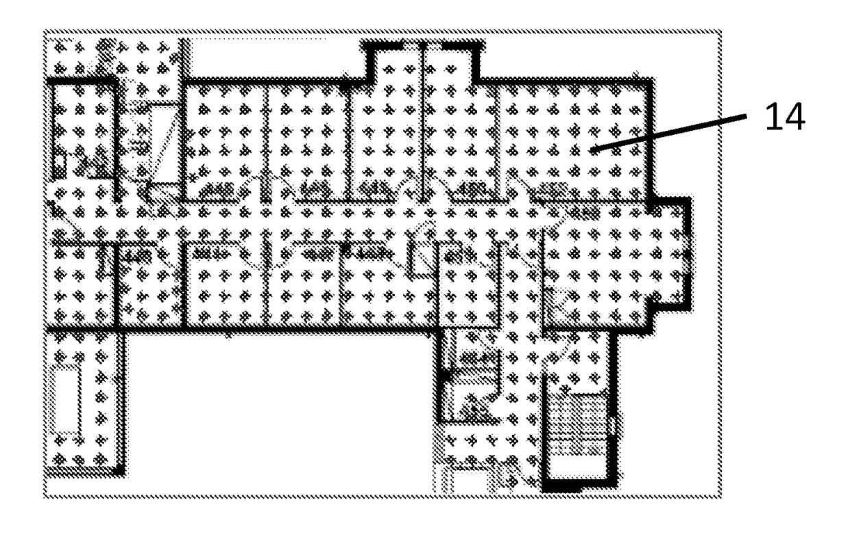
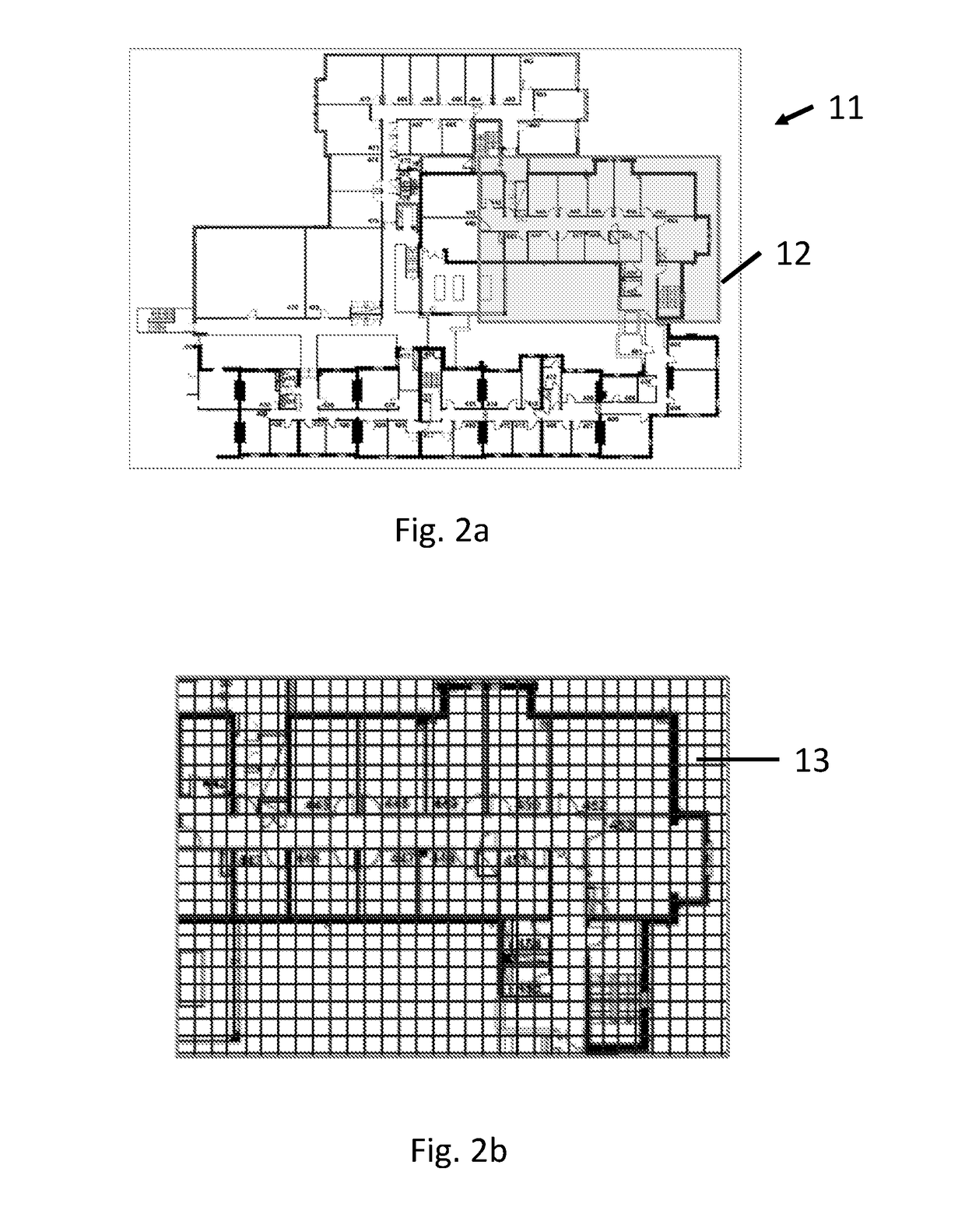
[0048]A system in accordance with an embodiment of the invention is now described with reference to FIGS. 1 to 3. The system determines the position of a device by map matching using an undirected graph model, in particular a model based upon linear chain conditional random fields (CRFs), as described in detail below. CRFs have been successfully used for various applications such as computer vision (e.g. to classify regions of an image), bioinformatics (e.g. to segment genes in a strand of DNA), and natural language processing (e.g. to extract syntax from natural-language text).

[0049]CRFs are undirected probabilistic graphical models that were introduced in J. D. Lafferty, A. McCallum, F. C. N. Pereira, Conditional random fields: Probabilistic models for segmenting and labelling sequence data, Proceedings of the Eighteenth International Conference on Machine Learning, ICML '01, pp. 282-289, 2001. In linear chain CRFs, the conditional probability of states given observations is propo...


PUM


Abstract

A method of determining the position of a mobile device using a model. The model comprises a graph comprising a set of vertices and a set of edges between the vertices, and one or more feature functions that take as input one or more vertices of the graph and a set of observations for the device, and return a feature value. The model is constructed by obtaining a map of the geographical area, constructing the graph using the map, wherein the vertices of the graph correspond to areas of the map, and two vertices are joined by an edge when the areas corresponding to the vertices are adjacent and can be travelled between by a device, and building the one or more feature functions using the graph, wherein the feature value of the one or more feature functions indicates the extent to which the observations support the device being positioned in the areas corresponding to the one or more vertices of the graph. The method then comprises the steps of: obtaining a set of observations from the sensors of the device; determining the trajectory for the device that optimises the values given by the feature functions given for the set of observations; and determining the position of the device to be the end point of the trajectory.

Description

FIELD OF THE INVENTION[0001]The present invention concerns methods and devices for determining the position of a mobile device in a geographical area. The invention is particularly applicable where the geographical area is an indoor area. More particularly, but not exclusively, the invention concerns methods of constructing models comprising graphs and feature functions for performing the determination.BACKGROUND OF THE INVENTION[0002]The identification of the position of a device when outdoors, for example to identify the position of a mobile phone, is primarily done using GPS (Global Positioning System). However, GPS data is not always available, particularly when a device is indoors, due to its reliance on radio signals emitted by dedicated GPS satellites. As a result, various positioning systems have been proposed that use do not use GPS data, but rather use motion measurements provided by inertial measuring units of devices, such as accelerometer, magnetometer and gyroscopic un...

Claims


Application Information

Patent Timeline
IPC IPC(8): G01C21/20G06K9/52G06K9/00G06K9/46G01C21/32G01C21/36
CPCG01C21/206G01C21/32G01C21/3667G06K9/52G06K9/469G06K9/4604G06K9/00476G06F18/2323G01C21/3844G06V30/422
Inventor TRIGONI, NIKIXIAO, ZHUOLING
Owner OXFORD UNIV INNOVATION LTD
Why Eureka
Try Eureka