

Agricultural Drone for Use in Controlling the Direction of Tillage and Applying Matter to a Field
a technology for agricultural drones and fields, applied in the field of agricultural drones, can solve the problems of inaccurate information, level furrows around the field being worked, and insufficient information to meet the desired farming operating parameters and/or applicable regulatory requirements, so as to prevent excessive erosion and/or runoff, improve monitoring, and measure and map
- Summary
- Abstract
- Description
- Claims
- Application Information
AI Technical Summary
Benefits of technology
Problems solved by technology
Method used
Image

Examples
Embodiment Construction
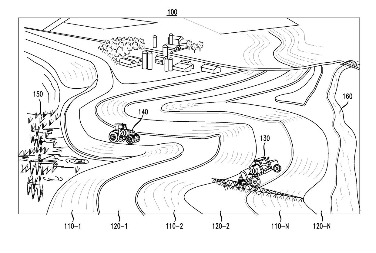
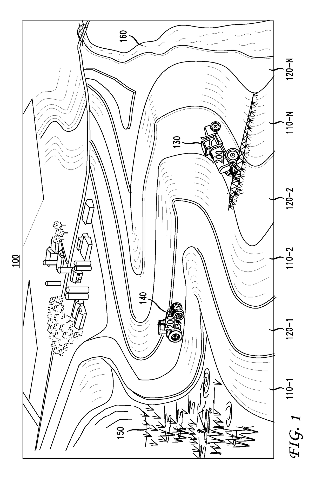
[0007]In accordance with various embodiments, one or more agricultural drones are used to improve the monitoring, measuring and mapping of a field in order to produce contour maps that will be useful for working the field, in particular, controlling a direction of tillage applied to the field and / or controlling the application and spreading of matter (e.g., fertilizer, manure or sewage treatment sludge) across the field while preventing excessive erosion and / or runoff.
[0008]More particularly, in accordance with an embodiment, one or more agricultural drones are dispatched to fly over one or more fields (illustratively, a contour farming field) for collecting real-time contour, topology, elevation and other information (collectively referred to herein as “contour analysis information”) with respect to the field. Such contour analysis information may include multispectral and / or hyperspectral pictures, for example, to facilitate the generation of a three dimensional (3D) terrain map w...
PUM
 Abstract
Description
Claims
Application Information