

System and method for defining and creating surrogate addresses for township and range quarter sections
a technology of surrogate addresses and townships, applied in process and machine control, navigation instruments, instruments, etc., can solve the problems of not being able to meet the requirements of adequate not being able to provide the ideal alignment needs, and not being able to be ordered. , to achieve the effect of ensuring the alignment needs, achieving the ideal alignment needs, and achieving the effect of adequately cataloging and identifying places
- Summary
- Abstract
- Description
- Claims
- Application Information
AI Technical Summary
Benefits of technology
Problems solved by technology
Method used
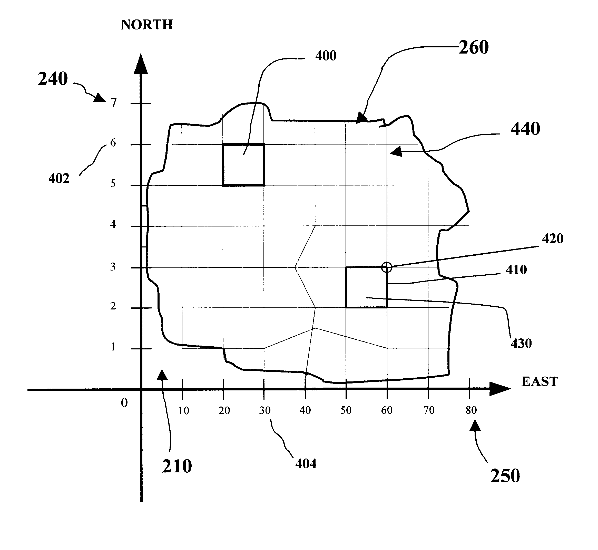
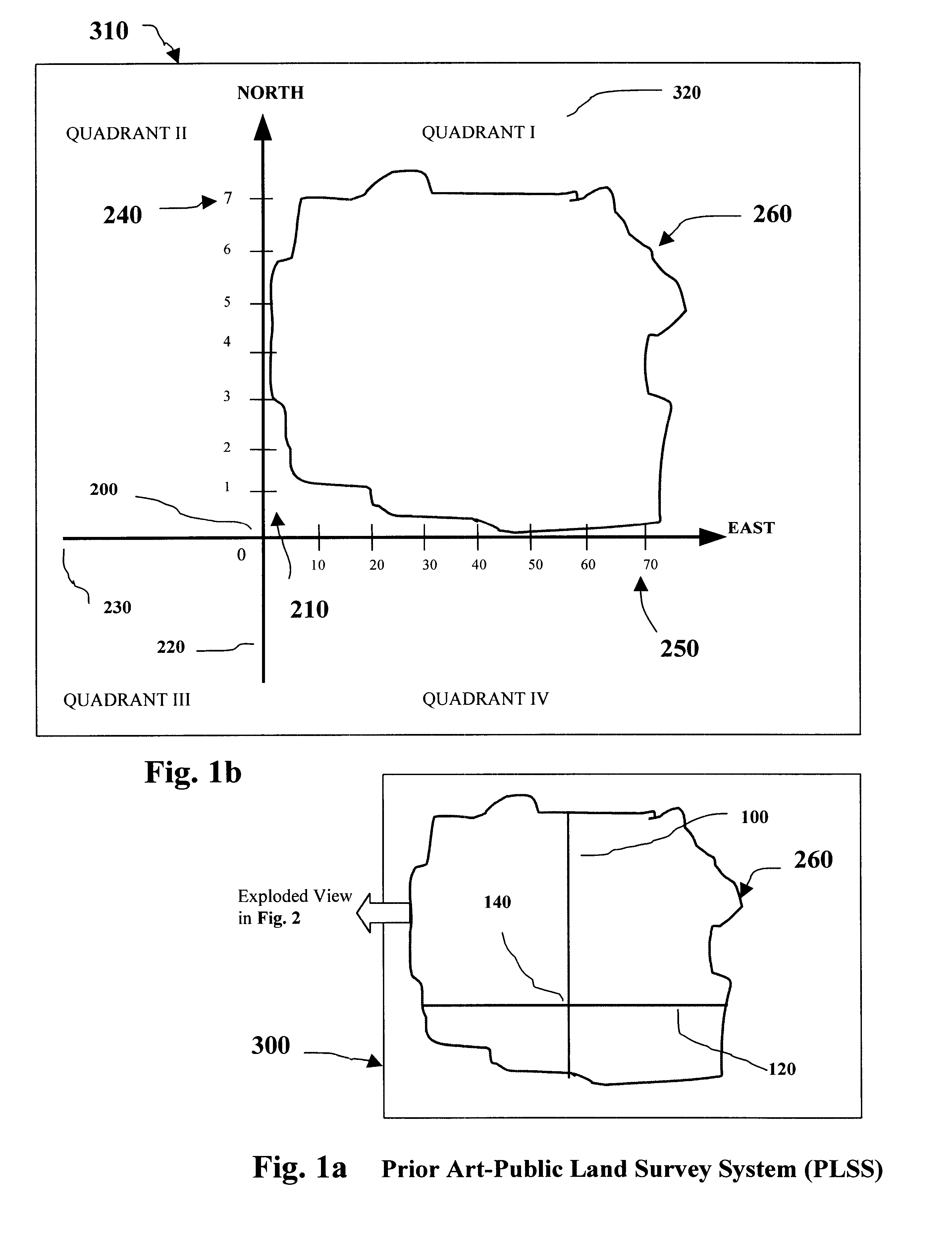
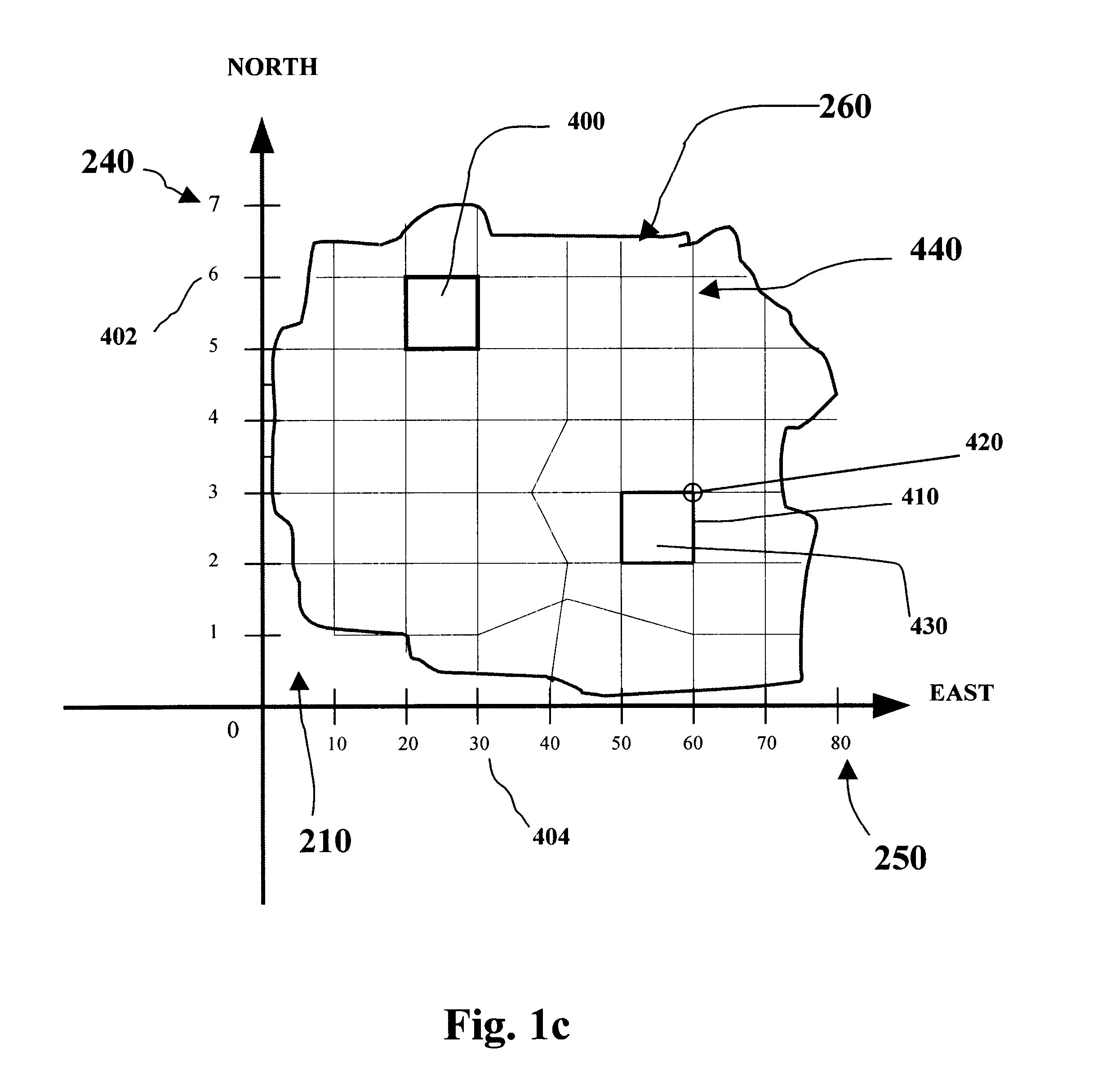
Image

Examples
example 2
, FIG. 7.0 demonstrates how situs addresses can be enhanced through the addition of Locality ID.TM.(s). Residents and travelers alike will enjoy the ease of finding places when this additional information is used in conjunction with an Locality Locator map of the area. Using the Locality ID.TM.(s), residents and travelers will be able to quickly and easily identify the general location of each of the court facilities as well as other points of interest using the Locality Locator map of the Phoenix Metropolitan area, which covers over 2100 square miles.
example 3
, FIG. 7.0 shows how Census data can be referenced using Locality ID.TM.(s) that are cross-indexed to Census tracts. This example identifies four (4) adjacent census tracts and corresponding Locality ID.TM.(s) in the City of Chandler, Ariz.
example 4
, FIG. 8.0 demonstrates how Census data at the block level can be indexed to Locality ID.TM.(s). This example shows how Census data for the City of Scottsdale in the Phoenix, Ariz., SMSA can be indexed to support observation and analysis of statistical data without the user having to know anything about Census Tracts and Blocks.
PUM
 Abstract
Description
Claims
Application Information