System and method for distribution of GPS satellite information

a satellite information and positioning system technology, applied in the field of system and method for distributing positioning information of positioning system, can solve the problems of time-consuming process of locating gps satellites in view, 12.5-second acquisition time of ephemeris information can become a problem for gps receivers, etc., to increase the service area and reliability of satellite information distribution system.

Inactive Publication Date: 2009-08-11
TRIMBLE NAVIGATION LTD
View PDF25 Cites 20 Cited by
  • Summary
  • Abstract
  • Description
  • Claims
  • Application Information

AI Technical Summary

Benefits of technology

[0014]The mobile unit, wishing to determine its position, locates the GPS satellites above the horizon using satellite information transmitted by the information processing station through the data network. The mobile unit then acquires the time of arrival information from three or more GPS satellites and acquires the ephemeris information for the same GPS satellites from the information processing station through the data network. Thus, the roving mobile unit can perform trilateration to determine its position even when the mobile unit is roaming in an urban area or is indoor where the GPS signals may be weak or obstructed. The roving mobile unit does not need to maintain contact wi

Problems solved by technology

Further, since no ground stations are typically involved in GPS positioning, a navigation system based on GPS has unlimited range.
The process of locating the GPS satellites in view can be time-consuming, particularly when the receiver does not have prior, useful positional or GPS almanac information.
Although this lengthy acquisition time poses no problem for GPS receivers mounted on aircraft or used in geological or archaeological expeditions where the receivers remain mostly exposed to the open sky, the 12.5-second acquisition time for ephemeris information can become a problem for GPS receivers mounted on roving mobile units traveling in an urban environment, particularly where the area is densely built.
These roving GPS receivers typically cannot maintain contact with any GPS satellite for the lengthy observation period

Method used


Image

  • System and method for distribution of GPS satellite information
  • System and method for distribution of GPS satellite information
  • System and method for distribution of GPS satellite information

Examples


Embodiment Construction

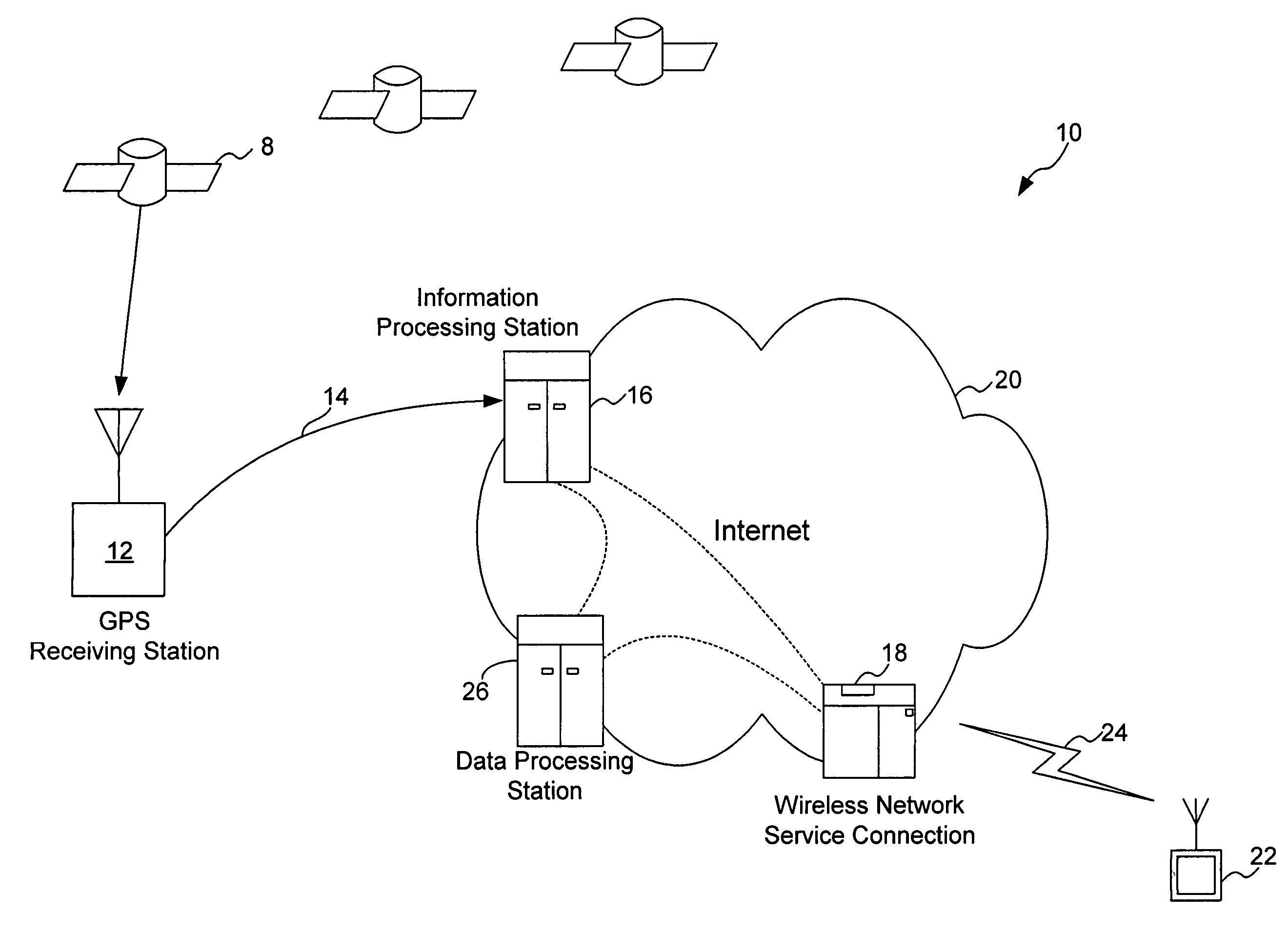
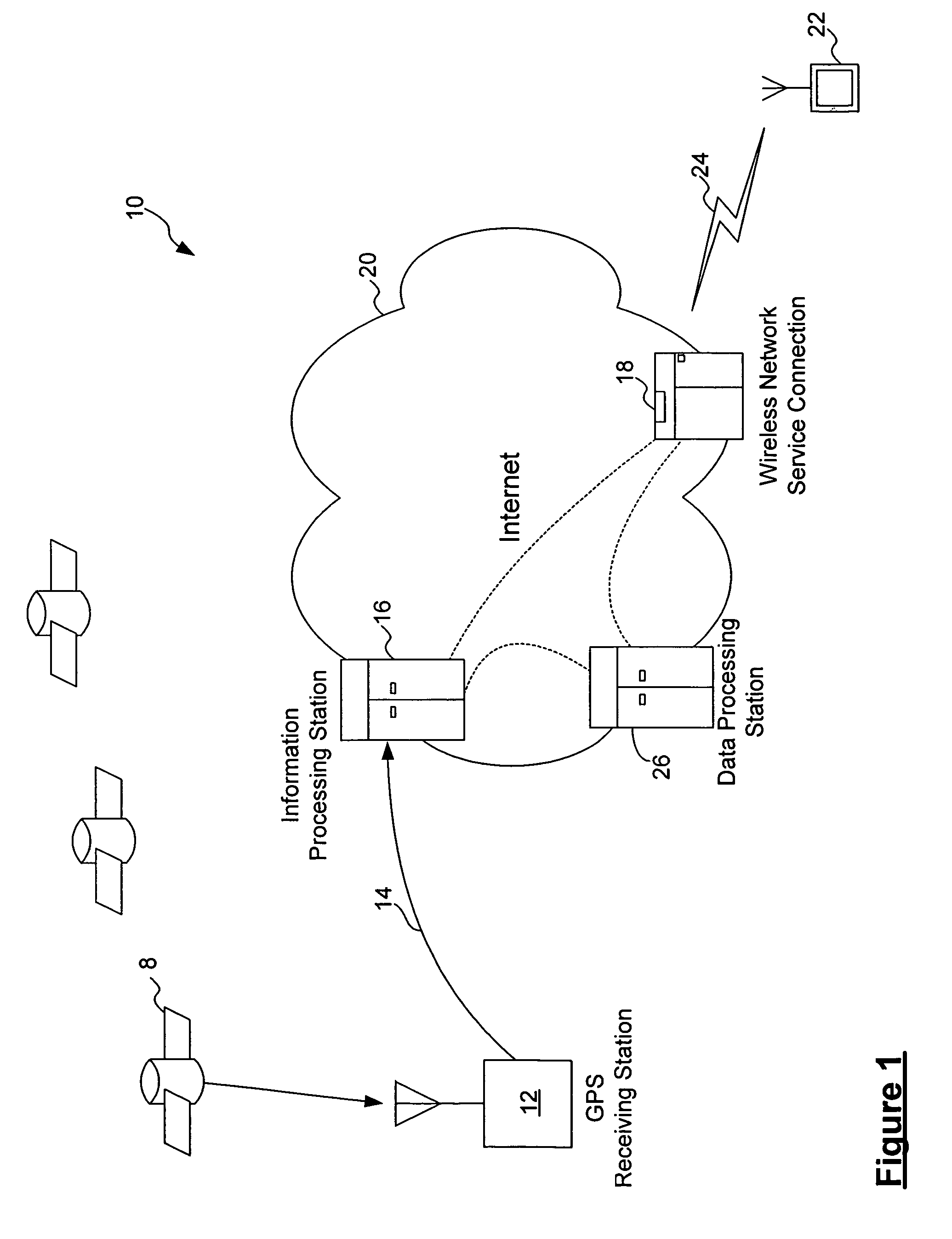
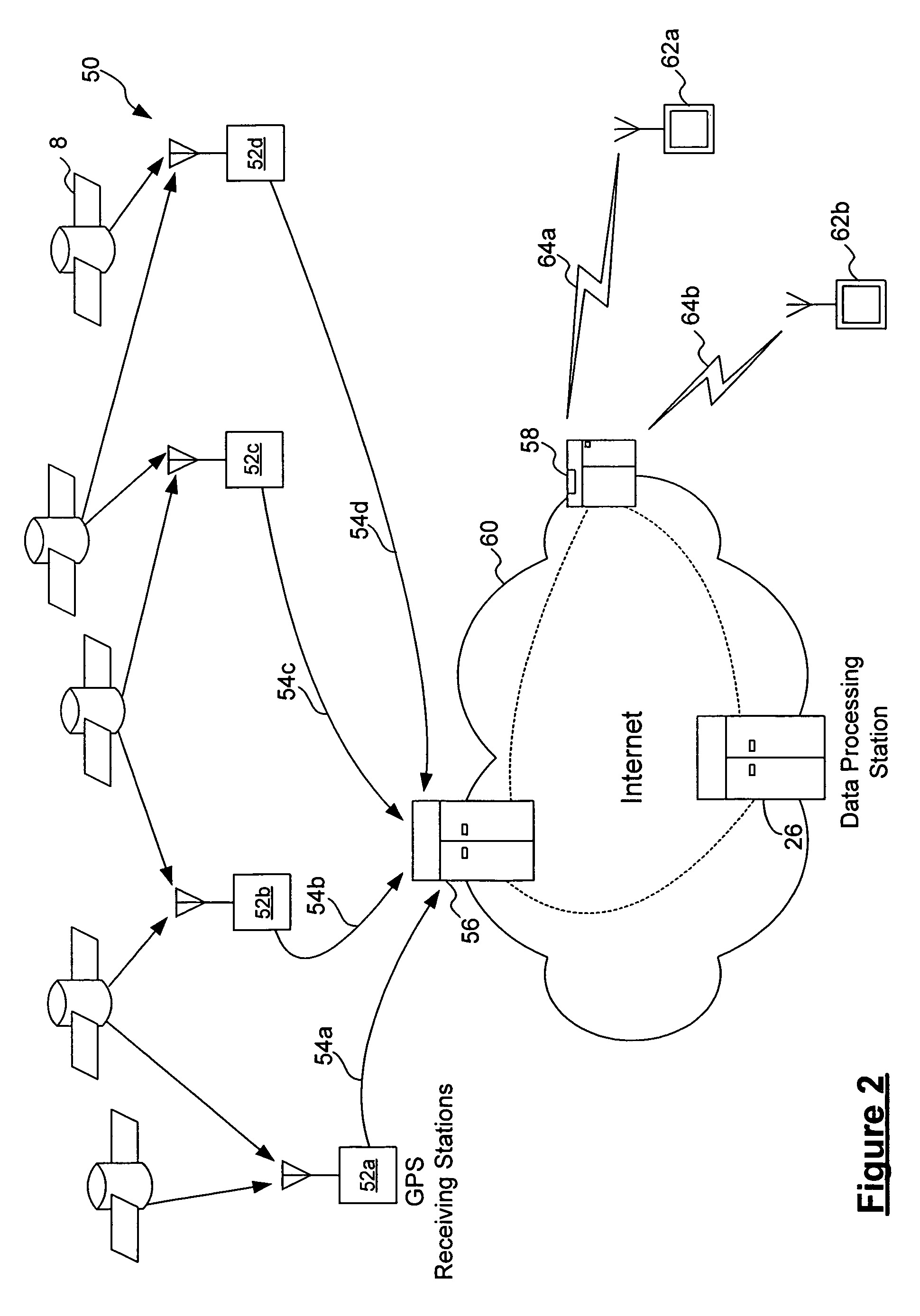
[0020]According to one embodiment of the present invention, a GPS satellite information distribution system collects GPS satellite information from GPS satellites using a GPS receiving station and stores the information in an information processing station which is accessible through a data network. The information processing station makes the GPS satellite information available to roving mobile units equipped with GPS receivers using wireless communication. The satellite information is transmitted either by broadcasting the satellite information through the data network or by transmitting the information through the data network upon demand of the mobile unit. A roving mobile unit, wishing to determine its position, locates the GPS satellites above the horizon using satellite information transmitted by the information processing station through the data network. The mobile unit then acquires the time of arrival information from three or more GPS satellites and acquires other satell...


PUM


Abstract

A positioning information distribution system for distributing positioning information through a data network is described. In one embodiment, the system distributes satellite information from a global positioning system (GPS). The system includes an information processing station connected to a data network accessible by wireless communication, a receiving station including a GPS receiver, and a mobile unit including a GPS receiver and a wireless receiver. The information processing station collects GPS satellite information from the receiving station and transmits the satellite information to the mobile unit using wireless communication. Alternately, a network of receiving stations are provided. The mobile unit can obtain the satellite information from the information processing station for determining its measured position, even when the mobile unit is roaming in an urban area and is not able to observe the GPS satellites for the lengthy observation period needed to acquire the satellite information itself.

Description

BACKGROUND OF THE INVENTION[0001]1. Field of the Invention[0002]The invention relates to a system and a method for distributing positioning information of a positioning system, and more particularly to a system and a method which uses a data network, such as the Internet, to distribute global positioning system (GPS) satellite information to roving GPS receivers.[0003]2. Description of the Related Art[0004]The Global Positioning System (GPS) includes approximately twenty four satellites each orbiting the earth at a substantially constant speed and altitude. In the GPS system, each satellite sends out, at precisely synchronized times, a code sequence which identifies the satellite. Specifically, the code sequence transmitted by each satellite is a precisely timed binary pulse train including a C / A-code (Coarse Acquisition Code) for civilian use and a P-code (Precision Code) for military use. The code sequence transmitted by each GPS satellite contains a unique C / A-code identifying th...

Claims


Application Information

Patent Timeline
IPC IPC(8): H04W24/00G01S1/00G01S5/00
CPCG01S5/0027G01S5/0045G01S19/05G01S2205/008G01S19/256G01S19/258G01S19/254
Inventor FAN, RODRIC C.ENGE, PER K.
Owner TRIMBLE NAVIGATION LTD
Why Eureka
Try Eureka