Portable locator system with jamming reduction

a portable, locator technology, applied in the field of electronic systems, can solve problems such as messy cleanup, serious injury and property damage, and disrupt the comfort and convenience of residents, and achieve the effect of reducing interference and improving the maximum detection range or signal-to-noise ratio

Active Publication Date: 2010-07-13
SEEKTECH
View PDF19 Cites 106 Cited by
  • Summary
  • Abstract
  • Description
  • Claims
  • Application Information

AI Technical Summary

Benefits of technology

[0032]According to another embodiment, the portable locator may be left in a free standing unmoving fixed position, to process signal data for a long period of time to narrow the bandpass of the employed digital filters to improve maximum detection ran...

Problems solved by technology

If a backhoe or other excavation equipment hits a high voltage line or a gas line, serious injury and property damage may result.
Severing water mains and sewer lines leads to messy cleanups.
The destruction of power and data cables can seri...

Method used


Image

  • Portable locator system with jamming reduction
  • Portable locator system with jamming reduction
  • Portable locator system with jamming reduction

Examples


example # 1

Example #1

Locating Utilities in a Road Intersection

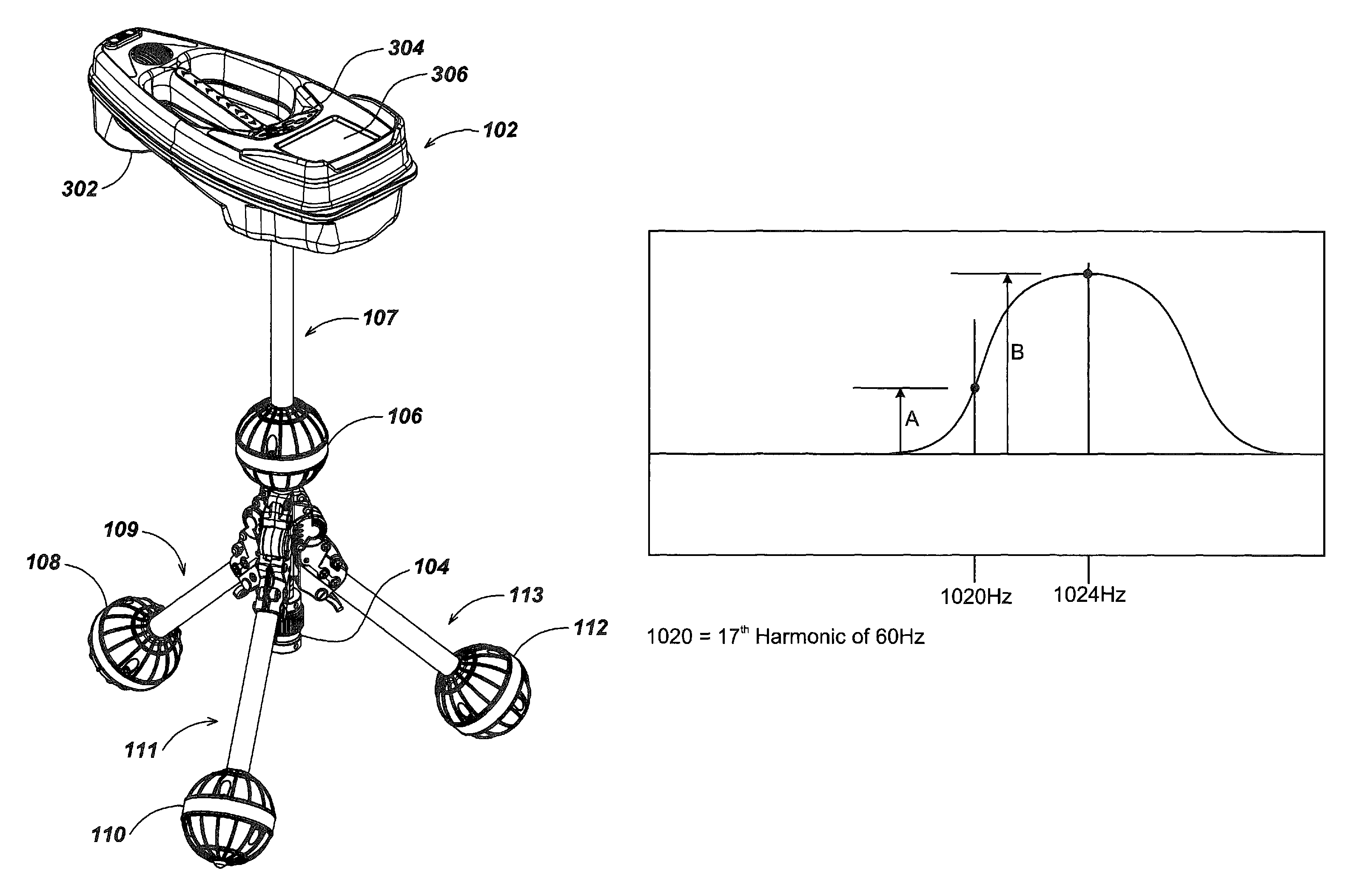
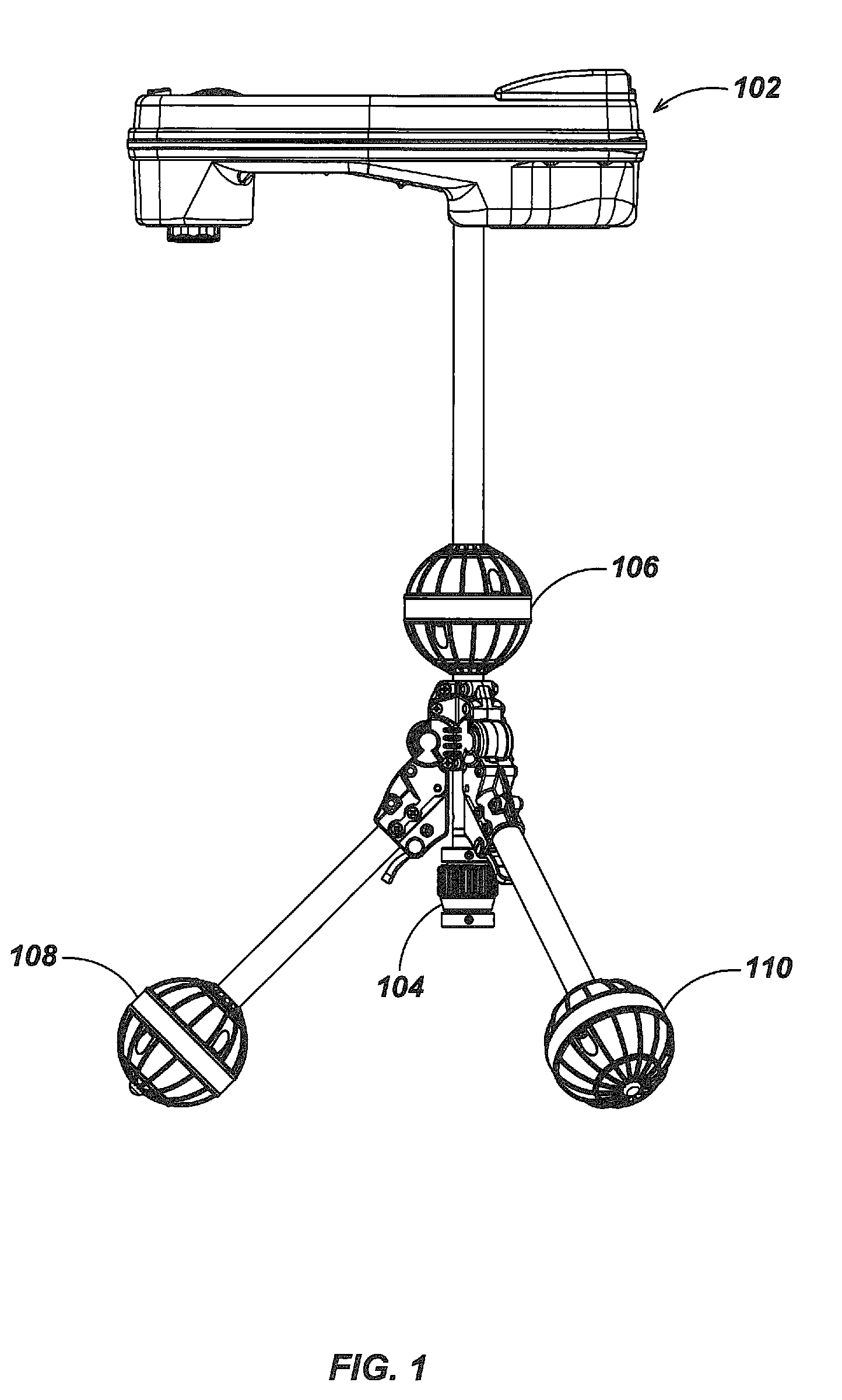
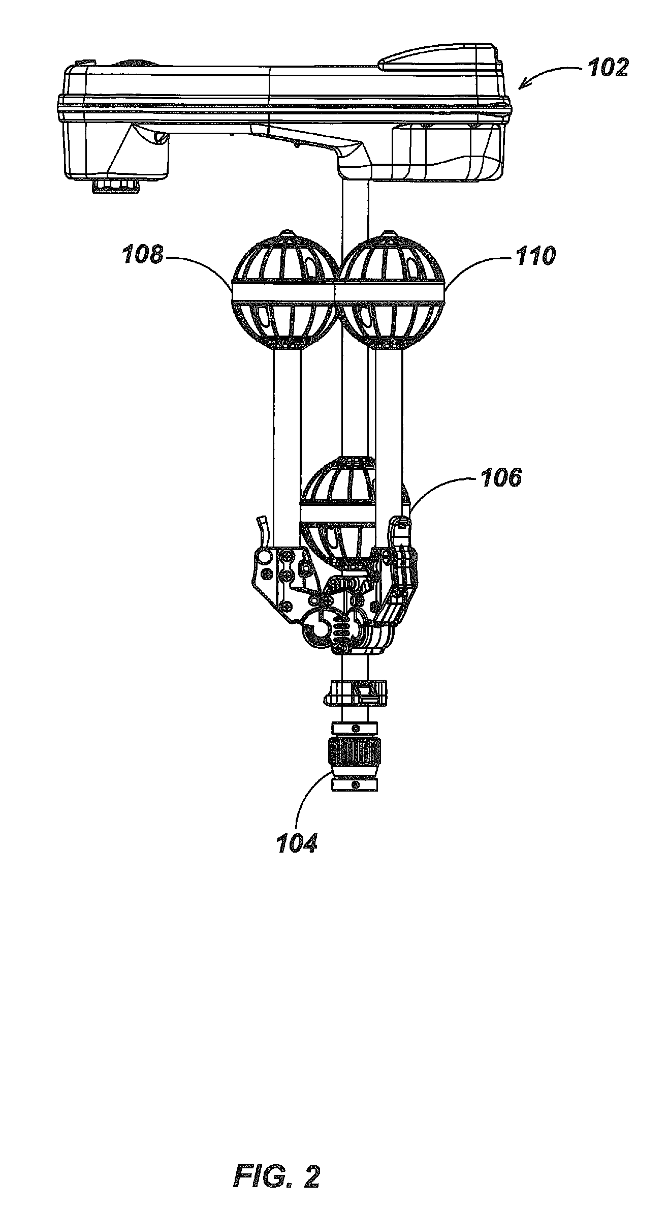
[0225]A fixed positional reference dipole beacon is placed at each of four corners of an intersection, each transmitting a separately distinguishable signal that can be located by the self-standing multi-channel locator. These positional reference dipole beacons can themselves consist of one or more transmitting dipoles. Signals are placed by known means (direct connection or inductive coupling) on all known utilities within the region of the intersection to be mapped either using separately distinguishable signals or by attaching signal transmitting means to one utility at a time. Using both active (signals placed by the transmitting means) or passive (signals of opportunity already present) locating techniques elsewhere described, the positions of all detectable utilities are determined relative to the position of the locator at the time of measurement. The position of the locator is determined at the same time relative to one or ...

example # 2

Example #2

Mapping an Existing Structure and Site for Remodel Construction

[0231]A number of high powered very low frequency beacons are placed external to a structure. These beacons incorporate GPS receivers and use some combination of DGPS, WAAS and RTK techniques to improve accuracy. The fact that these are not moving during the course of the structure mapping process aids in improving the positional accuracy of these devices. The positional data from each of these beacons can be transmitted continuously or downloaded later to the self-standing locator or some other data logging station. Some number of optionally lower power beacons, are placed temporarily through out the structure as needed. The self-standing locator is moved from room to room or from area to area, and the hand-pointable laser range meter is then used to map each area. The laser range meter may have controls that designates such measured values as floor, wall, and ceiling to aid automated or manually directed mean...

example # 3

Example #3

Mapping Square Footage of a House for Resale Listing

[0234]Often the square footage of a house is not well known and may change due to new construction. Such measurements are often not accurate and may be biased from the seller's perspective. Either prior to listing or during a home inspection period prior to close of escrow it may be desirable to accurately verify the useable floor area of a structure. If an absolute map is not needed this can be done with a single beacon or even no reference beacon or by using the beacon in the laser range meter itself to determine the positional offset of the self-standing locator when it is moved from room to room.

[0235]Similar to the techniques described in example 2 above, the locator is moved and placed, perhaps on a stand (to reduce distorting magnetic coupling to any nearby objects) in the middle of each room. The hand-pointable, dipole tracked laser range meter is then used to map the room, perhaps only the floor area. Often floor...


PUM


Abstract

A portable self-standing electromagnetic (EM) field sensing locator system with attachments for finding and mapping buried objects such as utilities and with intuitive graphical user interface (GUI) displays. Accessories include a ground penetrating radar (GPR) system with a rotating Tx/Rx antenna assembly, a leak detection system, a multi-probe voltage mapping system, a man-portable laser-range finder system with embedded dipole beacon and other detachable accessory sensor systems are accepted for attachment to the locator system for simultaneous operation in cooperation with the basic locator system. The integration of the locator system with one or more additional devices, such as fault-finding, geophones and conductance sensors, facilitates the rapid detection and localization of many different types of buried objects.

Description

CROSS-REFERENCES TO RELATED APPLICATIONS[0001]This application is a continuation of U.S. patent application Ser. No. 11 / 551,651, which was filed Oct. 20, 2006, and which is pending as of the filing of this application.[0002]This application claims priority benefit under 35 U.S.C. §119(e) and §120 of the filing date of provisional Patent Application No. 60 / 730,124 filed on Oct. 24, 2005 of Mark S. Olsson et al. entitled “Self-Standing Mapping Sonde and Line Locator Employing Improved Display Methods with Integral Ground-Penetrating Radar and Other Detachable Detection Apparatus.” The entire disclosure of said provisional application is hereby incorporated by reference.[0003]This application is related by common inventorship and subject matter to the commonly-assigned patent application Ser. No. 10 / 268,641, which was filed on Apr. 15, 2004 and published on Apr. 15, 2004 as U.S. Patent Application No. 2004 / 0070399A1 entitled “Omnidirectional sonde and line locator,” and the commonly-as...

Claims


Application Information

Patent Timeline
IPC IPC(8): G01R19/00G01V3/08G01V3/10
CPCG01V3/15G01R29/0892G01R19/00
Inventor MARTIN, MICHAEL J.
Owner SEEKTECH
Why Eureka
Try Eureka