A simulation method for large-scale terrain roam based on rule grid

A large-scale terrain, simulation method technology, applied in 3D modeling, 3D image processing, image data processing and other directions, can solve the problem of no implementation algorithm, low efficiency, etc., to improve the rendering speed, fast update speed, Improve the effect of speed problems

Inactive Publication Date: 2008-09-10
BEIHANG UNIV
View PDF0 Cites 16 Cited by
  • Summary
  • Abstract
  • Description
  • Claims
  • Application Information

AI Technical Summary

Problems solved by technology

But as far as Geometry Clipmap is concerned, the original text did not give the implementation algorithm of its framework. Some researchers have conducted research on this aspect: Asirvatham introduced an algorithm for implementing Geometry Clipmap using GPU in "GPU Gems 2" (Arul Asirvatham, Hugues Hoppe.Terrain Rendering Using GPU-BasedGeometryClipmaps.In: GPU Gems 2: Programming Techniques for High-Performance Graphics and General-Purpose Computation (GPU Gems), 20

Method used


Image

  • A simulation method for large-scale terrain roam based on rule grid
  • A simulation method for large-scale terrain roam based on rule grid
  • A simulation method for large-scale terrain roam based on rule grid

Examples


Embodiment Construction

[0052] The concrete implementation of the present invention can be divided into following main steps, as Figure 5 Shown:

[0053] 1. Use the Geometry Clipmap framework in the preprocessing stage to form a clipmap pyramid

[0054] According to the size of the terrain, set the grid size of each clipmap pyramid to be n×n, with a total of L layers. In order to ensure the alignment between the two layers of grids, n must be an odd number, and when the texture size is a power of 2, the hardware can be optimized, so the present invention selects n=2 k +1 (k is an integer greater than zero), which happens to ensure that the texture size is 2 to the power of k. At the same time, when the amount of terrain data is M×N vertices, the clipmap size n and the number of layers L have the following relationship:

[0055] (n-1)×2 L +1≥max(M,N) (3)

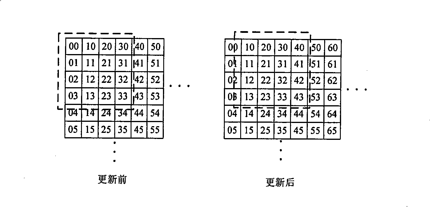
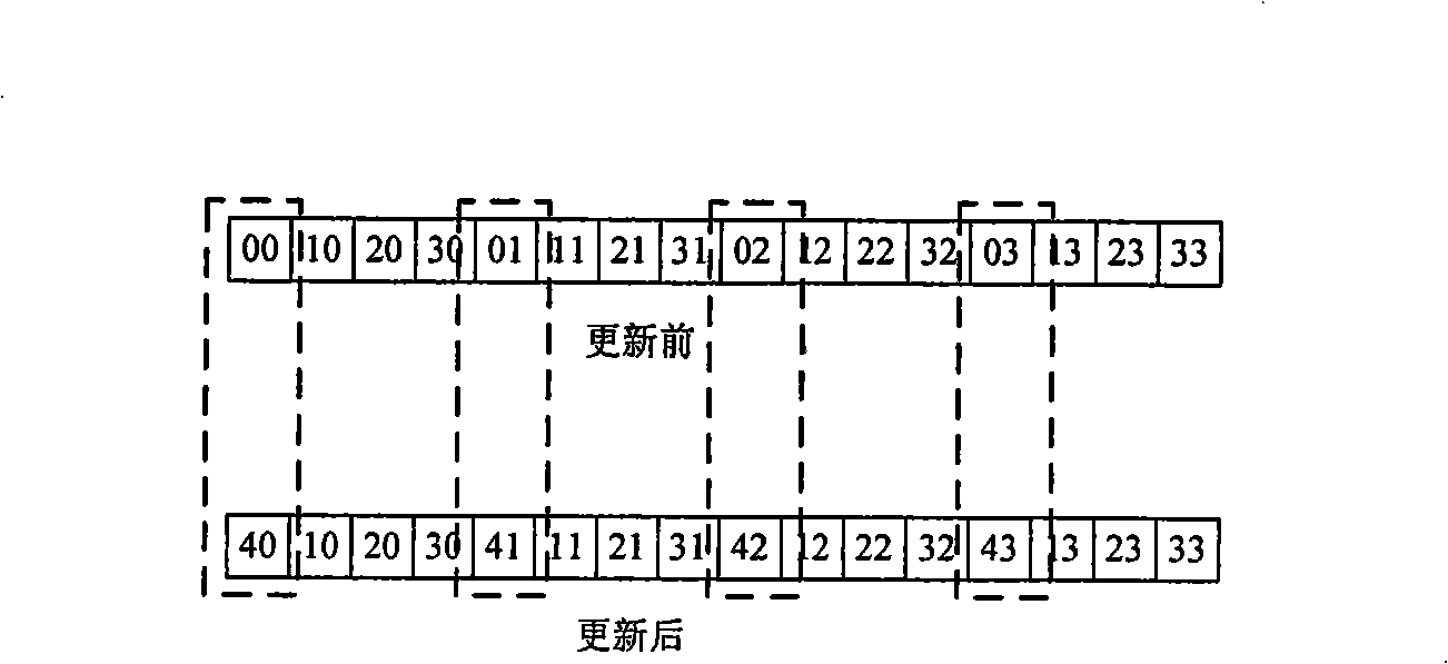
[0056] Construct a vertex queue of size n×n and an index queue of size 2n×(n-1) for each clipmap level.

[0057] Vertex Queue: Read DEM data...


PUM


Abstract

A large scale landform roaming simulation method based on regular gridding is based on the Geometry Clipmap principle and takes VBO as a basic storage mode, thus optimizing the top point updating strategies. The method includes the steps that: (1) a Geometry Clipmap framework is used at the pre-treating stage to form a clipmap pyramid; the landform is taken as a 2D elevation map, the data points of the regular gridding is used to express the ground height and caching the landform data in a group of embedded regular gridding which takes an observation point as the center for the use of drafting; (2) at the protracting stage, the VBO technology that is universally supported in a display card of a newer generation is used to quicken and draft the landform situation that is gradually degressive layer by layer by taking the observation point as the center resolution factor; (3) in the operation process, a new method for updating a top point queue and searching the queue is adopted to real time update the data of the embedded gridding according to the change of the observation point. The large scale landform roaming simulation method based on regular gridding of the invention effectively improves the important problem of speed during large scale landform drafting.

Description

technical field [0001] The invention belongs to the technical field of computer virtual reality and computer graphics, in particular, it is a technology for processing and visualizing large-scale data, which can be widely used in three-dimensional games, simulated military training and the like. Background technique [0002] For a long time, the large-scale terrain rendering method has always been a research hotspot in the field of computer graphics. The terrain conditions in the real world are complex and often have a large range. has a very wide range of applications. [0003] Although the development of display hardware has been very rapid in recent years, since the amount of model data required for large-scale terrain simulation can often reach tens of millions or more, it is impossible to achieve real-time direct rendering. Therefore, it is necessary to use frustum culling, level of detail Represent (Level of Detail, LOD) and other methods to reduce the number of verti...

Claims


Application Information

Patent Timeline
IPC IPC(8): G06T15/10G06T17/05
Inventor 梁晓辉梁春阳于卓
Owner BEIHANG UNIV
Why Eureka
Try Eureka