Water conservation coal cutting method for small and medium-sized coal mines in waterhead area
A technology for water-retaining coal mining and water source areas, applied in surface mining, underground mining, earthwork drilling and mining, etc., can solve problems such as poor water-retaining coal mining effect and loss of diving resources
- Summary
- Abstract
- Description
- Claims
- Application Information
AI Technical Summary
Problems solved by technology
Method used
Image
Examples
Embodiment 1
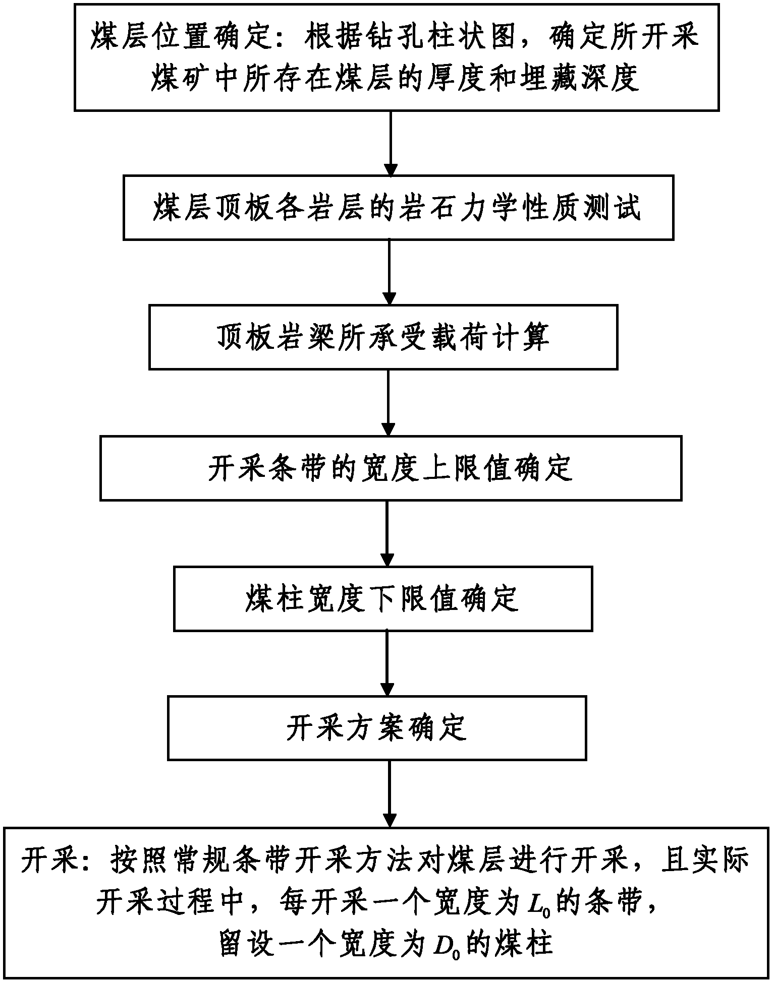
[0078] Such as figure 2 As shown, in this embodiment, the mined coal mine is the Yubujie coal mine located in the water source area (also known as the water source protection area). Yubujie Coal Mine is located in Yubujie Village, 11km north of Yulin City. It is located in the southwestern edge of the Yushen mining area planned by the state. The administrative division is under the jurisdiction of Niujialiang Town, Yuyang District. The designed production capacity was 0.06Mt / a (Million ton / annual in English, that is, one million tons / year), the production capacity of the mine was increased to 0.30Mt / a after technical upgrading in 2008. The Yubujie Coal Mining Area is located in the border area between the northern edge of the Loess Plateau in northern Shaanxi and the Mu Us Desert. Most of the mining area is typical aeolian sand dunes and aeolian sandy landforms. The desert coverage rate is over 80%, with fixed sand and semi-fixed sand as the main Mainly, the vegetation cove...
Embodiment 2
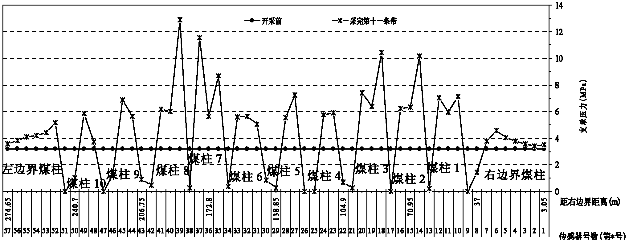
[0156] Such as Figure 5 As shown, in this embodiment, the mined coal mine is Erdun Coal Mine, which is located 21 kilometers northeast of Yulin City, Shaanxi Province, and is under the jurisdiction of Mahuangliang Town, Yuyang District, and belongs to a place in the planned local coal mining area. coal mine. Erdun Coal Mine is located at the border of the northern edge of the Loess Plateau in northern Shaanxi and the Mu Us Desert. The area of the well field is completely covered by Quaternary loose strata, with patches of loess in the south, and alluvial and lacustrine silt and sandy soil along both sides of the Liuxiang River. The bare loess in the area is relatively flat, high in the south, low in the north and middle, and the altitude is between +1200 and +1305. The area of the well field is completely covered by Quaternary aeolian sand and loess, and no bedrock is exposed. From bottom to top, the well field strata are the Middle Jurassic Yan'an Formation, the Middle ...
PUM
 Abstract
Description
Claims
Application Information
 - R&D
- Intellectual Property
- Life Sciences
- Materials
- Tech Scout
- Unparalleled Data Quality
- Higher Quality Content
- 60% Fewer Hallucinations
Browse by: Latest US Patents, China's latest patents, Technical Efficacy Thesaurus, Application Domain, Technology Topic, Popular Technical Reports.
© 2025 PatSnap. All rights reserved.Legal|Privacy policy|Modern Slavery Act Transparency Statement|Sitemap|About US| Contact US: help@patsnap.com


