Method and system for geometric correction of UAV (unmanned aerial vehicle) loaded imaging hyperspectrum
A hyperspectral and UAV technology, applied in the field of image processing, can solve problems such as being easily affected by airflow, poor stability of UAV platform, and small coverage of UAV-borne imaging hyperspectral single line array.
- Summary
- Abstract
- Description
- Claims
- Application Information
AI Technical Summary
Problems solved by technology
Method used
Image
Examples
Embodiment Construction
[0047] Embodiments of the present invention will be described in detail below with reference to the accompanying drawings.
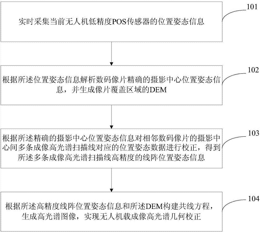
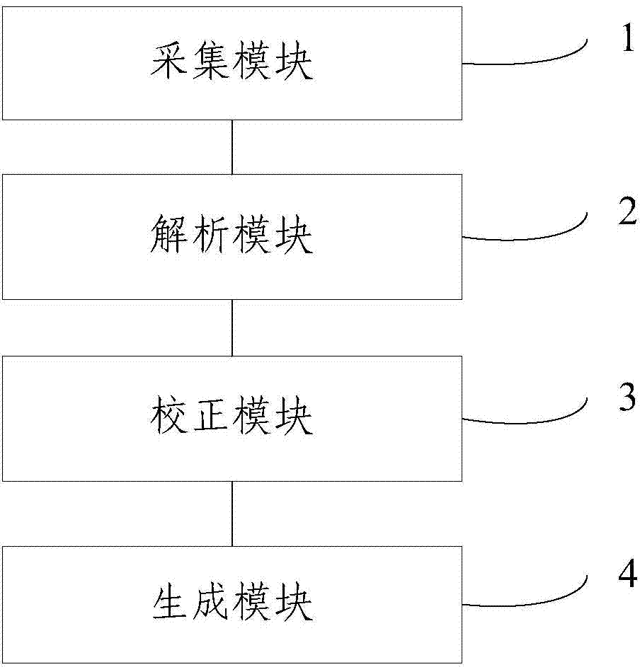
[0048]The present invention proposes a method and system for UAV-borne imaging hyperspectral geometric correction, which integrates a high-resolution area array imaging digital camera (DC, Digital Camera) and The linear array push-broom imaging hyperspectral instrument (HIS, Hyperspectral Imaging System) uses digital photos, ground control points, and low-precision POS (Position and Orientation System) sensors carried by the drone itself to simultaneously collect position and attitude information, and uses aerial triangulation The measurement method is to solve the POS information of the high-precision digital photo photography center and the DEM of the survey area. Polynomial fitting is performed on the POS data corresponding to each scan line of the imaging hyperspectrometer between adjacent digital photo photography centers, and then the calculated hi...
PUM
 Abstract
Description
Claims
Application Information
 - R&D
- Intellectual Property
- Life Sciences
- Materials
- Tech Scout
- Unparalleled Data Quality
- Higher Quality Content
- 60% Fewer Hallucinations
Browse by: Latest US Patents, China's latest patents, Technical Efficacy Thesaurus, Application Domain, Technology Topic, Popular Technical Reports.
© 2025 PatSnap. All rights reserved.Legal|Privacy policy|Modern Slavery Act Transparency Statement|Sitemap|About US| Contact US: help@patsnap.com


