Visual measurement and three-dimensional reconstruction method of model terrain in muddy water

A technology for three-dimensional reconstruction and underwater terrain, which is applied in the field of visual measurement and three-dimensional reconstruction of model terrain in muddy water, and can solve problems such as inability to realize underwater model terrain.

Inactive Publication Date: 2014-08-27
WUHAN UNIV
View PDF2 Cites 3 Cited by
  • Summary
  • Abstract
  • Description
  • Claims
  • Application Information

AI Technical Summary

Problems solved by technology

In recent years, a variety of measuring instruments have been developed at home and abroad to measure the terrain of river engineering models, such as photoelectric reflection topographs, resistive topographs, tracking topographs, ultrasonic topographs, laser scanners and other instruments. At present, t

Method used


Image

  • Visual measurement and three-dimensional reconstruction method of model terrain in muddy water
  • Visual measurement and three-dimensional reconstruction method of model terrain in muddy water
  • Visual measurement and three-dimensional reconstruction method of model terrain in muddy water

Examples


Embodiment Construction

[0038] The implementation process of the present invention mainly comprises the following steps:

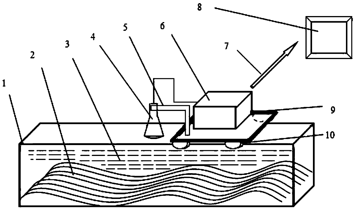
[0039] Step 1, connect the system device of the present invention according to Fig. 1;

[0040] Step 2. Fix the B-ultrasound probe, adjust the wireless network, and connect to the computer;

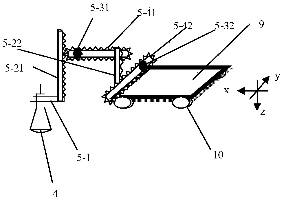
[0041] Step 3. The three-dimensional walking platform drives the B-ultrasound instrument to the position to be tested and makes the B-ultrasound probe touch the water surface;

[0042] Step 4, turn on the B-ultrasound instrument to adjust, so that the B-ultrasound instrument can better image the underwater terrain;

[0043] Step 5, controlling the B-ultrasonic instrument to carry out continuous video image acquisition of the underwater model terrain;

[0044] Step 6, the collected video image is transmitted to the computer through the wireless network; the computer completes in sequence: receiving the video image and analyzing it into a continuous single-frame B-ultrasound image; extractin...


PUM


Abstract

The invention provides a visual measurement and three-dimensional reconstruction method of a model terrain in muddy water. According to the method, firstly, a video image file of the underwater model terrain is directly obtained by using a B-ultrasound instrument, and a single frame of B-ultrasound image is analyzed; then, according to the gray level and gradient features (a breakdown process exists) of terrain bright bands in the B-ultrasound image and the continuity of the model terrain in the horizontal direction, single-pixel extraction of a terrain boundary line in the single frame of the image is achieved at a time; according to the similarity of terrain lines in multiple frames of continuous images, cubic spline function interpolation is conducted, and underwater three-dimensional terrain is reconstructed. The visual measurement and three-dimensional reconstruction method is good in penetrability, high in adaptivity, suitable for underwater model terrain such as plastic sand, natural sand, pulverized coal ash and bakelite powder, high in operation speed, high in measurement accuracy, visual, efficient, rapid and capable of effectively eliminating imaging disturbance of unrelated moving suspended particles in water and reappearing underwater original terrain appearance; the single operation time is shorter than 0.1 second, and underwater terrain errors are all less than 1 millimeter after single measurement and reconstruction.

Description

technical field [0001] The patent of the invention belongs to the technical field of hydraulic model topography measurement, and in particular relates to a visual measurement and three-dimensional reconstruction method of model topography in muddy water. Background technique [0002] The river engineering model experiment is an important means for people to understand and study the river water and sediment movement, evolution and flood evolution law. In model tests, the real-time observation and analysis of underwater topography is of great significance to the study of river siltation and water erosion. In order to accurately obtain information such as underwater topography and its erosion and deposition changes in model tests, it is necessary to find a device for real-time dynamic observation and analysis of underwater topography information. In recent years, a variety of measuring instruments have been developed at home and abroad to measure the terrain of river engineeri...

Claims


Application Information

Patent Timeline
IPC IPC(8): G06T17/00
Inventor 邹先坚马志敏宋欢杜剑锋胡文斌
Owner WUHAN UNIV
Why Eureka
Try Eureka