
Integrated method for above-water and underwater integrated measurement system of ship-borne water shoreline

A technology for above and below water and measurement systems, applied in the direction of measurement devices, general control systems, control/regulation systems, etc., to improve data interpolation efficiency, avoid repeated calibration work, improve information mining capabilities and on-site decision support capabilities Effect

Active Publication Date: 2018-02-27
QINGDAO XIUSHAN MOBILE SURVEYING CO LTD
View PDF1 Cites 0 Cited by
  • Summary
  • Abstract
  • Description
  • Claims
  • Application Information

AI Technical Summary

Problems solved by technology

[0004] The purpose of the present invention is to provide a ship-borne water shoreline water and underwater integrated measurement system integration method, which solves the problem of underwater and underwater integrated measurement of coastal zones, islands, reefs, inland waterways and underwater structures.

Method used


Image

  • Integrated method for above-water and underwater integrated measurement system of ship-borne water shoreline
  • Integrated method for above-water and underwater integrated measurement system of ship-borne water shoreline
  • Integrated method for above-water and underwater integrated measurement system of ship-borne water shoreline

Examples


Embodiment Construction

[0039] The present invention is specifically described below in conjunction with accompanying drawing:

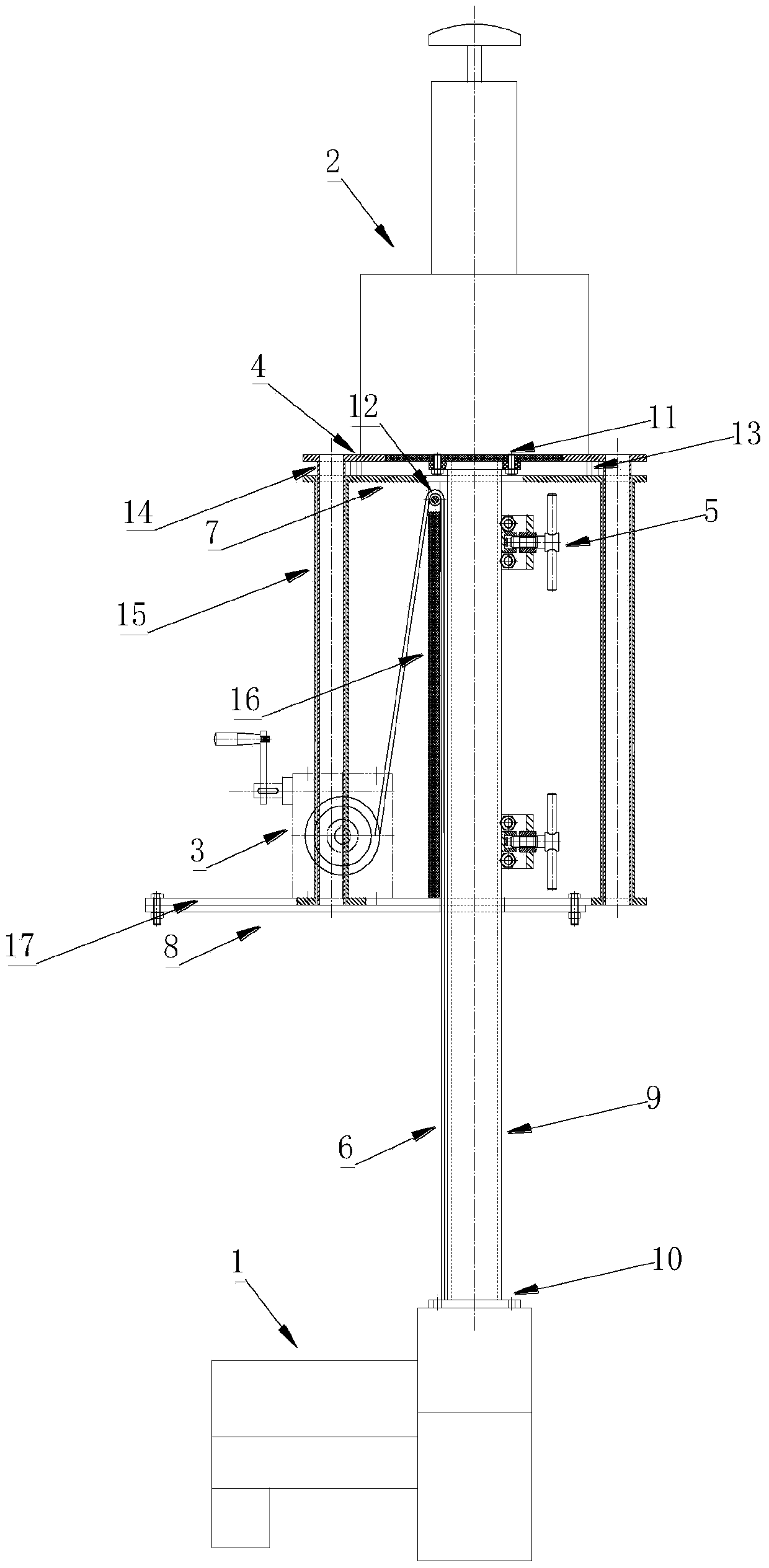
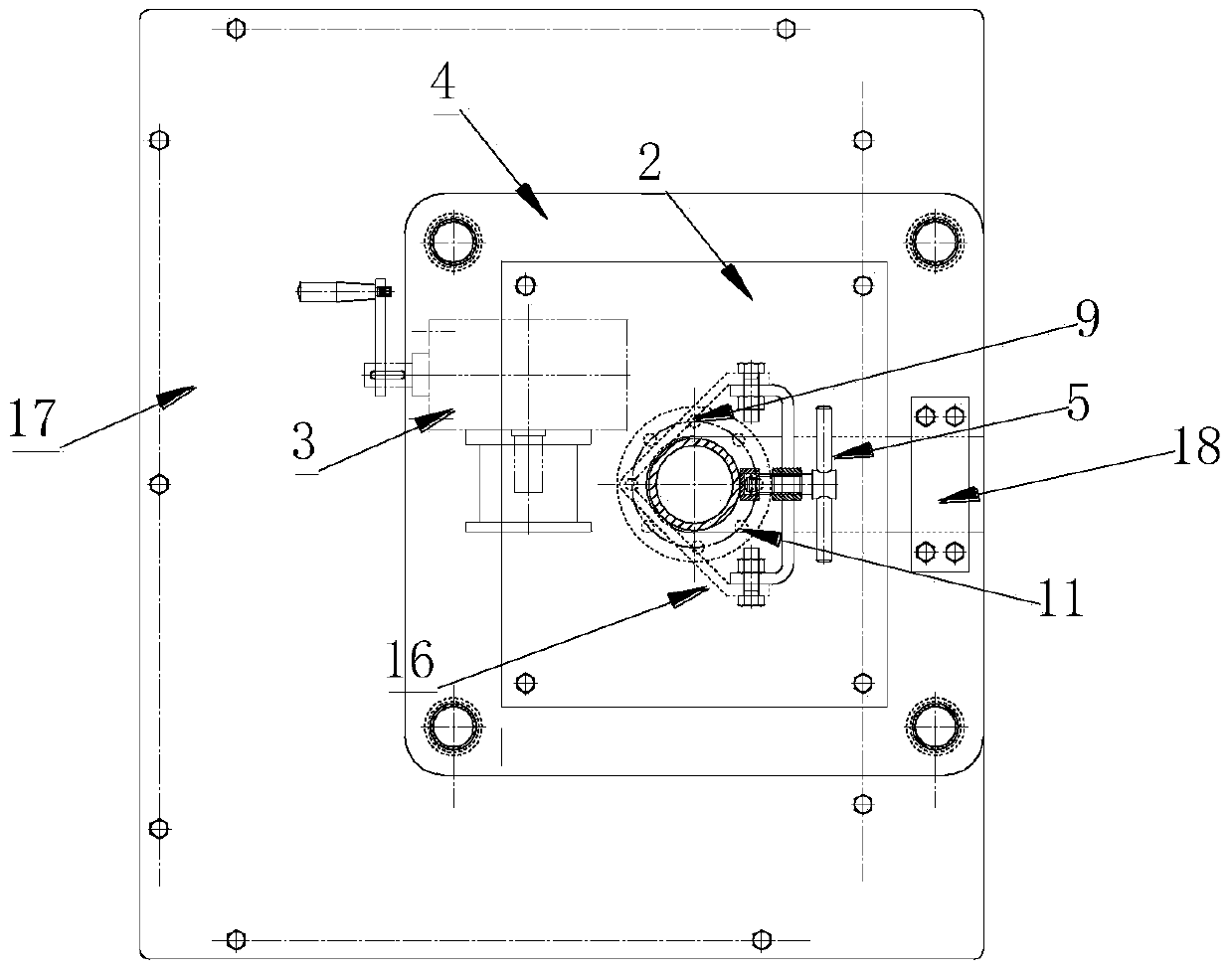
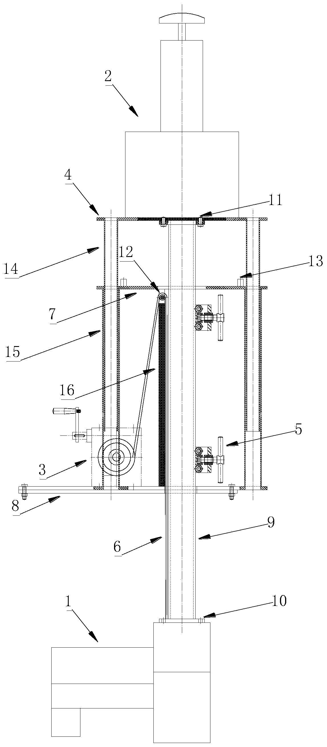
[0040] combine Figure 1 to Figure 3 , the system includes a ship-borne integrated underwater and underwater mapping device, and the integrated mapping device includes a fixing mechanism and a lifting mechanism.

[0041] Wherein, the fixing mechanism includes four first steel pipes 15, the top plate 7 of the fixing mechanism and the bottom plate 17 of the fixing mechanism are respectively welded to the upper and lower ends of the first steel pipe 15, and a An intermediate steel plate 16 with a triangular cross-section is provided with a pulley 12 and a rotation fixing device 5 . The top plate 7 of the fixing mechanism is provided with a base 13, the bottom plate 17 of the fixing mechanism is also provided with a cover plate 18, and the bottom plate 17 of the fixing mechanism is fixedly connected with a connecting plate 8 for connecting with the hull.

[0042] The lifting ...


PUM


Abstract

The invention provides a shipborne water bank line overwater and underwater integrated measurement system integrated method; integration of hardware of a measurement system is realized through design of a multi-sensor lift platform of an integrated mapping device, and requirements of changing sensor upper and lower positions under different operating conditions of a measurement ship are met. The system designs a data acquisition display control software framework to realize multi-sensor collaborative data acquisition, point cloud real-time display and the like. Through point cloud data preprocessing, data interpolation, spatial registration and other steps, multi-source data are subjected to fusion and resolution, so as to obtain a point cloud product for solving problems of difficult-and-inappropriate-to-reach island topographic measurement and marine unit coastal zone and mud flat topographic survey. The method realizes water bank line overwater and underwater integrated measurement, overcomes limitation of a traditional measurement technology, greatly improves the efficiency of measurement, and provides a bran-new measuring technological means for high-precision three-dimensional measurement problems required by wisdom navigation channels, digital water conservancy, wharfs, bank lines, off-lying sea islands and various engineering construction.

Description

technical field [0001] The invention relates to the technical field of marine surveying and mapping, in particular to an integration method for a ship-borne water shoreline integrated above-water and underwater measurement system. Background technique [0002] Accurate seabed topography of islands (reefs) and continental shelves is an important basis for determining my country's territorial waters and exclusive economic zones. The survey of seabed topography and near-shore water topography in shallow water areas of remote islands and reefs has always been a difficult problem in the field of surveying and mapping at home and abroad. [0003] Traditional field surveying and mapping generally uses a ship-borne single-beam echo sounder for underwater shoal surveys, and technical means such as artificial beaches, aerial photography, and satellite remote sensing are used for water topographic surveys; the non-integrated surveying method not only makes the cost High, and it is diff...

Claims


Application Information

Patent Timeline
Patent Type & Authority Patents(China)
IPC IPC(8): G01C7/04G05B19/042
CPCG01C7/04G05B19/0428G05B2219/2656
Inventor 卢秀山石波景冬马跃刘振王明伟
Owner QINGDAO XIUSHAN MOBILE SURVEYING CO LTD
Learn More