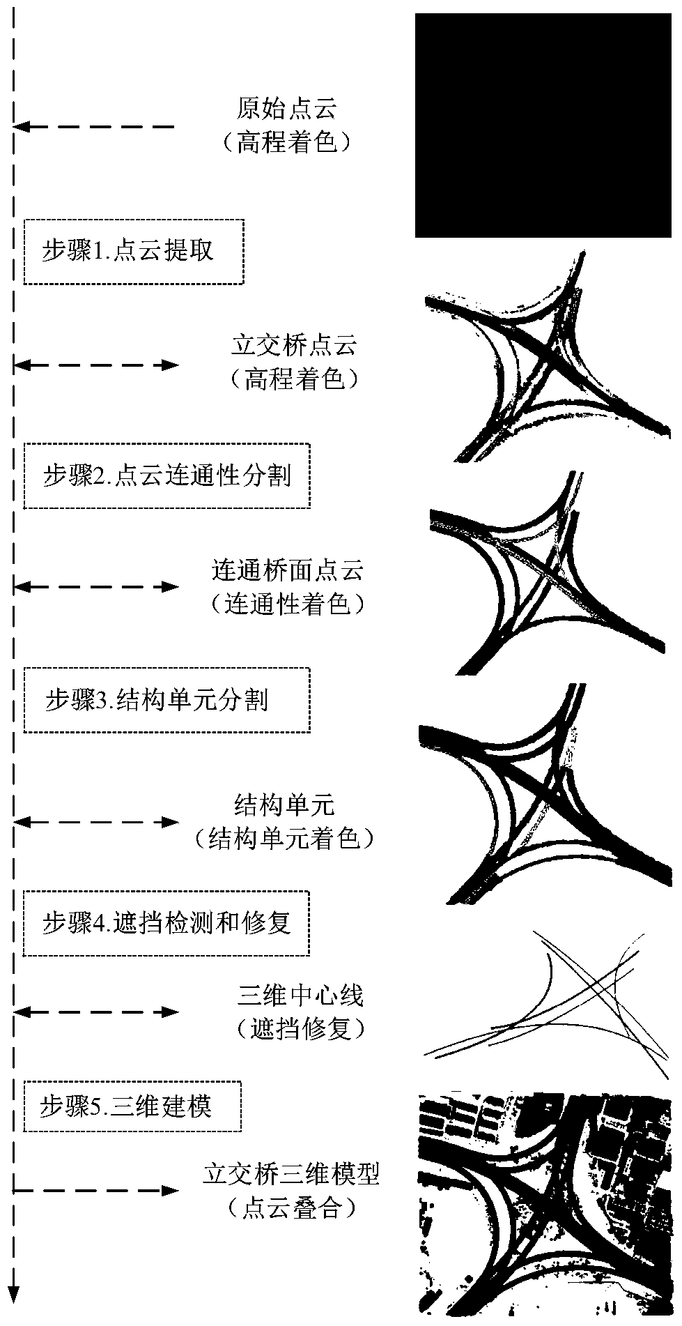
A Method for Reconstructing 3D Models of Large and Complex Overpasses Using Airborne Lidar Data
A technology for 3D model and data reconstruction, applied in image data processing, image analysis, image enhancement, etc., can solve problems such as overpass occlusion, achieve the effect of improving quality, reducing technical difficulty, and improving reconstruction efficiency and accuracy
- Summary
- Abstract
- Description
- Claims
- Application Information
AI Technical Summary
Problems solved by technology
Method used
Image
Examples
Embodiment Construction
[0066] The embodiment area of the present invention is an overpass bridge in Jiangsu Province. Airborne LiDAR raw data ( Figure 2-a ), as the example data for reconstructing a 3D model of a large complex overpass, the average point spacing is 1m, the elevation accuracy is 0.20m, and the plane accuracy is 0.50m. The size of the embodiment area is about 520m×450m, and the original data has a total of 820,000 scanning points. High resolution image data ( Figure 2-b ), as the reference data for model evaluation, the image resolution is 0.10m.
[0067] Embodiments of the present invention utilize airborne LiDAR data to reconstruct a large-scale and complex overpass three-dimensional model method (see the overall process figure 1 ), including the following steps:
[0068] Step 1. Extract the overpass point cloud. Firstly, the overpass point cloud needs to be extracted from the raw LiDAR data. The original data mainly contains four types of point clouds: overpasses, buildin...
PUM
 Abstract
Description
Claims
Application Information
 - R&D
- Intellectual Property
- Life Sciences
- Materials
- Tech Scout
- Unparalleled Data Quality
- Higher Quality Content
- 60% Fewer Hallucinations
Browse by: Latest US Patents, China's latest patents, Technical Efficacy Thesaurus, Application Domain, Technology Topic, Popular Technical Reports.
© 2025 PatSnap. All rights reserved.Legal|Privacy policy|Modern Slavery Act Transparency Statement|Sitemap|About US| Contact US: help@patsnap.com


