Thermal infrared high spectral remote sensing data on-track spectral calibration method
A technology of hyperspectral remote sensing and spectral calibration, which is applied in the field of on-orbit spectral calibration of thermal infrared hyperspectral remote sensing data, which can solve the problems of lack of data and no practical application.
- Summary
- Abstract
- Description
- Claims
- Application Information
AI Technical Summary
Problems solved by technology
Method used
Image
Examples
Embodiment Construction
[0023] The embodiments of the present invention are described in further detail below, but the embodiments are not limited to the present invention, and all similar methods and similar changes of the present invention should be included in the protection scope of the present invention.
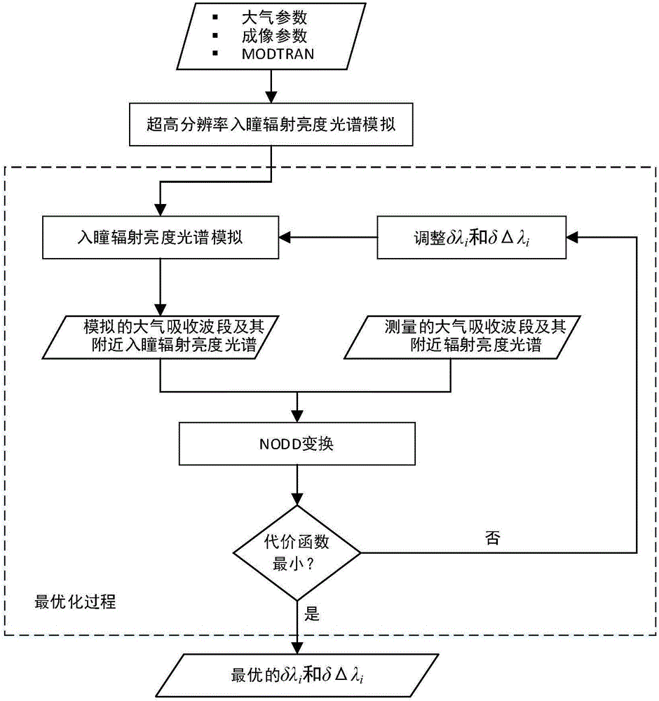
[0024] 1) Select the airborne thermal infrared hyperspectral data to be spectrally calibrated, and input the atmospheric parameters and imaging parameters when the thermal infrared hyperspectral remote sensing data is acquired into the MODTRAN atmospheric radiation transfer simulation software to obtain the simulated 1nm ultra-high resolution entrance pupil radiance spectrum . The input atmospheric parameters mainly include atmospheric model, water vapor content, aerosol model, meteorological sight distance, etc. The input imaging parameters mainly include sensor height, observation zenith angle, observation azimuth angle, surface elevation, and surface reflectance (ρ s ), surface temperature...
PUM
 Abstract
Description
Claims
Application Information
 - R&D
- Intellectual Property
- Life Sciences
- Materials
- Tech Scout
- Unparalleled Data Quality
- Higher Quality Content
- 60% Fewer Hallucinations
Browse by: Latest US Patents, China's latest patents, Technical Efficacy Thesaurus, Application Domain, Technology Topic, Popular Technical Reports.
© 2025 PatSnap. All rights reserved.Legal|Privacy policy|Modern Slavery Act Transparency Statement|Sitemap|About US| Contact US: help@patsnap.com


