Rapid measuring method for growing height of agricultural crops in mountainous areas based on unmanned aerial vehicle photographed image

A crop and UAV technology is applied in the field of rapid measurement of the growth height of mountain crops based on UAV images to achieve the effects of good measurement accuracy, high efficiency and low terrain requirements.

Inactive Publication Date: 2017-05-10
INST OF MOUNTAIN HAZARDS & ENVIRONMENT CHINESE ACADEMY OF SCI
View PDF3 Cites 17 Cited by
  • Summary
  • Abstract
  • Description
  • Claims
  • Application Information

AI Technical Summary

Problems solved by technology

At present, this method is effective for measuring the height of a single crop, but for the measurement of the average growth of large crops, this method still needs to be improved, and it is currently only suitable for cultivated land in flat plains, and for complex terrain and fragmented land There is no good method for fast and efficient measurement of crop growth height

Method used


Image

  • Rapid measuring method for growing height of agricultural crops in mountainous areas based on unmanned aerial vehicle photographed image
  • Rapid measuring method for growing height of agricultural crops in mountainous areas based on unmanned aerial vehicle photographed image
  • Rapid measuring method for growing height of agricultural crops in mountainous areas based on unmanned aerial vehicle photographed image

Examples


Embodiment

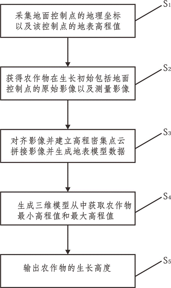
[0053] 1. Implementation process

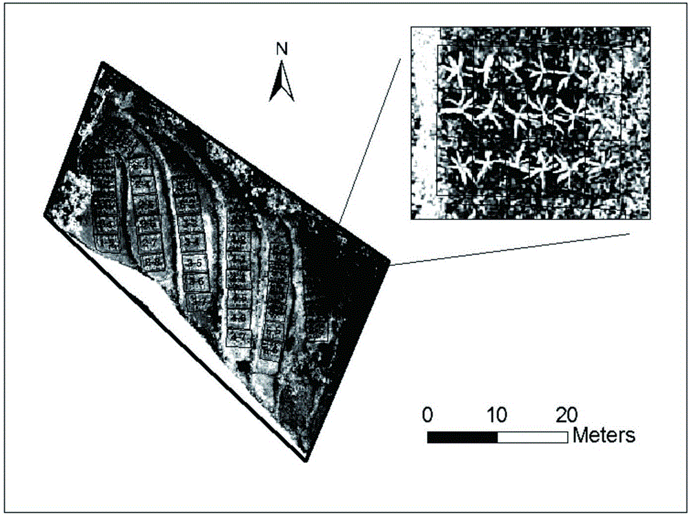
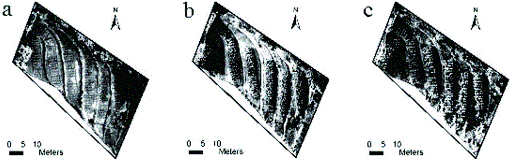
[0054] Taking the corn planting terrace test area in the small watershed of the Wuqiao River in the middle of the Three Gorges reservoir area as the research object, high-precision images were obtained through low-altitude aerial photography of drones, and digital surface models were extracted by image automatic processing software based on machine vision, and extracted by spatial analysis methods. The height of the crop.

[0055] 1.1. Overview of the test site

[0056] The research test area is located in Changling Town, Wanzhou District. The test plot is a terraced field with a total area of ​​about 900m 2 , including 6 rungs. The overall slope of the terraces is about 10°, and the height difference between the top and the bottom is about 4m. The length and width of different steps are different, and the height difference of each level is between 0.7-1.0m (Table 1).

[0057] Table 1: Experimental information

[0058]


PUM


Abstract

The invention discloses a rapid measuring method for the growing height of agricultural crops in mountainous areas based on an unmanned aerial vehicle photographed image. The method comprises the following steps: acquiring the geographical coordinates of all ground control points and the surface elevation value H; acquiring an initial image P1 and a measurement image P2; establishing elevation dense point clouds; generating respectively a ground splicing image and digital surface model data; generating a three-dimensional model for an agricultural crop growing area and extracting from the three-dimensional model the bare soil elevation value and the measurement elevation value; and outputting the growing height of the agricultural crops. According to the invention, through an unmanned aerial vehicle, it is possible to obtain what is influential in the growing process of agricultural crops; and through the cooperation with the ground control points, DSM data are generated and a three-dimensional model is obtained; and from the three-dimensional model, the growing height of the agricultural crops in each period can be further obtained. With a spatial analysis method to extract the growing height of agricultural crops, the method does not require much on the terrains, therefore, making it suitable for the height measurement of different types of agricultural crops in different growing periods. Capable of measuring at a short time, the method also achieves high efficiency and good measurement precision.

Description

technical field [0001] The invention relates to the technical field of agricultural monitoring, in particular to a method for quickly measuring the growth height of crops in mountainous areas based on drone images. Background technique [0002] Crop growth monitoring is an important task in agricultural production activities, and its purpose is to provide an important basis for early crop yield estimation and provide reliable information for field management. Quick and effective access to crop growth information can improve planting efficiency and reduce planting costs while reducing manual labor workload. As important information on growth, crop growth height is an important indicator to measure growth speed, estimate agricultural yield, and characterize lodging resistance. very important. For the measurement of plant height, the manual method is most commonly used. The result of this method is more accurate, but it consumes a lot of manual time and is extremely ineffici...

Claims


Application Information

Patent Timeline
Patent Type & Authority Applications(China)
IPC IPC(8): G01B11/06
CPCG01B11/0608
Inventor 陈颖锋王玉宽傅斌徐佩
Owner INST OF MOUNTAIN HAZARDS & ENVIRONMENT CHINESE ACADEMY OF SCI
Why Eureka
Try Eureka