Terrain infrared texture modulation template generation method based on remote sensing image
A remote sensing image and template generation technology, which is applied in the field of computer simulation, can solve problems such as solidified shadows and special objects, uneven brightness of images, and inconsistent color tones, so as to improve the quality of remote sensing images, increase image self-similar information, and save time. Effect
- Summary
- Abstract
- Description
- Claims
- Application Information
AI Technical Summary
Problems solved by technology
Method used
Image
Examples
Embodiment 1
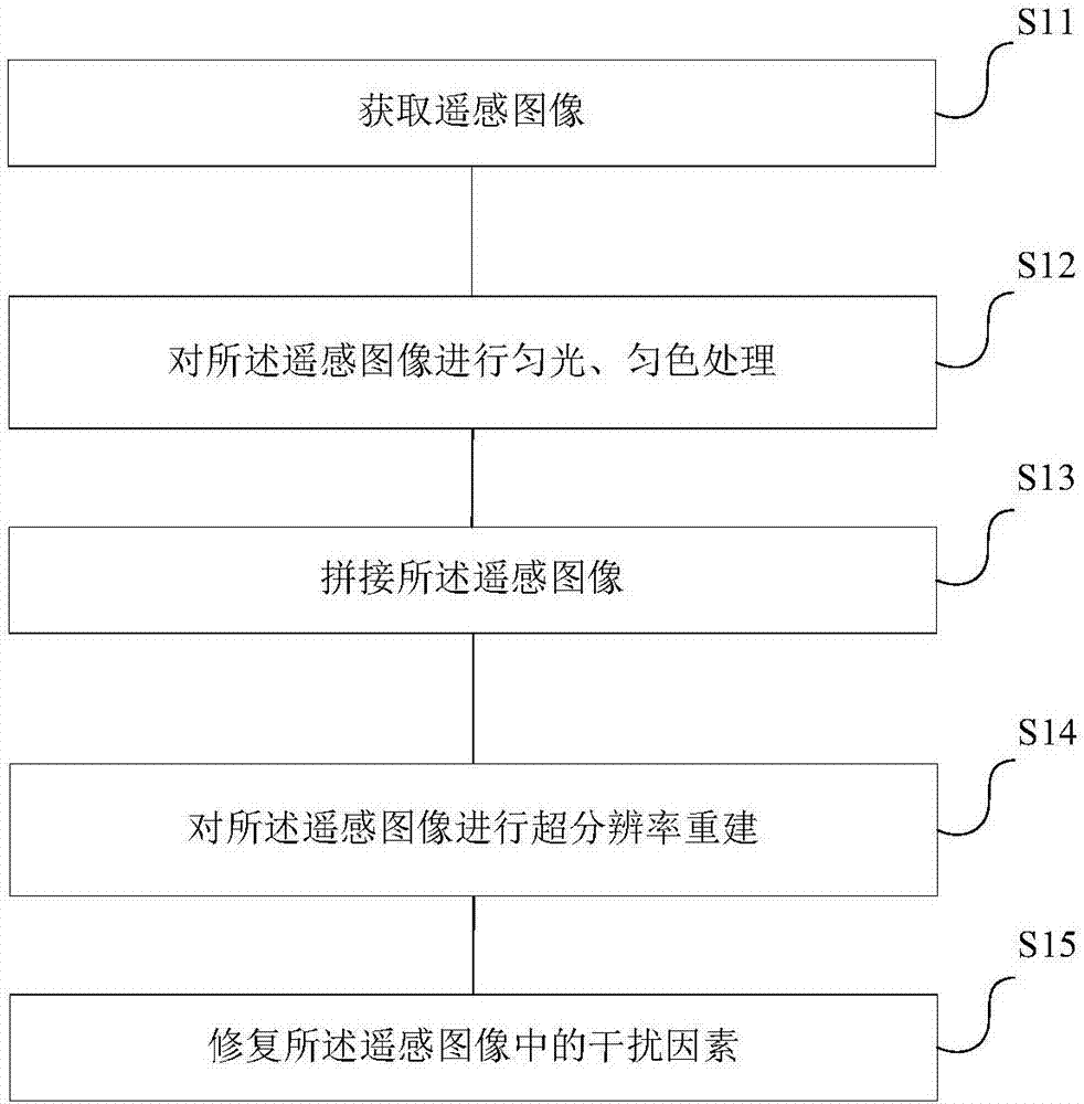
[0043] See figure 2 , figure 2 A flow chart of a method for generating infrared texture modulation templates of ground objects based on remote sensing images provided by an embodiment of the present invention, the method includes:
[0044] S11. Acquiring remote sensing images;
[0045] S12. Perform uniform light and color uniform processing on the remote sensing image;
[0046] S13. Stitching the remote sensing images;
[0047] S14. Perform super-resolution reconstruction on the remote sensing image;
[0048] S15. Restoring interference factors in the remote sensing image.
[0049] Preferably, performing uniform light and color uniform processing on the remote sensing image in step S12 may include:
[0050] S121. Perform uniform light processing on the remote sensing image by using the fuzzy positive image method;
[0051] S122. Perform color uniformity processing on the remote sensing image by using the Wallis filter method for uniform color between images.
[0052] ...
Embodiment 2
[0069] Specifically, see image 3 , image 3 It is a schematic diagram of a process flow for generating an infrared texture modulation template of ground objects provided by another embodiment of the present invention. The process includes:
[0070] S21. Acquiring visible light remote sensing images;
[0071] S22. Perform light uniformity and color uniformity processing on the remote sensing image;
[0072] S23. Splicing and processing remote sensing images;
[0073] S24. Perform super-resolution reconstruction on the remote sensing image;
[0074] S25, repairing the interference factors of the remote sensing image;
[0075] S26. Generate a ground object infrared texture modulation template.
[0076] Preferably, in step S22, the uniform light and color uniform processing of the remote sensing image includes firstly using the MASK uniform light algorithm, that is, the fuzzy positive image method, to perform uniform light processing on the remote sensing image, and then us...
Embodiment 3
[0095] For a clearer understanding, the following specific examples are given to describe the image self-similarity-based super-resolution method in the above embodiment in detail:
[0096] Specifically, see Figure 4 , Figure 4 A frame diagram of a super-resolution method based on image self-similarity provided by another embodiment of the present invention. In the super-resolution method based on image self-similarity, the remote sensing image is proportionally reduced and enlarged to form a downsampling layer and an upsampling layer respectively; the original remote sensing image and the downsampling layer form a downsampling image pyramid, and the downsampling image pyramid is extracted Small blocks at the same position in different layers make up the image database. The data of the image database is expanded to four times by the super-resolution method of image rotation self-similarity.
[0097] Furthermore, when performing super-resolution reconstruction, the origina...
PUM
 Abstract
Description
Claims
Application Information
 - R&D
- Intellectual Property
- Life Sciences
- Materials
- Tech Scout
- Unparalleled Data Quality
- Higher Quality Content
- 60% Fewer Hallucinations
Browse by: Latest US Patents, China's latest patents, Technical Efficacy Thesaurus, Application Domain, Technology Topic, Popular Technical Reports.
© 2025 PatSnap. All rights reserved.Legal|Privacy policy|Modern Slavery Act Transparency Statement|Sitemap|About US| Contact US: help@patsnap.com


