A method of lidar scanning to determine the coal mining subsidence basin in the mining area

A technology of laser radar and mining area, which is applied in the direction of measuring device, electromagnetic wave reradiation, radio wave measurement system, etc., can solve the problems that it is difficult to guarantee the processing accuracy of point cloud data, and the surface subsidence basin deviates from the real state, etc.

A technology of laser radar and mining area, which is applied in the direction of measuring device, electromagnetic wave reradiation, radio wave measurement system, etc., can solve the problems that it is difficult to guarantee the processing accuracy of point cloud data, and the surface subsidence basin deviates from the real state, etc.

CN110726998BActive Publication Date: 2020-08-07XIAN UNIV OF SCI & TECH

Image

  • A method of lidar scanning to determine the coal mining subsidence basin in the mining area
  • A method of lidar scanning to determine the coal mining subsidence basin in the mining area
  • A method of lidar scanning to determine the coal mining subsidence basin in the mining area

Examples


Embodiment Construction

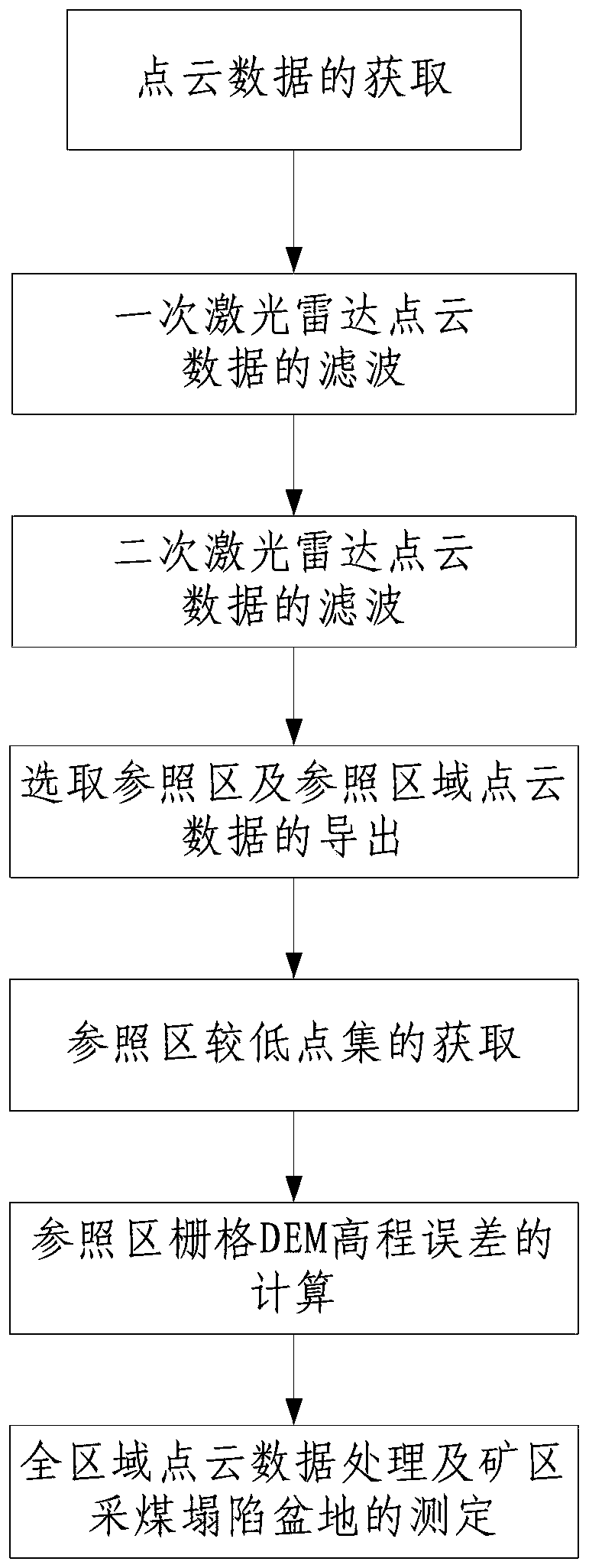
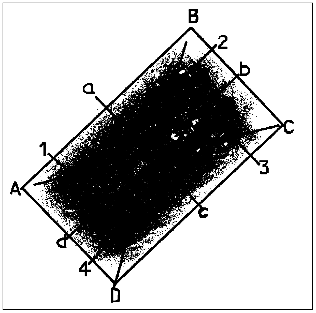
[0079] Such as Figure 1 to Figure 4 Shown is a method for measuring the coal mining subsidence basin in a mining area by laser radar scanning, comprising the following steps:

[0080] Step 1. Acquisition of point cloud data:

[0081] Step 101, using a drone equipped with a laser radar to perform a laser radar scan on the mining area to be determined to obtain a laser radar point cloud data; wherein, a laser radar point cloud data includes the coordinate data of the first scanning point of the mining area to be determined, the second The coordinate data of the scanning point of the mining area to be determined, ..., the coordinate data of the scanning point of the ith mining area to be determined, ..., the coordinate data of the scanning point of the n'th mining area to be determined; wherein, i and n' are both positive integers, n'≥100, and 1≤i≤n', the coordinate data of the scanning point of the i-th mining area to be determined is denoted as P i (x i ,y i ,z i ), x i ...


PUM


Abstract

The invention discloses a method for measuring a coal mining subsidence basin of a mining area by laser radar scanning. The method comprises the following steps: 1, acquiring point cloud data; 2, filtering primary laser radar point cloud data; 3, filtering secondary laser radar point cloud data; 4, selecting a reference area and exporting point cloud data of the reference area; 5, acquiring a lower point set of the reference area; 6, calculating a grid DEM high elevation error of the reference area; and 7, processing full-area point cloud data and measuring a coal mining subsidence basin of the mining area. The method is simple and reasonable in design, reduces errors of human intervention, has simple processing process, avoids errors caused by non-ground point noise and DEM modeling and superposition algorithms, ensures the accuracy of measurement of the coal mining subsidence basin of the mining area, and has strong practicability.

Description

technical field [0001] The invention belongs to the technical field of coal mining subsidence basin measurement in mining areas, and in particular relates to a laser radar scanning method for measuring coal mining subsidence basins in mining areas. Background technique [0002] The traditional method for the determination of coal mining subsidence basins in mining areas is to lay out a certain number of monitoring points in the coal mining subsidence basins, and measure the coordinate changes of these points to fit and approximately describe the main characteristics of coal mining surface subsidence in mining areas. Obtaining the three-dimensional fine features of the subsidence basin on the surface, and the measurement work is inefficient; while using the photogrammetry method of UAV, although the general shape of the subsidence basin on the surface can be obtained through aerial three-dimensional modeling, the elevation and plane The accuracy cannot meet the basic requirem...

Claims


Application Information

Patent Timeline
07 Aug 2020
Publication
CN110726998B
IPC
G01S17/89; G06T7/521
CPC
G01S17/89
Inventors
汤伏全; 杨倩