Soil water content inversion method of comprehensive drought model

A soil water content and drought model technology, applied in complex mathematical operations, design optimization/simulation, etc., can solve problems such as exaggerating the influence of vegetation and difficulties in NDVI critical thresholds, and achieve suitable promotion and application, high correlation, and improved inversion The effect of precision

Active Publication Date: 2020-03-27
SHANDONG UNIV OF SCI & TECH
View PDF5 Cites 3 Cited by
  • Summary
  • Abstract
  • Description
  • Claims
  • Application Information

AI Technical Summary

Problems solved by technology

However, the VSWI method exaggerates the influence of vegetation and has serious hysteresis, and it is difficult to determine the critical threshold of NDVI

Method used


Image

  • Soil water content inversion method of comprehensive drought model
  • Soil water content inversion method of comprehensive drought model
  • Soil water content inversion method of comprehensive drought model

Examples


Embodiment Construction

[0036] The present invention will be described in further detail below in conjunction with specific embodiments and accompanying drawings.

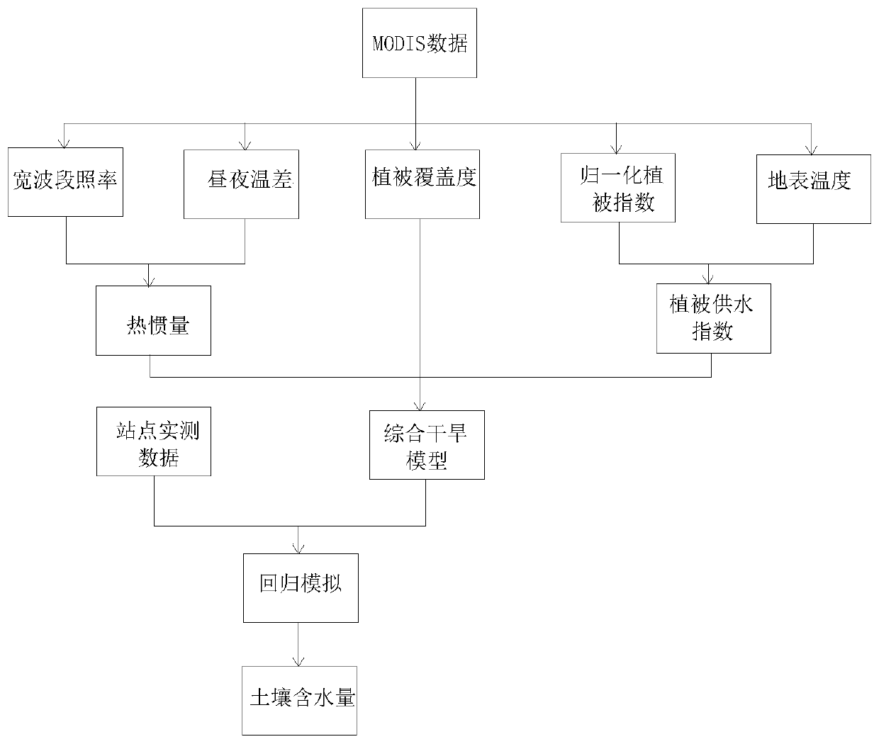
[0037] a kind of like figure 1 The soil water content inversion method of the comprehensive drought model shown in the figure, the specific steps are as follows:

[0038] The first step is to select cloudless MODIS data in the study area as the data source, including MOD09 surface albedo data and MOD11 surface temperature data, and preprocess the data source.

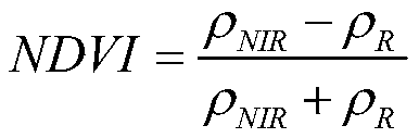
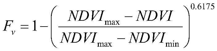
[0039] The data source MOD09GA provides the surface reflectance data of the MODIS1-7 band (visible light-near infrared) with a spatial resolution of 500m; the MOD11A1 data provides daytime and nighttime surface temperature data with a spatial resolution of 1000m. Sinusoidal projection method. Due to the inconsistent spatial resolution of the two data, it is necessary to resample the MOD09GA data to make it the same resolution as MOD11A1. Then cut according to the actual research...


PUM


Abstract

The invention provides a soil water content inversion method of a comprehensive drought model. The soil water content inversion method comprises the following steps: A, selecting cloudless MODIS datain a to-be-studied area range as a data source, and preprocessing the data source; B, calculating a broadband albedo, a normalized vegetation index and vegetation coverage (Fv) according to the surface reflectance in the MOD09 data, and calculating the day and night temperature difference of the area to be researched according to the surface temperature in the MOD11; C, calculating an apparent thermal inertia and vegetation water supply index model according to the result of the step B, assigning a vegetation coverage degree as a coefficient to a vegetation water supply index, assigning (1-Fv)as a coefficient to the apparent thermal inertia, and weighting the two products to obtain a comprehensive drought model; and D, performing regression simulation on the calculation result of the comprehensive drought model and the actually measured soil water content data to obtain a relational expression between the comprehensive drought model and the soil water content for inverting the soil water content of the research area.

Description

technical field [0001] The invention provides a soil water content inversion method for a comprehensive drought model, which belongs to the technical field of remote sensing image processing. Background technique [0002] Drought is a natural disaster that affects the most extensive areas and causes the most serious social and economic losses in the world. Soil moisture content is an important indicator of drought monitoring, an important parameter in climate, hydrology, ecology, agriculture and other fields, and an important part of global climate change. Remote sensing has the characteristics of large-area observation, fast speed, and short cycle, which provides an effective means for timely obtaining large-scale surface soil moisture. [0003] Drought monitoring using remote sensing technology is mainly to explore the soil moisture of different surface types, mainly including bare soil / low vegetation cover and high vegetation cover. For bare soil / low vegetation coverage...

Claims


Application Information

Patent Timeline
IPC IPC(8): G06F30/20G06F17/18
CPCG06F17/18
Inventor 孙林刘喜荣王春香于会泳
Owner SHANDONG UNIV OF SCI & TECH
Why Eureka
Try Eureka