Radar resolution measuring method
A measurement method and resolution technology, applied in the field of remote sensing, can solve problems such as low efficiency, and achieve the effect of low processing complexity
- Summary
- Abstract
- Description
- Claims
- Application Information
AI Technical Summary
Problems solved by technology
Method used
Image

Examples
example
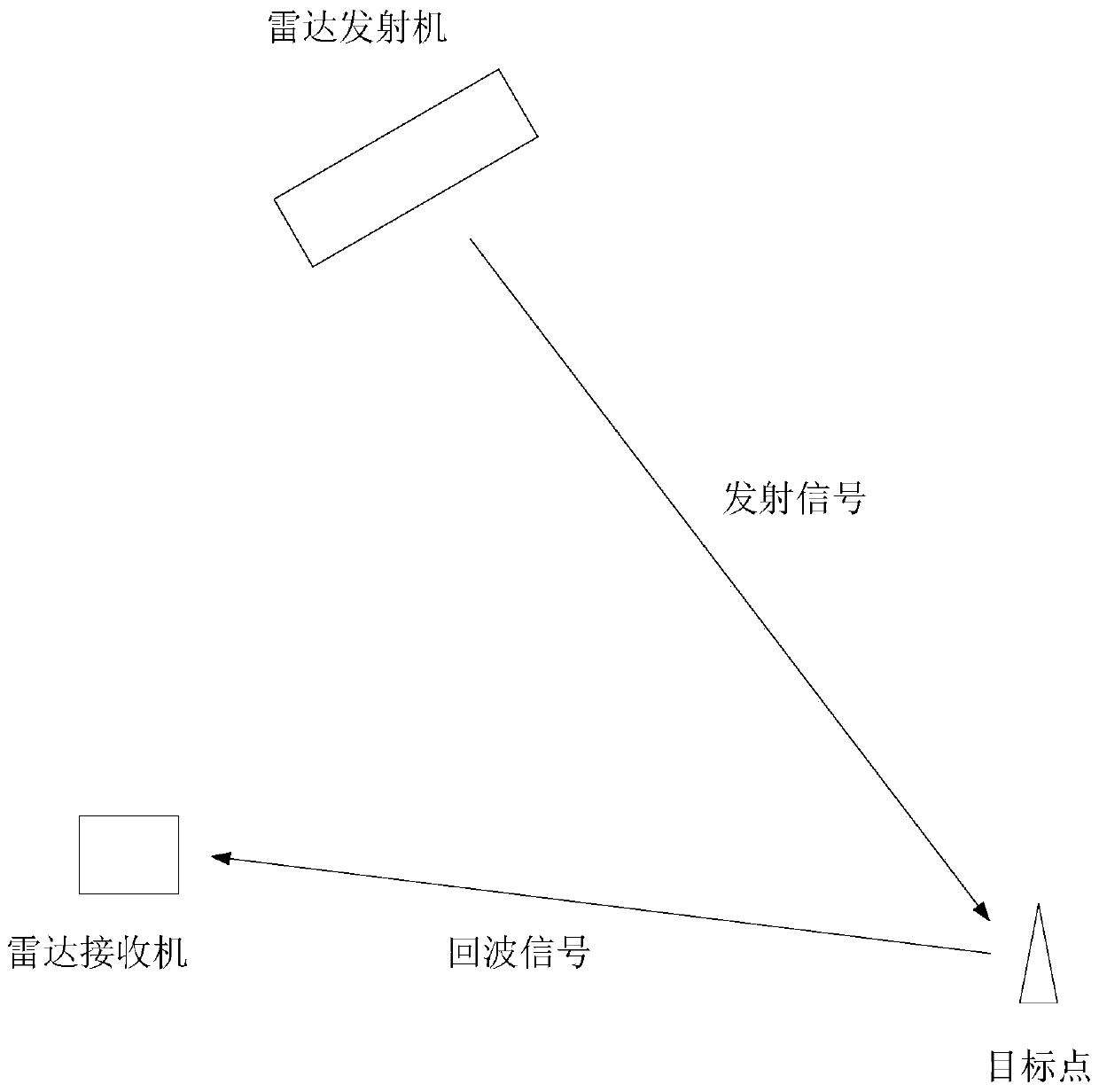
[0133] The simulation parameters are: the radar transmitter platform is placed on a satellite in geostationary orbit, the radar receiver moves on the surface of the earth, the inclination angle θ of the initial position of the radar receiver is 20 degrees, the moving speed v of the radar receiver is 30 m / s, The distance between the initial position of the radar receiver and the target point is 250 meters, and the vector of the target point is (250,0,0), the vector of the radar transmitter is (320,680,35800000). The total time of the radar movement is 30 seconds, and the imaging scene size is 100 meters × 40 meters.
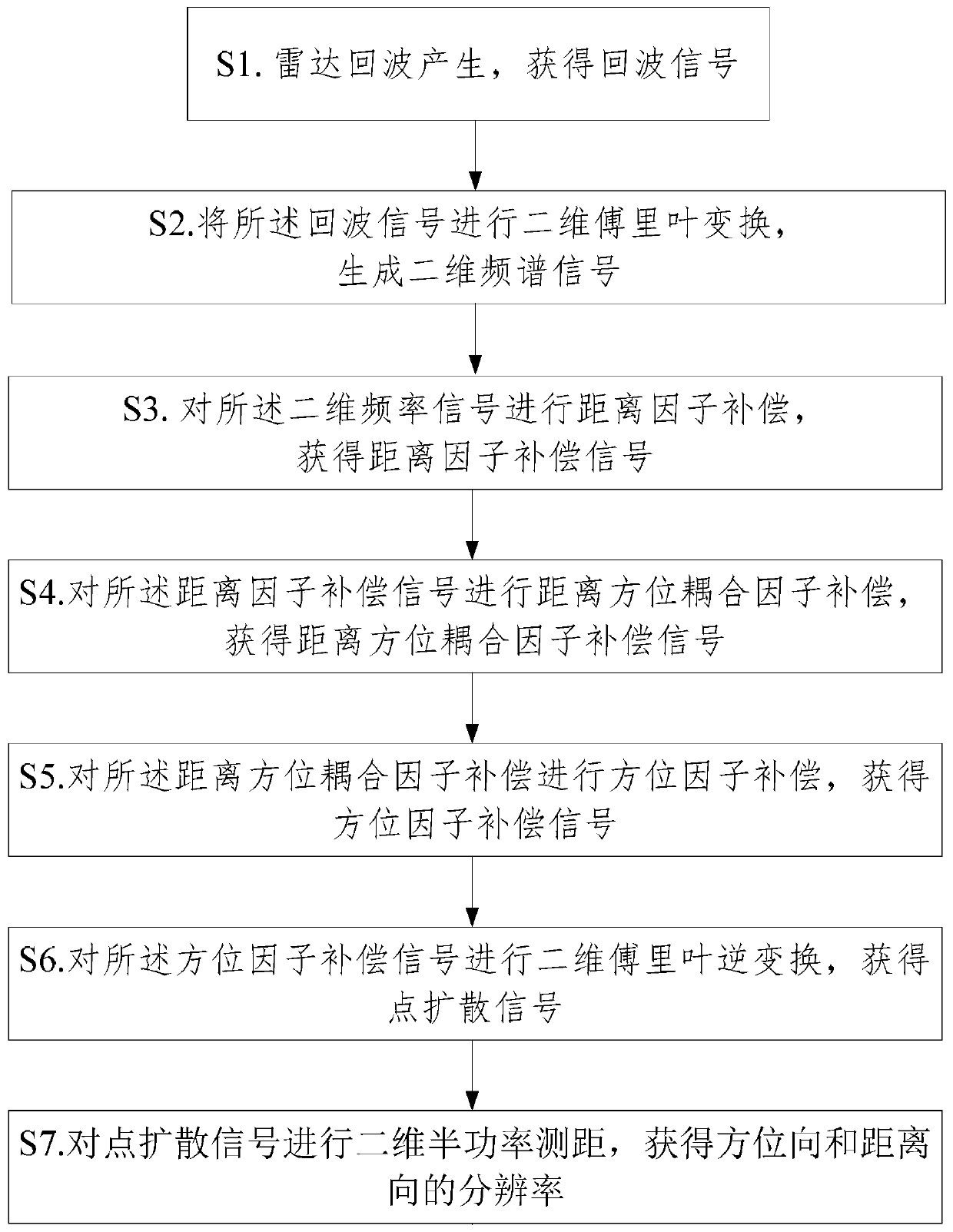
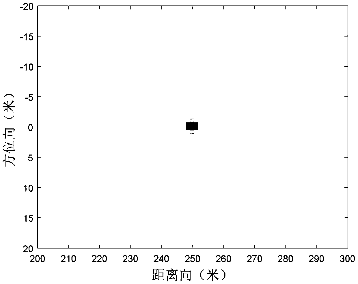
[0134]Firstly, formula derivation is performed according to steps S1 to S6 to obtain the point spread signal. Combined with the simulation parameters, Matlab software is used to simulate the point spread signal and two-dimensional half-power ranging to obtain the resolution of the azimuth direction and the distance direction, as follows:
[0135] S71. Use mat...
PUM
 Abstract
Description
Claims
Application Information