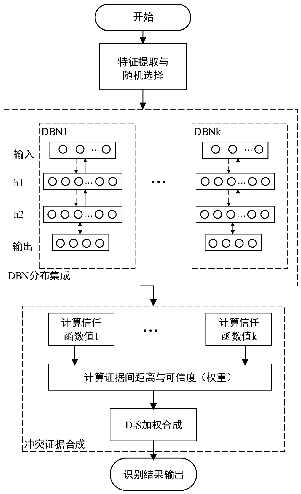
Remote sensing ground object identification method based on DBN distribution integration and conflict evidence synthesis
A feature recognition and conflict evidence technology, applied in the field of remote sensing data feature recognition, can solve the problems of improving recognition accuracy, ignoring contradictions, conflicts and paradoxes between evidence, reducing complexity, improving classification and recognition accuracy, and achieving accurate The effect of classification
- Summary
- Abstract
- Description
- Claims
- Application Information
AI Technical Summary
Problems solved by technology
Method used
Image


Examples
Embodiment Construction
[0050] The technical solutions of the present invention will be further described below in conjunction with the accompanying drawings and through specific embodiments. It should be clear to those skilled in the art that the specific implementation is only to help understand the present invention, and should not be regarded as a specific limitation on the present invention.
[0051] The experimental data used in this example is collected by the Falcon II LIDAR system in the form of optical fiber scanning, the flight height is about 600m, and the average laser foot point density and point spacing are 4 points / m 2 and 0.5m, are registered to a 0.5m spatial resolution. The multispectral data includes blue, green, red, and near-infrared bands, and the elevation data includes the first and last echo elevations, as well as laser echo intensity. The measured area has a typical urban landform, and the ground cover types include buildings, trees, grassland and open space. The ground tr...
PUM
 Abstract
Description
Claims
Application Information
 - R&D
- Intellectual Property
- Life Sciences
- Materials
- Tech Scout
- Unparalleled Data Quality
- Higher Quality Content
- 60% Fewer Hallucinations
Browse by: Latest US Patents, China's latest patents, Technical Efficacy Thesaurus, Application Domain, Technology Topic, Popular Technical Reports.
© 2025 PatSnap. All rights reserved.Legal|Privacy policy|Modern Slavery Act Transparency Statement|Sitemap|About US| Contact US: help@patsnap.com