Remote sensing image processing system based on plug-in extensible architecture
A technology for remote sensing image processing and extension architecture, applied in the field of remote sensing image processing system based on plug-in scalable architecture, can solve the problems of late start, high purchase price, low system flexibility, etc. quick effect
- Summary
- Abstract
- Description
- Claims
- Application Information
AI Technical Summary
Problems solved by technology
Method used
Image

Examples
Embodiment Construction
[0033] The present invention will be further described in detail below in conjunction with the accompanying drawings and specific embodiments.
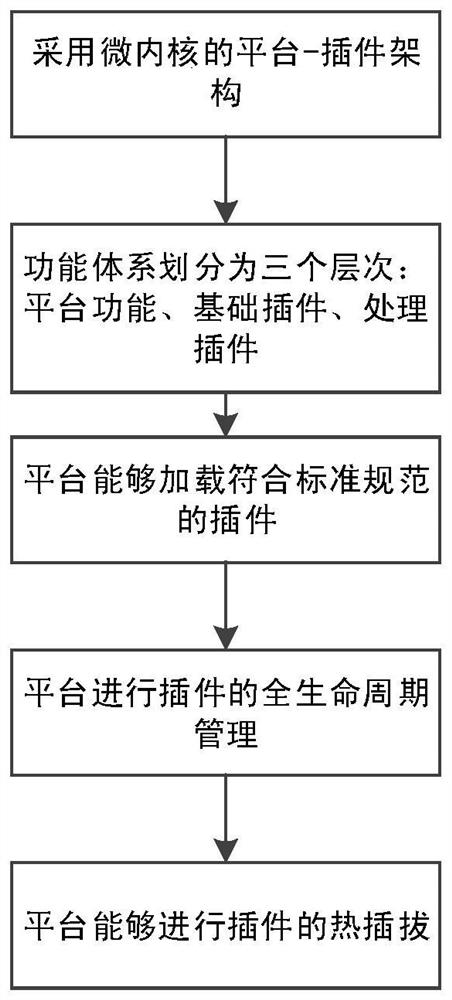
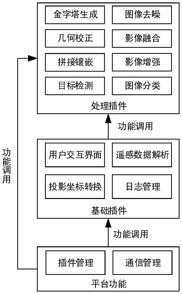
[0034] Such as figure 2 As shown, a remote sensing image processing system based on plug-in scalable architecture, which includes the following program modules running on the server:
[0035] Remote sensing plug-in loading module: for the kernel module of the system, search the specified directory according to the software configuration file, analyze the DLL files in the directory according to the system-defined plug-in rules, search for qualified plug-in files, and check the startup priority and dependency of the plug-in Analyze the relationship, build the plug-in dependency tree, and start each plug-in in turn according to the dependency of the plug-in;
[0036] Interface support module: provide the man-machine interface support services required for system operation, including the main program interface of the system, button spac...
PUM
 Abstract
Description
Claims
Application Information
PatSnap Eureka turns technology decisions into work you can execute. Powered by our Innovation Knowledge Graph, it runs expert workflows across engineering, life sciences, materials and intellectual property. Get your review-ready output in minutes.


