A spatio-temporal analysis method of pavement damage data based on multi-source feature fusion
A damage data and feature fusion technology, applied in special data processing applications, image analysis, database indexing, etc., to achieve the effects of improving detection efficiency, efficient and stable road condition detection, and reliable data support
- Summary
- Abstract
- Description
- Claims
- Application Information
AI Technical Summary
Problems solved by technology
Method used
Image
Examples
Embodiment
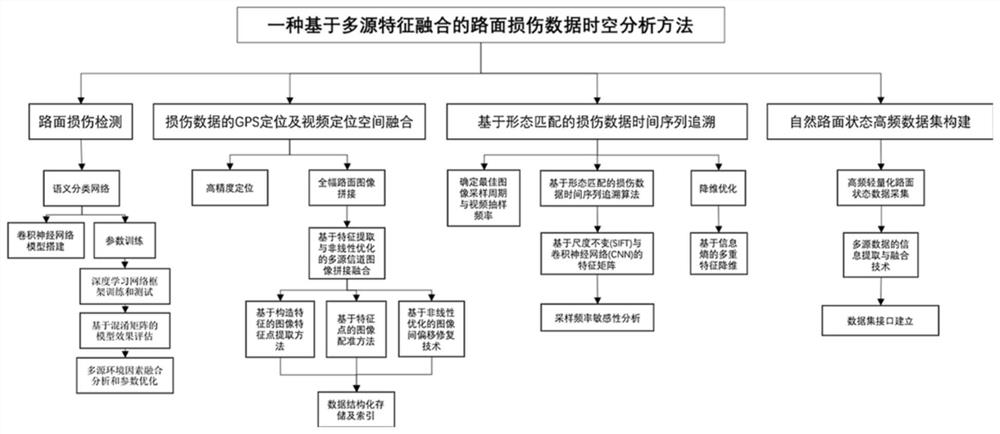
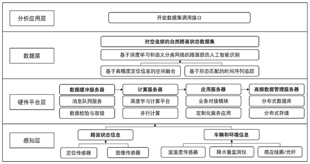
[0040] The invention relates to a spatiotemporal analysis method of pavement damage data based on multi-source feature fusion, such as figure 1 As shown in the figure, it includes a pavement damage detection step, a GPS positioning of damage data and a spatial fusion of video positioning, a time series tracing of damage data based on morphological matching, and a high-frequency data set construction step of natural road conditions. In order to realize each step, the method of the present invention is realized based on a layered framework, such as figure 2 shown, including the following:
[0041] 1) Perception layer: use positioning sensors and image sensors to obtain road status information; use temperature and humidity sensors, precipitation monitors, induction coils / optical fibers to obtain vehicle and environmental information.
[0042] 2) Hardware platform layer: use the data buffer server to aggregate data, and implement message queue service and data checksum fault tol...
PUM
 Abstract
Description
Claims
Application Information
 - R&D
- Intellectual Property
- Life Sciences
- Materials
- Tech Scout
- Unparalleled Data Quality
- Higher Quality Content
- 60% Fewer Hallucinations
Browse by: Latest US Patents, China's latest patents, Technical Efficacy Thesaurus, Application Domain, Technology Topic, Popular Technical Reports.
© 2025 PatSnap. All rights reserved.Legal|Privacy policy|Modern Slavery Act Transparency Statement|Sitemap|About US| Contact US: help@patsnap.com


