Oyster row extraction method and system based on high-resolution satellite remote sensing image, and medium

A satellite remote sensing image, high-resolution technology, applied in the field of remote sensing image processing, can solve the problems of low extraction accuracy, uncertain segmentation scale, low degree of automation, etc., to achieve convenient and quick grasp, ensure accuracy, and save costs Effect

Pending Publication Date: 2021-07-23
珠海欧比特卫星大数据有限公司
View PDF0 Cites 0 Cited by
  • Summary
  • Abstract
  • Description
  • Claims
  • Application Information

AI Technical Summary

Problems solved by technology

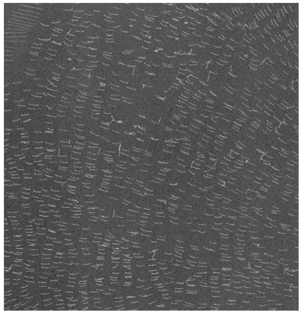
[0004] At present, the methods for extracting oyster steaks from satellite remote sensing images mainly include: (1) Visual interpretation method, using prior knowledge, through manual interactive operations, visual recognition for delineation, this method is time-consuming, labor-intensive, and efficient Low, highly subjective, and low degree of automation; (2) Based on the pixel method, the identification and extraction of oyster row is realized by analyzing the spectrum or texture difference between pixels, mainly by constructing a feature index. This method needs to be specific to the spectrum of different data The identification index is constructed by the characteristics, and the extraction accuracy is not high; (3) the object-oriented method, which uses the segmentation method to divide the image into different patches, based on the spectrum, texture, shape, and context features, and determines the category through certain rules. The rules established by this method Set versatility is poor, the segmentation scale is uncertain, and time-consuming

Method used


Image

  • Oyster row extraction method and system based on high-resolution satellite remote sensing image, and medium
  • Oyster row extraction method and system based on high-resolution satellite remote sensing image, and medium
  • Oyster row extraction method and system based on high-resolution satellite remote sensing image, and medium

Examples


Embodiment Construction

[0031] In order to facilitate those skilled in the art to understand and implement the present invention, the present invention will be described in further detail below in conjunction with the accompanying drawings and embodiments. It should be understood that the implementation examples described here are only used to illustrate and explain the present invention, and are not intended to limit the present invention. .

[0032] In the description of the present invention, the meaning of several means one or more, and the meaning of multiple means two or more than two. Greater than, less than, exceeding, etc. are understood as not including the original number, and above, below, within, etc. are understood as including the original number . If the description of the first and second is only for the purpose of distinguishing the technical features, it cannot be understood as indicating or implying the relative importance or implicitly indicating the number of the indicated techn...


PUM


Abstract

The invention discloses an oyster row extraction method and system based on a high-resolution satellite remote sensing image and a medium, and the method comprises the steps: obtaining the satellite remote sensing image, and carrying out the preprocessing operation, and obtaining the reflectivity data comprising geometric positioning; performing raster data processing on the reflectivity data, vectorizing the processed raster data, and generating an initial vector result of the oyster row; and processing the initial vector result of the oyster row based on a vector editing method to obtain a final extraction result of the oyster row. Based on the problem that the extraction efficiency of the oyster rows in the satellite remote sensing image is low, the workload of manually extracting the oyster rows is reduced, the identification error caused by manual operation is reduced, the automation of the extraction method is realized, and the accuracy and efficiency of extracting the oyster rows are improved.

Description

technical field [0001] The invention relates to the field of remote sensing image processing, in particular to a method, system and medium for extracting oyster steaks based on high-resolution satellite remote sensing images. Background technique [0002] The rapid development of my country's aquaculture industry has greatly promoted the continued growth of the fishery economy. Especially in coastal areas, aquaculture is the main source of income for fishermen, and oyster farming occupies an important position. With the continuous expansion of the scale of oyster farming, especially the extensive development model, it far exceeds the load capacity of the water environment, causing water quality problems such as increased nitrogen and phosphorus content, eutrophication of the water body, and destroying the marine ecological environment; There are also a large number of illegal farming in line with marine function planning, which will not only block the waterway and affect the...

Claims


Application Information

Patent Timeline
Patent Type & Authority Applications(China)
IPC IPC(8): G06T7/136G06T7/155G06T7/62G06T5/30
CPCG06T5/30G06T2207/10032G06T2207/10036G06T2207/20032G06T2207/20221G06T7/136G06T7/155G06T7/62
Inventor 刘璐铭颜军徐晓龙颜志宇蒋晓华周学林李先怡
Owner 珠海欧比特卫星大数据有限公司
Why Eureka
Try Eureka