
Apparatus and method for tracing a path travelled by an entity or object, and tag for use therewith

a technology of entity or object and path, applied in direction finders using radio waves, instruments, reradiation, etc., can solve the problems of inability to covert operation, require line-of-sight, and large receiver circuitry, so as to reduce mis-correlation to negligible levels, enhance the determination of the tag location, and improve the determination of the geographical area

Inactive Publication Date: 2005-12-29
TEKTRAP SYST
View PDF44 Cites 51 Cited by
  • Summary
  • Abstract
  • Description
  • Claims
  • Application Information

AI Technical Summary

Benefits of technology

"The present invention provides a system for tracing a path taken by an entity or object by using a radio receiver tag attached to the entity or object. The system includes a radio receiver that scans a predetermined radio frequency band and captures data representing a frequency spectrum thereof. The captured data is then stored and correlated with known antenna transmissions and location data to determine the location of the tag when each capture occurs. The system can be used to identify the path taken by the entity or object and provide a map of the region where the path was walked. The invention also includes a computer means for retrieving and correlating the captured frequency spectra with the constructed spectrum to determine the location of the tag. The system can also use signal strengths to select the signals for correlation. Overall, the invention provides a more efficient and accurate way to track the path taken by an entity or object."

Problems solved by technology

Disadvantages of such active RF systems include short operating times for transmitters or transceivers that, as a general rule, will be battery operated, and the fact that the transmissions may be detected easily, making them unsuitable for covert operation.
A major disadvantage of such GPS-based tracking systems is that they require a line-of-sight between the GPS antenna and the satellite(s).
In addition, the receiver circuitry is too large to meet most size requirements of covert systems and power consumption may limit battery life.
Again, the use of GPS introduces line-of-sight limitations, LORAN-C is limited to maritime applications, and only the one location of the container is of interest or consequence.
Some known systems, specifically systems using active RF techniques, provide tracking and / or tracing capabilities but, as compared with passive RF techniques, have limitations in that they do not provide, for example, (i) very low DC power consumption, meaning longer operational life; (ii) simple electronic circuitry, leading to miniature dimensions and very low cost; and (iii) inaccessible real-time data, meaning better compliance with human rights legislation.
This is an active system and so suffers from at least some of the disadvantages of active tracking systems, as described above.
Such cellular telephone tracking systems suffer from lack of ground coverage and dead spots, especially when the vehicle is indoors.
Moreover, like GPS receives, cellular telephone receivers consume substantially more DC power in comparison to FM receivers, especially if the FM receiver is used without any audio output.
While this arrangement maybe acceptable in the context of intrusion detection, the receiver only scans and stores location information if the container is opened, and the system does not provide for tracing a path taken by the container.
Also, the comparison is not automatic.

Method used


Image

  • Apparatus and method for tracing a path travelled by an entity or object, and tag for use therewith
  • Apparatus and method for tracing a path travelled by an entity or object, and tag for use therewith
  • Apparatus and method for tracing a path travelled by an entity or object, and tag for use therewith

Examples


Embodiment Construction

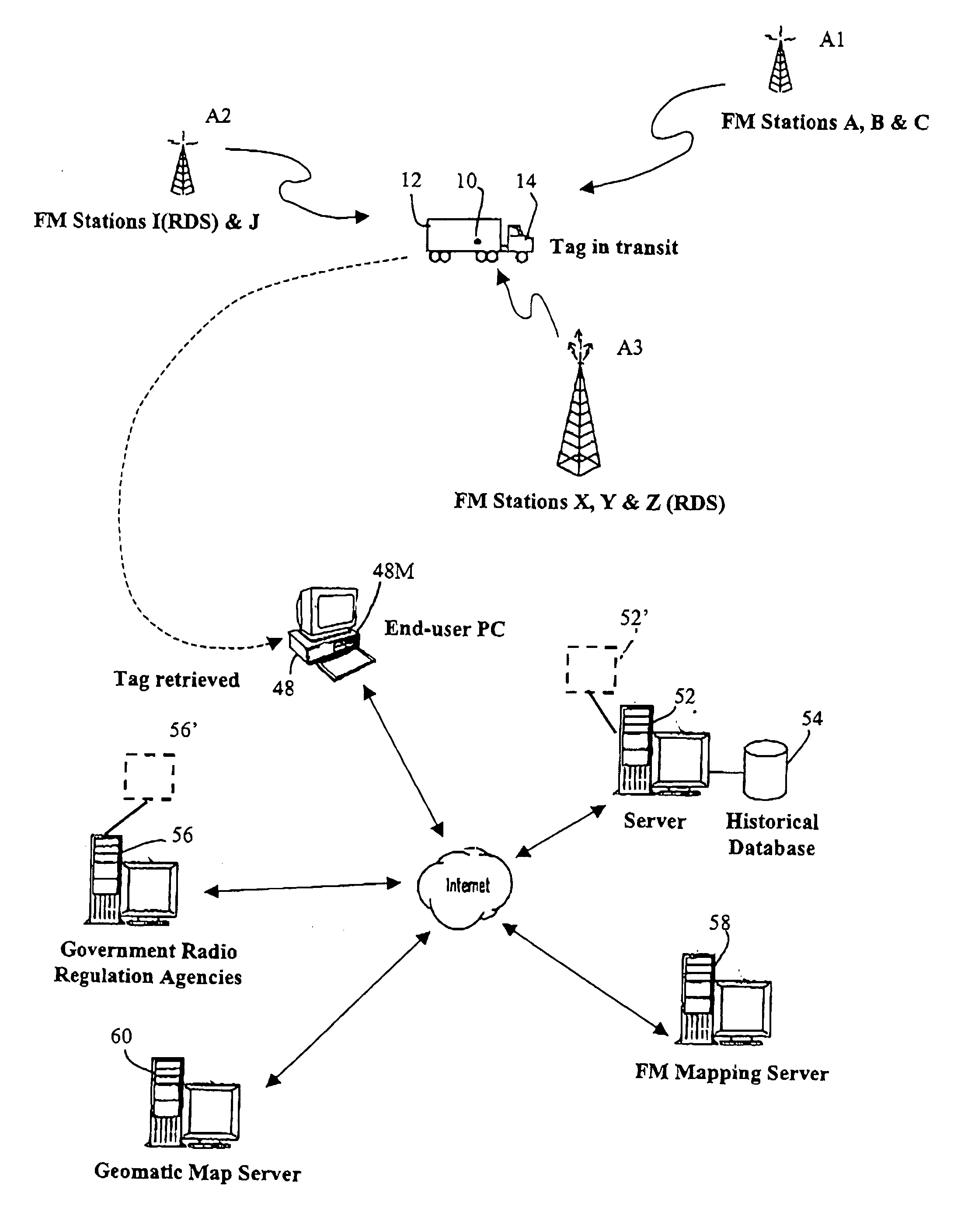
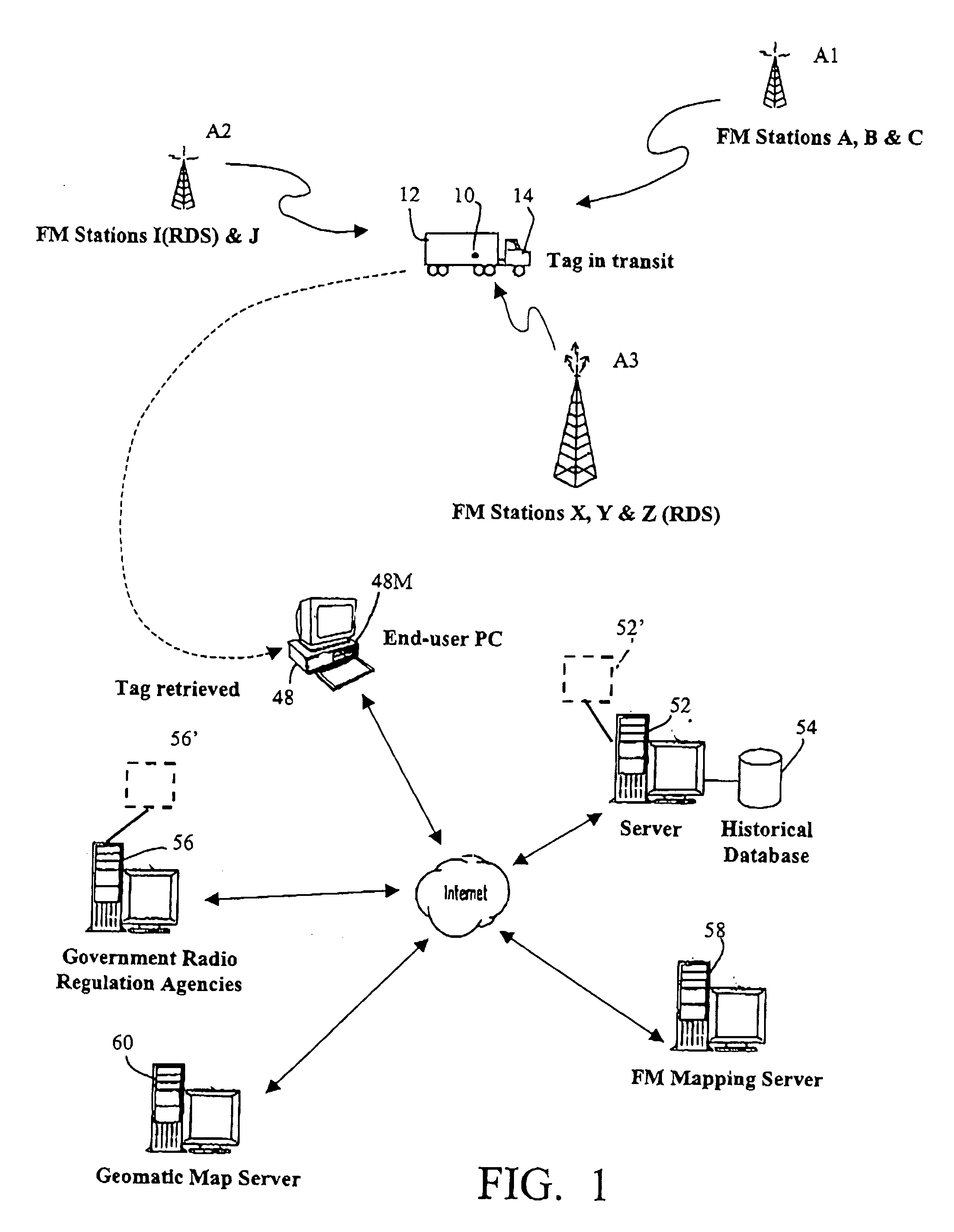
[0061] The present invention is predicated upon the fact that, typically, within a specific geographical area, a radio receiver will receive a wide range of man-made radio frequency (RF) signals including the broadcast commercial (AM radio, FM radio, TV, etc.) signals and private (communication, cellular, satellite, etc.) signals. Such RF signals form a frequency spectrum or RF signature that is unique to that specific geographical area. Databases are available that contain geographical locations (latitude, longitude) of transmission antennas associated with the frequencies of the signals transmitted from each such transmission antenna. Consequently, it is possible to construct a RE spectrum for a particular geographical area by identifying all of the antennas in the area and combining their transmission frequencies as provided by the database.

[0062] Such a database is owned by RadioSoft Corporation, of Demorest, Ga. 30535, USA and accessible to subscribers via the Internet. Embodi...


PUM


Abstract

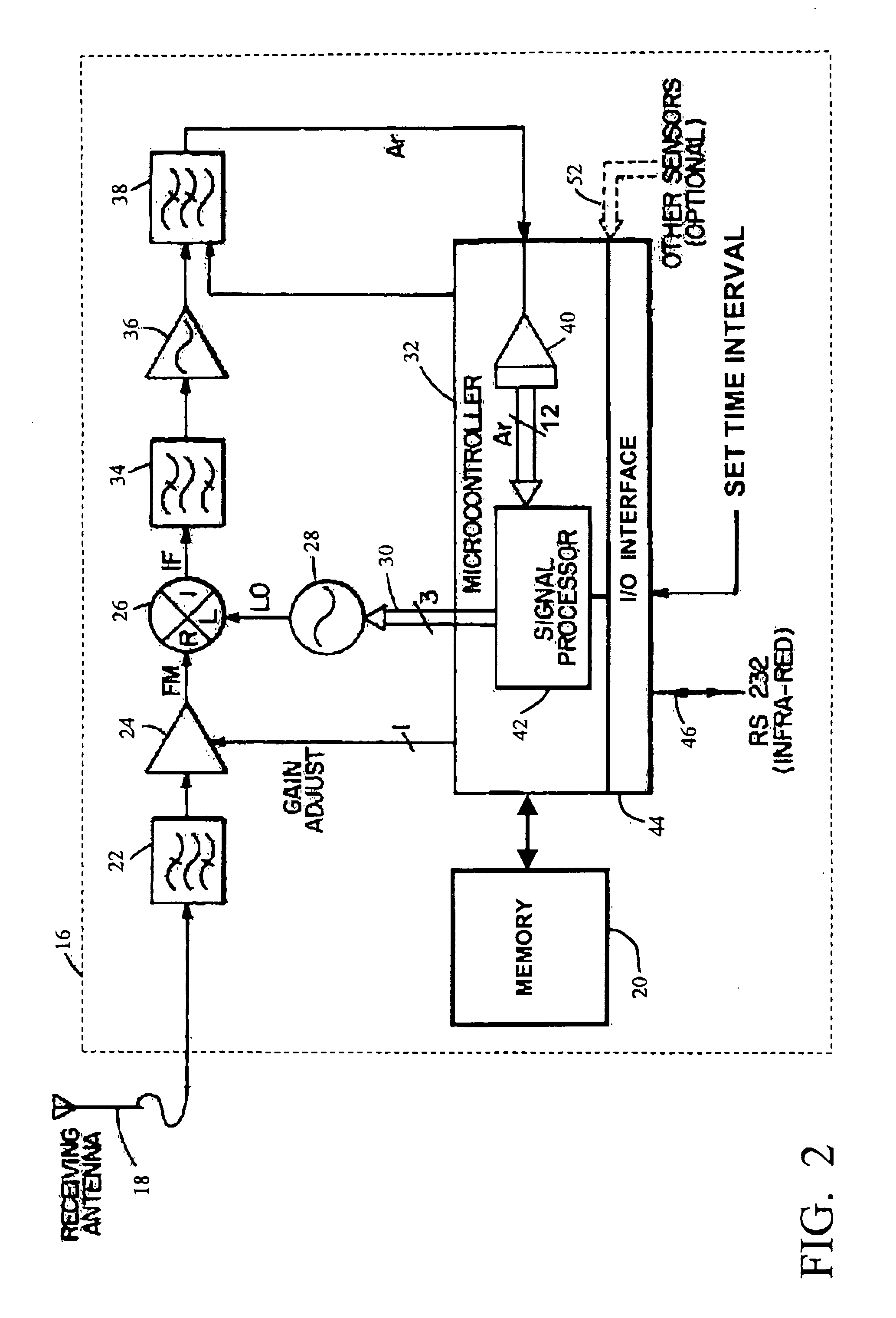
Apparatus and method for tracing a geographical journey taken by an entity, for example an article (shipment), asset or person, on a worldwide map uses a miniature, passive, low power, radio receiver tag that is attached to the entity and collects multiple FM spectra during the travels of the entity. When the tag is retrieved at the end of the journey, the FM spectra are downloaded and compared against a collection of constructed spectra constructed from antenna transmission and location data derived. Correlating each of the spectra collected by the receiver tag with the corresponding spectra in the database allows the regions traversed by the receiver tag, and hence the entity, during its travels to be plotted.

Description

CROSS REFERENCE TO RELATED APPLICATION [0001] This application claims priority from U.S. Provisional patent application Ser. No. 60 / 578,433 filed Jun. 10, 2004, the contents of which are incorporated herein by reference.BACKGROUND OF THE INVENTION [0002] 1. Technical Field [0003] The invention relates to a method and apparatus for tracing a path traversed by an entity or object, for example an article, e.g. a container shipment, asset or person, such as a person under surveillance, potentially worldwide. The invention also relates to a tag for use with the method and a method of providing a historical database of frequency spectra extant at different geographical locations. [0004] 2. Background Art [0005] The popularity and availability of the Global Positioning System (GPS) and low cost radio frequency identification (RFID) systems have led to significant increases in the use of systems for tracking articles or people. Thus, GPS is becoming a commodity product for the transport ind...

Claims


Application Information

Patent Timeline
Patent Type & Authority Applications(United States)
IPC IPC(8): G01S3/02G01S19/25G01S5/02G01S5/10G01S13/74G01V15/00
CPCG01S5/0294G01S5/0252F02P5/1502F02D35/023
Inventor GAGNON, ANDRE
Owner TEKTRAP SYST
Learn More