
Method and system for all-in-view coherent GPS signal prn codes acquisition and navigation solution determination

a technology of all-in-one view and gps signal, applied in the field of global positioning system, can solve the problems of delay, errors, delay, etc., and achieve the effect of reducing the introduction of multi-path errors, and facilitating the acquisition of real-time location information

Active Publication Date: 2009-10-22
THE BOEING CO
View PDF4 Cites 50 Cited by
  • Summary
  • Abstract
  • Description
  • Claims
  • Application Information

AI Technical Summary

Benefits of technology

The present disclosure provides a method and system for detecting and acquiring multiple satellite ranging signals from multiple GPS satellites simultaneously using a first GPS user receiver. This allows for a more robust detection of GPS satellite signals and a 10 dB improvement in signal-to-noise ratio acquisition performance compared to conventional approaches. The method also enables a position and time solution capability while simultaneously acquiring the PRN code signals. The system includes a plurality of GPS satellites and at least two GPS user receivers in wireless communication with each other. The technical effects of this patent include improved GPS navigation and positioning capabilities.

Problems solved by technology

For decades, the ability to obtain real time location and position information for mobile platforms and / or individuals has been a highly sough after technology.
These pseudorange measurements include the actual ranges to the satellites, in addition to an error associated with the receiver clock time offset relative to GPS time, plus other smaller errors.
However, along the route to the GPS user receiver, the GPS satellite ranging signals encounter some sources that cause the GPS satellite signals to be delayed in addition to the path delay associated with the speed of light propagation relative to range prediction models, and thus in error.
The potential sources of such delays and errors include satellite ephemeris and clock errors, selective availability (SA), ionospheric and atmospheric effects, multi-paths, and receiver clock error.
Signal acquisition is generally the most fragile phase associated with the GPS user receiver.
One reason is that the C / A code is weak and a small level of interference, intermittent attenuation, or obstruction of the Line-of-Sight (LOS) from a satellite to the GPS user receiver can cause the acquisition process to fail for one or more of the ranging signals.

Method used


Image

  • Method and system for all-in-view coherent GPS signal prn codes acquisition and navigation solution determination
  • Method and system for all-in-view coherent GPS signal prn codes acquisition and navigation solution determination
  • Method and system for all-in-view coherent GPS signal prn codes acquisition and navigation solution determination

Examples


Embodiment Construction

[0027]The following description of various embodiments is merely exemplary in nature and is in no way intended to limit the present disclosure, its application, or uses.

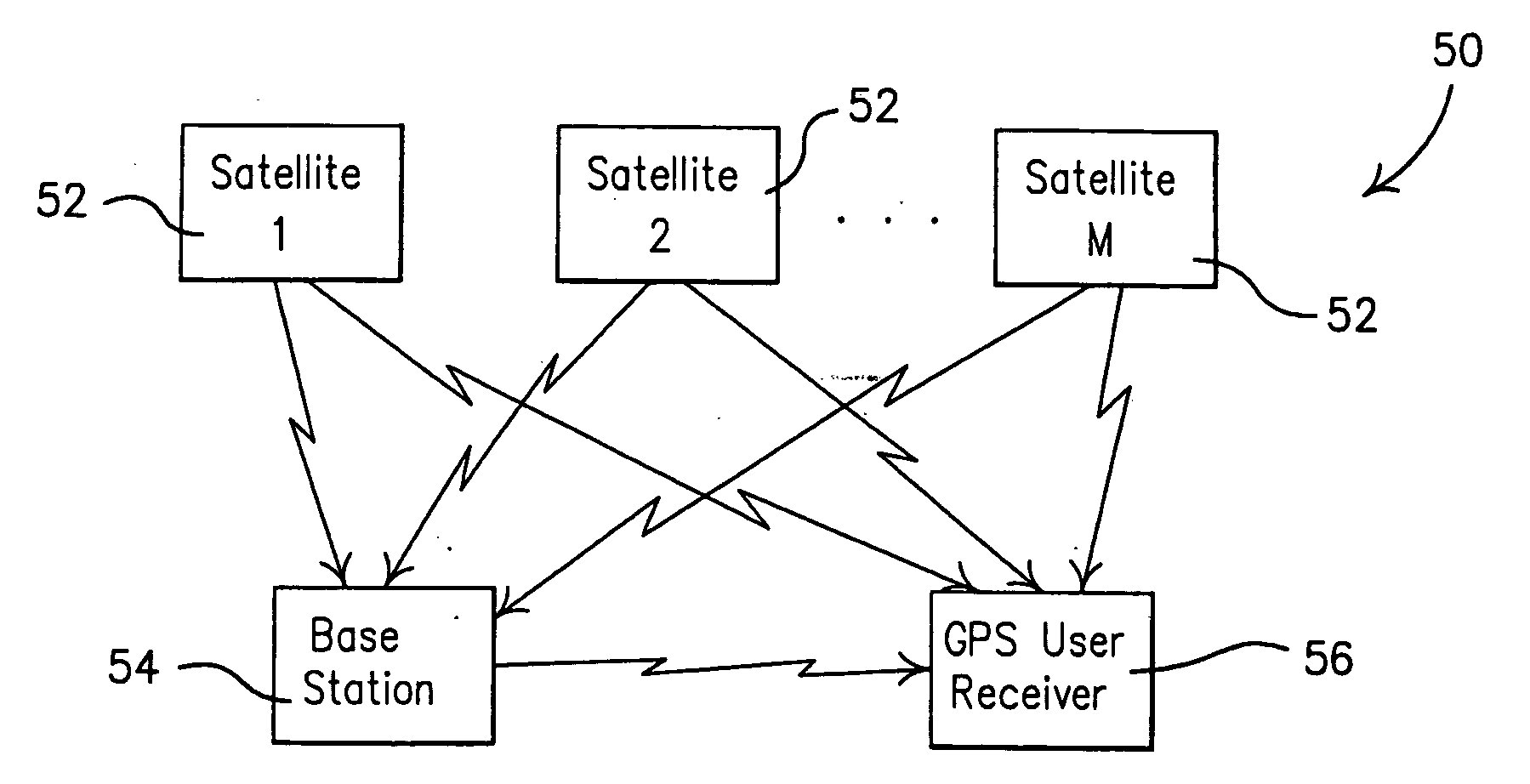
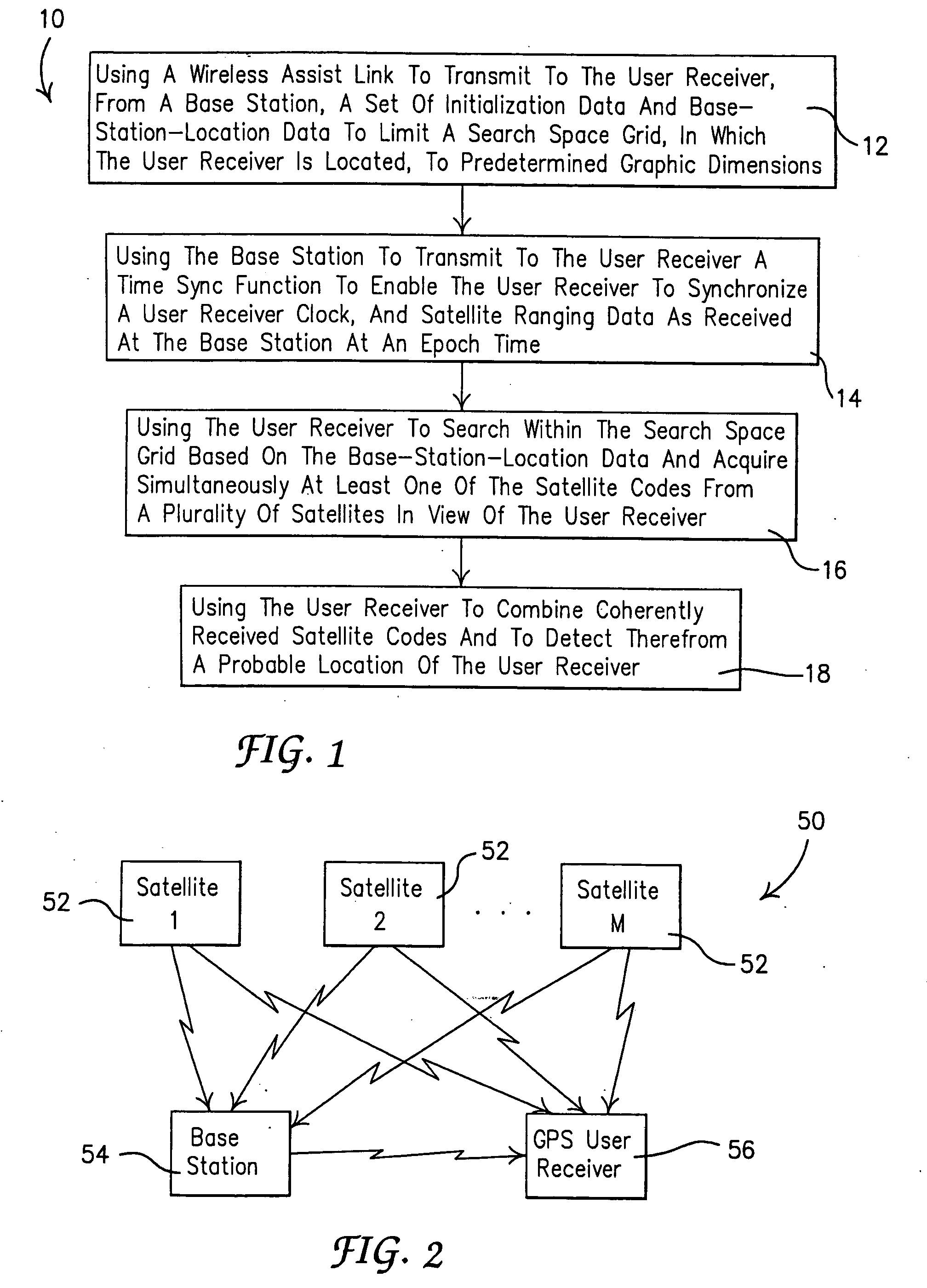
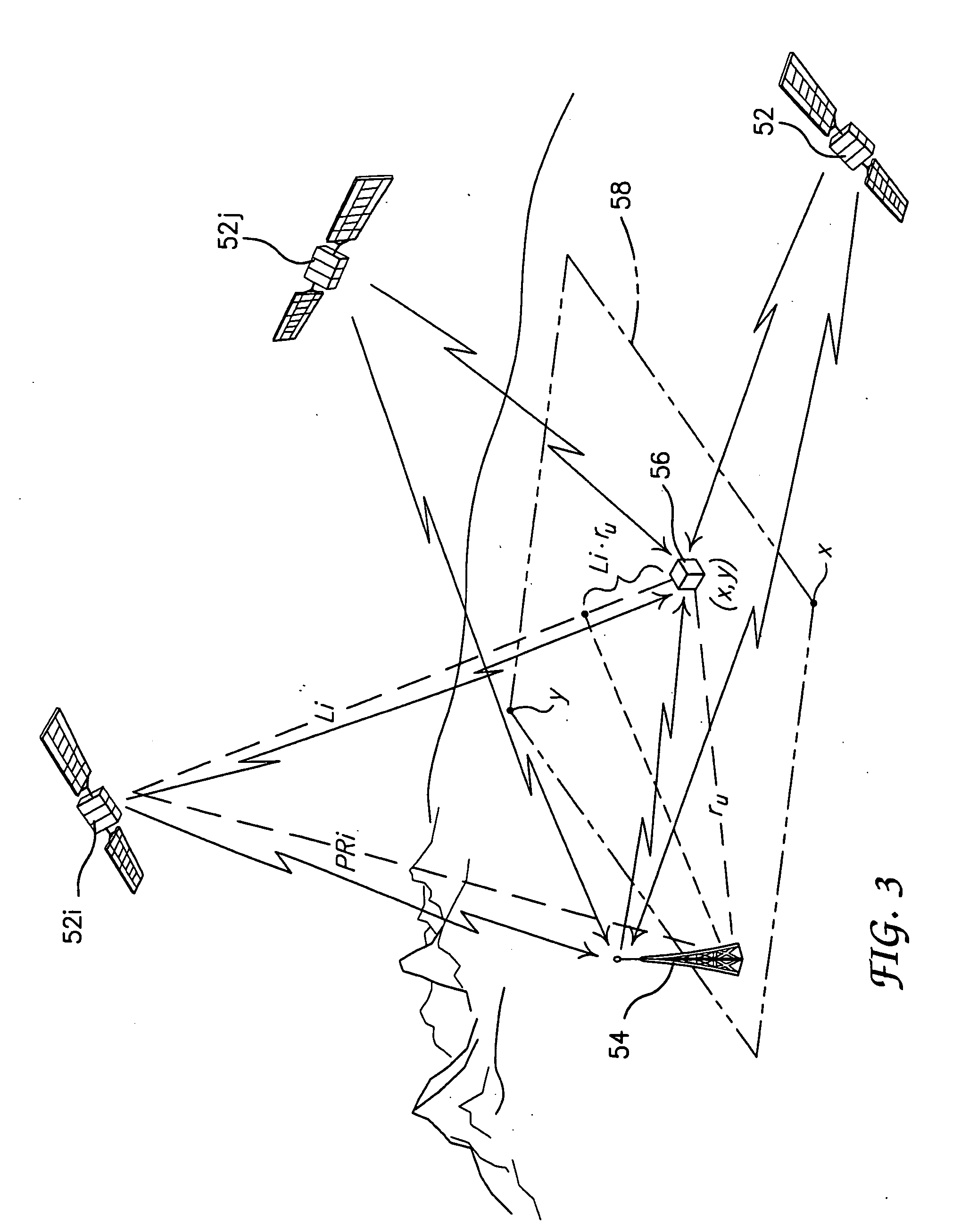
[0028]Referring to FIG. 1, the present disclosure illustrates one method 10 for using inputs from a plurality of satellites that are in view of a global positioning system (GPS). The plurality of satellites includes at least three satellites up to all satellites in view of the user receiver. The method 10 optionally includes using a wireless assist link to transmit to the user receiver, from a base station, a set of initialization data and base-station-location data at operation 12. Note that without loss of generality any user receiver within a connected network of user receivers may substitute for the base station, performing the same functions as the base station, and provide the same type of initialization information to aid operation of a second user receiver within the network. In this case, the transmission me...


PUM


Abstract

A method and system for enabling more robust detection, positioning and time solution using GPS satellite ranging signals based on a simultaneous, all-in-view coherent PRN code signal processing scheme rather than acquisition of GPS signals one at a time. Additionally, a plurality of signal processing operating modes are provided that include a Factory Start mode, a Hot Start mode, a Subsequent Fix mode and a Reacquisition mode. Each mode provides a user receiver with an ability to quickly determine its current probable location without undue delay when a prior probable location has been obtained. Preventing undue delay of predicting a probable location of the user can be especially valuable in conditions where weak signals are being received, or in high interference environments, or when signal jamming conditions are being experienced, or when a combination of such environments is present.

Description

CROSS-REFERENCE TO RELATED APPLICATIONS[0001]This application is a continuation-in-part of U.S. patent application Ser. No. 11 / 376,681 filed on Mar. 15, 2006. The disclosure of the above application is incorporated herein by reference. The present disclosure is also related to concurrently filed application U.S. Ser. No. ______ (Boeing docket 05-1214B).FIELD[0002]The present disclosure relates to a method and system for global positioning (GP). More specifically, the present disclosure relates to a method and system for acquiring global positioning system (GPS) signals from satellites to determine a location of a GPS user receiver.BACKGROUND[0003]For decades, the ability to obtain real time location and position information for mobile platforms and / or individuals has been a highly sough after technology. Since the implementation of the Global Positioning System (GPS), a world-wide radio navigation system introduced by the U.S. Air Force, this has become a reality. The GPS includes a...

Claims


Application Information

Patent Timeline
Patent Type & Authority Applications(United States)
IPC IPC(8): G01S1/00G01S5/14
CPCG01S19/05G01S19/252G01S19/25
Inventor DIESPOSTI, RAYMOND S.
Owner THE BOEING CO
Learn More