Method for suppressing multipath errors in a satellite navigation receiver

a satellite navigation and multipath technology, applied in satellite radio beaconing, measurement devices, instruments, etc., can solve the problems of delay measurement errors, distortion of measurements, and frequent missing satellite line-of-sight, and achieve the effect of eliminating multipath influen

Inactive Publication Date: 2010-10-21
MSTAR SEMICON INC +2
View PDF6 Cites 15 Cited by
  • Summary
  • Abstract
  • Description
  • Claims
  • Application Information

AI Technical Summary

Benefits of technology

[0014]An object of the proposed invention is to eliminate multipath influence on measurements of delays and Doppler frequencies, and to create a method, which is efficient for weak signals and does not require great computing capabilities for its realization. Distinguished technical effect consists in providing bit-synchronous forming an accumulated power grid and suppressing multipath errors by way of construction of a likelihood function with exception of nuisance parameters.

Problems solved by technology

Using navigation receivers in urban canyon conditions results in frequent missing a line-of-sight of satellites.
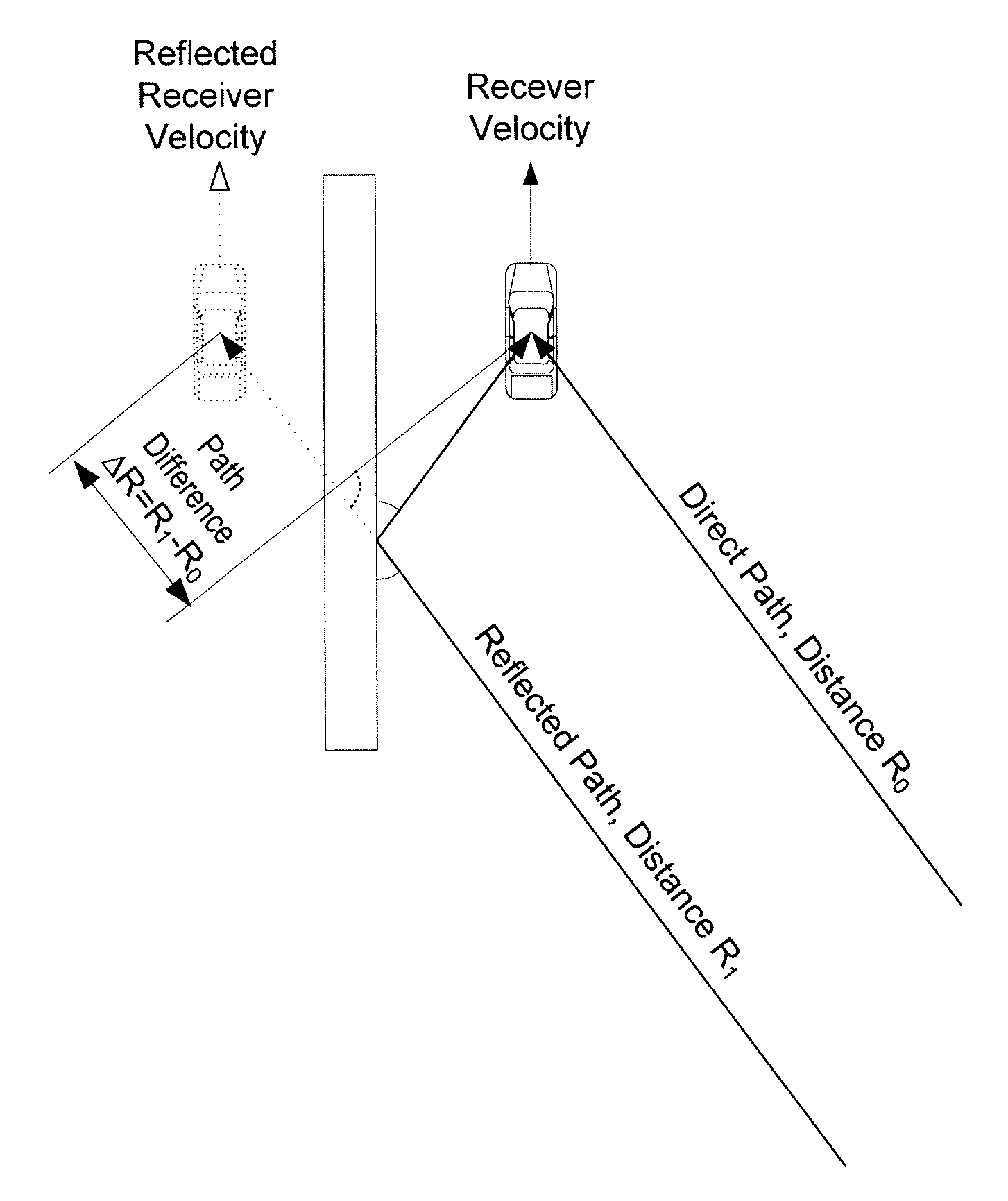
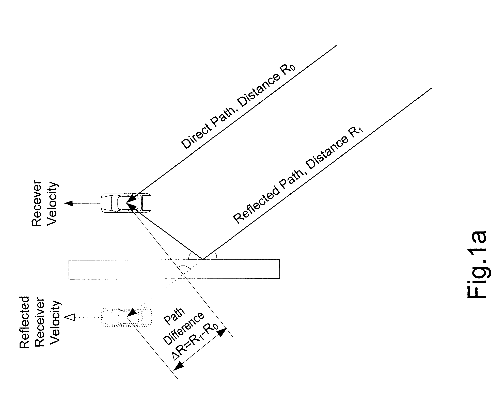
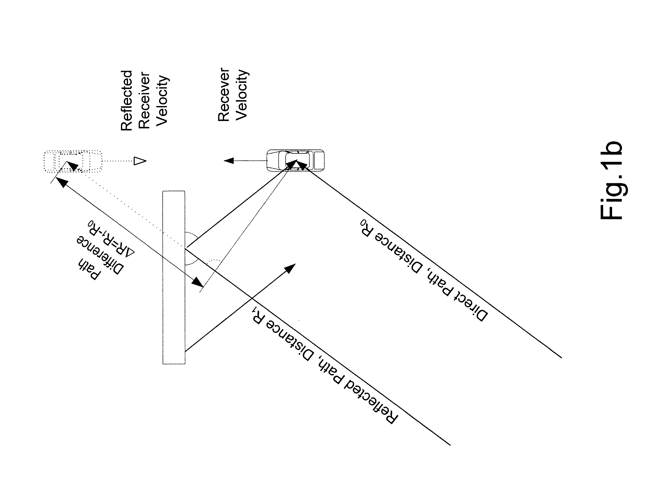
Presence of signals coming by direct and reflected paths results in occurrence both of delay and Doppler frequency errors. FIG. 1 illustrates the exemplary diagram of multipath signal propagation, results in distortions of measurements:for a static receiver or receiver moving in parallel with reflecting surface (FIG. 1a), delay measurement errors occur only, because rates of change of distance to a satellite for direct and reflected paths are equal;for a receiver moving in the direction of a reflecting surface (FIG. 1b), delay measurement errors are added to Doppler frequency measurement errors, because in this case rate of change of distance to the satellite by a reflected path differs from rate of change of distance to the satellite by a direct path.< / ul
These methods are easily realized in inexpensive mass produced receivers and reduce a pseudorange error, but their accuracy is not high.
These methods are used in high cost geodetic receivers and demand considerable expensive hardware for its realization.
Usage of adaptive antenna array for suppression of signals coming by reflected paths requires several receive antennas and additional processing of signals received by them, which also complicates consumer equipment considerably.
Disadvantages of this method consist in necessity of saving input signal samples, quantized in a high frequency (in the patent the sampling rate is indicated as equal 20 MHz for GPS system), as well as in processing these samples in real-time.
Other disadvantage is limited accumulation time.

Method used


Image

  • Method for suppressing multipath errors in a satellite navigation receiver
  • Method for suppressing multipath errors in a satellite navigation receiver
  • Method for suppressing multipath errors in a satellite navigation receiver

Examples


Embodiment Construction

[0058]Disclosed below is an example of implementation of the invention.

[0059]A block scheme of a typical GNSS receiver with tracking in an open loop system is shown in FIG. 2.

[0060]Signal processing in a typical navigation receiver is divided on analogue (unit 1) and digital (units 2, 3) parts. A part of digital signal processing requiring high rate of computation, and not requiring complex processing algorithms, is performed by a digital very large scale integrated (VLSI) circuit 2. Other part requiring complex processing algorithms at low rate is performed, as a rule, by programmed processor 3.

[0061]Radio frequency electromagnetic signals received by an antenna (2.1) are converted in electric signals and amplified. Then, analogue radio frequency transformation is carried out in step 2.2, namely, transferring from radio frequency to intermediate frequency is carried out, and also analogue signal discrete sampling by time and its quantization by level are carried out. The reference ...


PUM


Abstract

A method of multipath error suppression in a satellite navigation receiver, including steps of navigation satellites signals searching, receiving and processing complex signals from each satellite, tracking found signals with a following-up open loop and determining coordinates, receiver velocity and exact time based on measurements of direct and reflected signal delay and Doppler frequency, the method including: forming, on the basis of navigation parameters, a two-dimensional accumulated power grid, calculating single-path signal corrections using the centered accumulated power grid determining, whether a multipath is presented, and performing, in case of positive result of this determination, improvement of corrections using weights, wherein, performing improvement of corrections using weights is carried out by forming a likelihood function on the basis of a centered accumulated powers vector, and correction is performed according to the found likelihood function global maximum.

Description

FIELD OF THE INVENTION[0001]The present invention relates to satellite radio navigation, and more particularly to methods of obtaining pseudo-range and pseudo-velocity measurements at multipath conditions in navigating receivers of Global Navigating Satellite System (GNSS).BACKGROUND[0002]Several GNSSs exist or are created in the world. Those are live systems: Global Positioning System (GPS, USA), Global Navigating Satellite System (GLONASS, Russian Federation), Galileo (European Space Agency, ESA) which is under creation, and BeiDou or Compass (Peoples Republic of China). The present invention can be used in navigation receivers of all of these or other GNSSs.[0003]Using navigation receivers in urban canyon conditions results in frequent missing a line-of-sight of satellites. Power of received signals thus becomes low or vanishes. In these conditions, traditional autonomous signal tracking in a close-loop system by means of delay lock loop (DLL) and a frequency lock loop (FLL) is o...

Claims


Application Information

Patent Timeline
Patent Type & Authority Applications(United States)
IPC IPC(8): G01S19/22
CPCG01S19/22G01S19/52
Inventor KHOLOSTOV, MIKHAILFEDOTOV, ALEXANDERMIKHAYLOV, NIKOLAYJALALI, BIJAN
Owner MSTAR SEMICON INC
Why Eureka
Try Eureka