

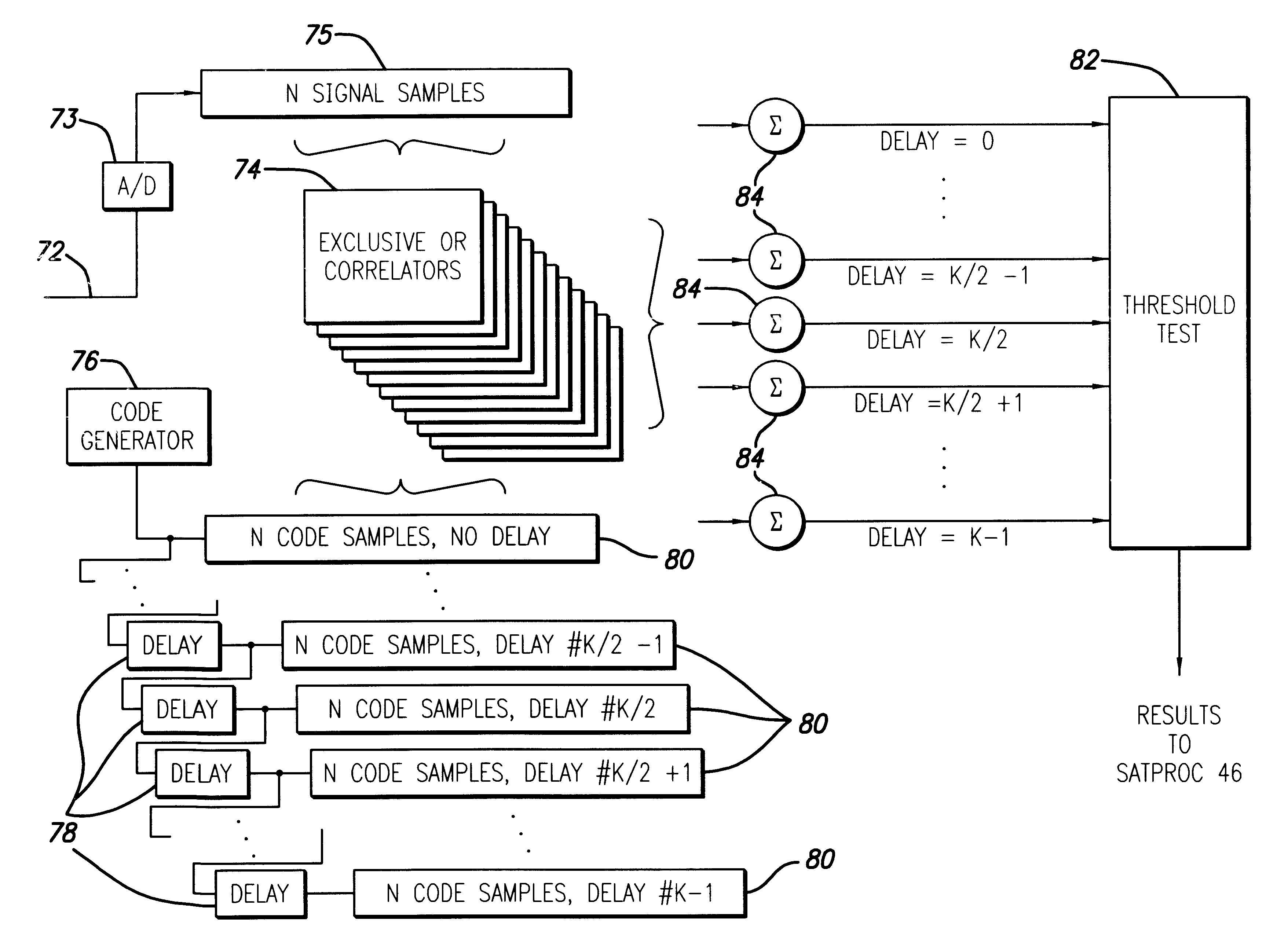
Spread spectrum receiver with multi-bit correlator
a receiver and spectrum technology, applied in the field of spread spectrum receivers, can solve the problems of limited acceptance of 4 gps satellites, difficult maintenance of continuous reception from 4 gps satellites, and increased complexity and cost of such combined systems
- Summary
- Abstract
- Description
- Claims
- Application Information
AI Technical Summary
Problems solved by technology
Method used
Image

Examples
Embodiment Construction
All Vee and Vcc pins should be connected to ensure reliable operation.
Notes on Pin Descriptions
1. All bypassing should be to the positive supply unless otherwise specified. Capacitors with low dissipation factor should be placed as close as possible to all power pins.
2. Differential input and output signals should be used for optimal system performance.
3. Good RF practices must be followed in the PC board layout, ground and power planes should be used whenever possible.
4. Vee is commonly referred to as GND.
LNA / Mixer
The GRF1 receives the GPS L1 signal via an external antenna and suitable LNA. The L1 input signal is a Direct Sequence Spread Spectrum (DSSS) signal at 1575.42 MHz with a 1.023 Mbps Bi-Phase Shift Keyed (BPSK) modulated spreading code. The input signal power at the antenna is approximately -130 dBm (spread over 2.048 MHz), the desired signal is under the thermal noise floor. The front-end compression point is -30 dBm, given adequate external filterin...
PUM
 Abstract
Description
Claims
Application Information