Secure interactive 3d navigation method and device

a secure, interactive technology, applied in the direction of traffic control systems, cosmonautic components, position/direction control, etc., can solve the problems of affecting the economic viability of ground teams dedicated to preparing missions, and affecting the accuracy of aircraft missions. , to achieve the effect of reducing the risk of collision, and improving the accuracy of prediction

Active Publication Date: 2008-03-18
EUROCOPTER
View PDF7 Cites 23 Cited by
  • Summary
  • Abstract
  • Description
  • Claims
  • Application Information

AI Technical Summary

Benefits of technology

[0056]The method of the invention acts in real time to provide the pilot or operator on board the aircraft with piloting assistance that is of improved accuracy, in particular because it makes it possible to use smaller safety margins.
[0057]Specifically because the predicted traje...

Problems solved by technology

Such an IFR navigation system satisfies the needs of commercial transport planes, but it impedes performing certain missions that aircraft are required to perform, in particular those of civilian helicopters which present special characteristics.
Most helicopter missions are emergency missions (this applies particularly to EMS missions), which puts severe constraints on the opportunities for meticulous preparation being performed on the ground.
Even when the emergency is not as great as that for an EMS mission, helicopter missions are often varied and specific, unlike the regular routes followed by commercial air transport; therefore, as a general rule, flight plans cannot be reused several times over, which means that a ground team dedicated to preparing missions is unlikely to be economically viable.
That system does not enable the p...

Method used


Image

  • Secure interactive 3d navigation method and device
  • Secure interactive 3d navigation method and device
  • Secure interactive 3d navigation method and device

Examples


Embodiment Construction

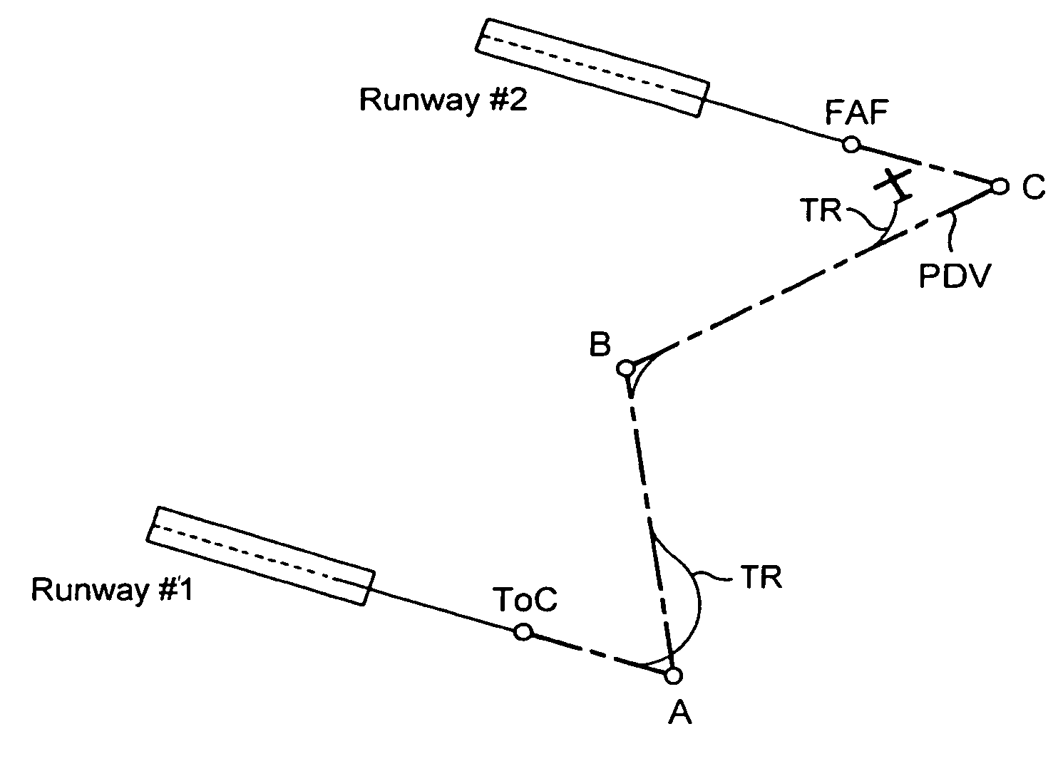
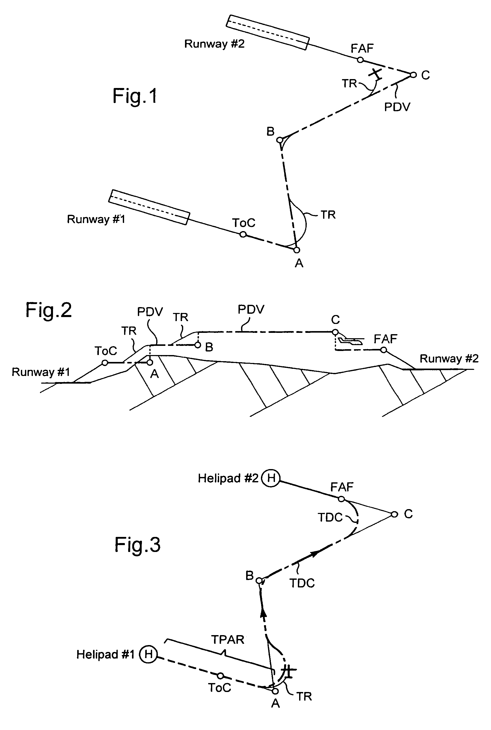
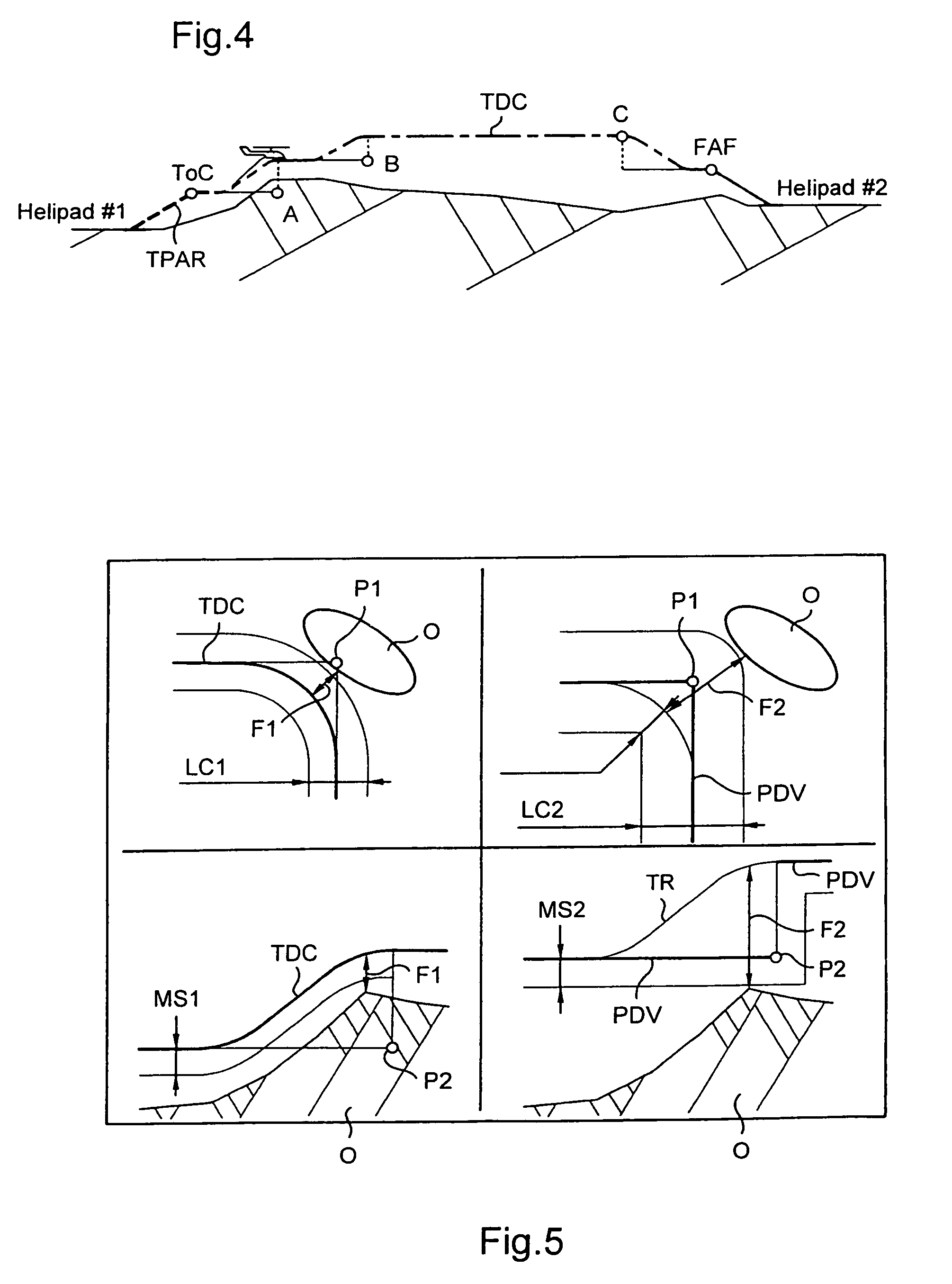
[0082]In the meaning of the present application, the term “itinerary” designates a succession of waypoints to be overflown, approached, or landed on, and where appropriate a succession of segments or “legs” defined by taking these points in pairs.

[0083]Each itinerary portion or segment can be defined by the three coordinates at each of the two ends of the segment; alternatively, an itinerary segment can be defined by the latitude and longitude only of each of its ends, together with the altitude of the segment; in a variant, the altitude can be replaced by a height at which the highest point of the terrain overflown by said segment is itself to be overflown.

[0084]For each waypoint of the itinerary, it is also possible to define whether the point is to be overflown or to be approached; it is also possible to specify a safety width and a safety height defining a safety volume for all or part of the itinerary, in particular for the takeoff and landing segments.

[0085]An itinerary as def...


PUM


Abstract

A safe interactive navigation apparatus and method allows the crew of an aircraft to prepare and follow a safe flight plan without relying on instrument flying infrastructure. An aircraft navigation assistance method calculates a continuous, three-dimensional projected path on board the aircraft as a function of data related to the route and characteristics of the aircraft.

Description

FIELD OF THE INVENTION[0001]The present invention relates to a safe interactive navigation method and apparatus enabling the crew of an aircraft to prepare and follow a safe flight plan without relying on instrument flying infrastructure.[0002]The invention relates to the field of flight management systems (FMS) for aircraft, and more particularly to flight management systems for helicopters.BACKGROUND OF THE INVENTION[0003]The FMS concept usually covers the functions of positioning, preparing flight plans, and guidance.[0004]Positioning serves continuously to determine where the aircraft is in three-dimensional space (latitude, longitude, and altitude). Implementing this function makes use of a set of sensors continuously delivering a state vector of the aircraft, including sensors for ground speed, rate of turn, trim and heading, and air speed.[0005]In a conventional FMS, a flight plan is essentially a succession of rectilinear segments that are horizontal, i.e. without any vertic...

Claims


Application Information

Patent Timeline
IPC IPC(8): G01C23/00B64D45/04G08G5/04
CPCB64D45/04G08G5/0008G08G5/0078G08G5/0086G08G5/045G01C21/20G05D1/106
Inventor PETILLON, JEAN-PAUL
Owner EUROCOPTER
Why Eureka
Try Eureka