Six degrees of freedom position and attitude determination method based on landmark navigation

A technology for determining methods and degrees of freedom, applied in road network navigators, surveying and navigation, measuring devices, etc., can solve problems such as low accuracy and poor applicability, and achieve the effect of improving solution accuracy and reducing complexity

Inactive Publication Date: 2012-02-15
BEIJING INSTITUTE OF TECHNOLOGYGY
View PDF0 Cites 0 Cited by
  • Summary
  • Abstract
  • Description
  • Claims
  • Application Information

AI Technical Summary

Problems solved by technology

[0005] The purpose of the present invention is to provide a six-degree-of-freedom position and attitude determination method to solve the problems of low precision and poor applicability in the current six-degree-of-freedom state solution method using road sign pixel information

Method used


Image

  • Six degrees of freedom position and attitude determination method based on landmark navigation
  • Six degrees of freedom position and attitude determination method based on landmark navigation
  • Six degrees of freedom position and attitude determination method based on landmark navigation

Examples


Embodiment Construction

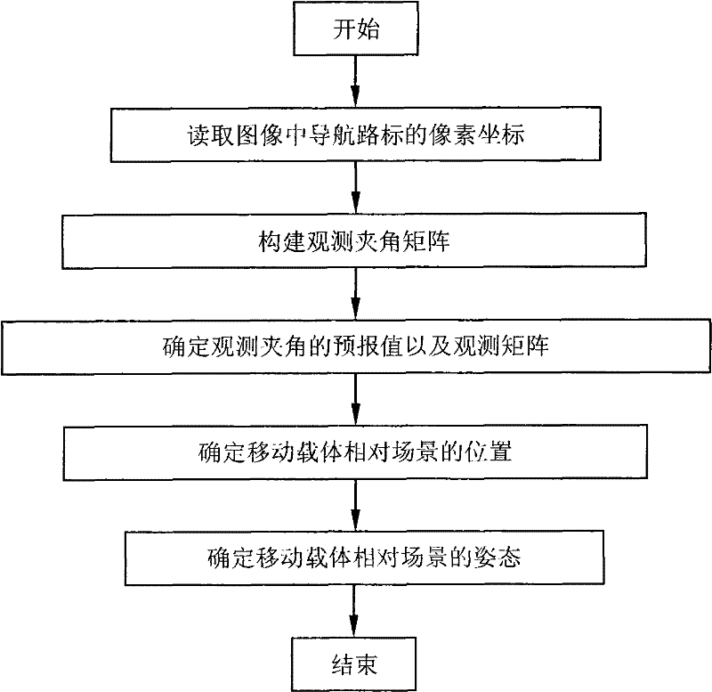
[0061] In order to better illustrate the purpose and advantages of the present invention, the present invention will be further described below in conjunction with the accompanying drawings and specific embodiments.

[0062] The concrete steps of this embodiment are as follows:

[0063] Step 1, read the pixel coordinates of the navigation landmarks in the image captured by the optical camera

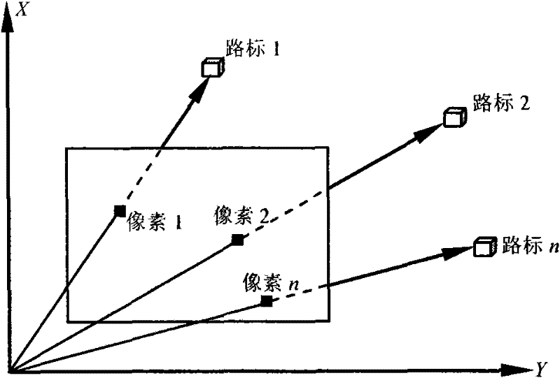
[0064] The mobile carrier can use its optical camera to image the navigation landmarks in the scene. By extracting the pixel and image line coordinates of the navigation landmarks in the image, the pointing direction of the navigation landmarks in the mobile carrier coordinate system can be obtained. The imaging relationship of the navigation landmarks is as follows: figure 2 shown.

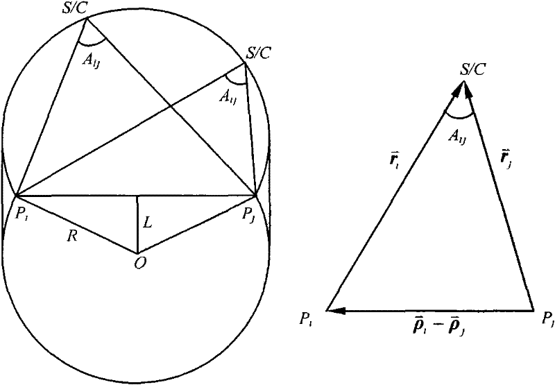
[0065] In the scene coordinate system, the position vector of the i-th navigation landmark is The prior estimation value and transformation matrix of the position vector of the mobile carrier camera coo...


PUM


Abstract

The invention relates to a six-degree-of-freedom position and attitude determination method based on road sign navigation, which belongs to the field of information processing in an automatic control system. According to the coupling between the position element and the attitude element in the pixel observation equation, the invention considers the invariance of the angle under the Euclidean transformation, and takes the angle formed between the observation sight lines of each navigation road sign as the observation amount, and uses the position and attitude in the pixel observation equation. State decoupling, solves the position and attitude states in the pixel observation equation separately, reduces the complexity of the algorithm, quickly determines the result and improves the solution accuracy. The applicability of this method can also be extended from 3 navigation landmarks to multiple landmarks.

Description

technical field [0001] The invention relates to a six-degree-of-freedom position and posture determination method based on landmark navigation, which belongs to the field of information processing in automatic control systems. Background technique [0002] Autonomous positioning and navigation is one of the most basic and important functions of autonomous mobile carriers. Optical sensors have attracted widespread attention because they can perceive rich environmental information. Many existing visual positioning methods have adopted navigation based on landmark optical information. way, and has achieved some success in mobile robotics, aerospace, vehicle navigation and other fields. The way of navigation based on the optical information of landmarks mainly relies on the optical camera to capture the image of the scene where the mobile carrier is located, and extracts the pixel information of the relevant landmarks in the image. The positions of these landmarks in the scene a...

Claims


Application Information

Patent Timeline
Patent Type & Authority Patents(China)
IPC IPC(8): G01C21/26G01C11/00
Inventor 崔平远朱圣英乔栋尚海滨徐瑞
Owner BEIJING INSTITUTE OF TECHNOLOGYGY
Why Eureka
Try Eureka