Multi-source satellite image real-time online processing technical method and device
A satellite image, real-time processing technology, applied in image communication, television, electrical components, etc., to achieve the effect of simple implementation, improved data packet throughput, and increased speed
- Summary
- Abstract
- Description
- Claims
- Application Information
AI Technical Summary
Problems solved by technology
Method used
Image
Examples
Embodiment Construction
[0030] A specific embodiment of the present invention will now be described in conjunction with the accompanying drawings.
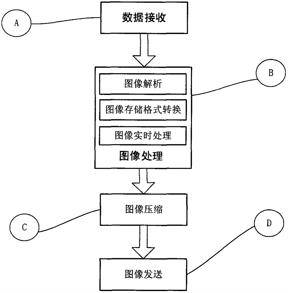
[0031] The flow of the real-time online processing system combined with multi-source satellite images is as follows: figure 1 According to the specific description in "Summary of the Invention", the main steps of the technical solution of the present invention are: data receiving; image processing; image compression; image sending and the implementation of analog sending and receiving software.
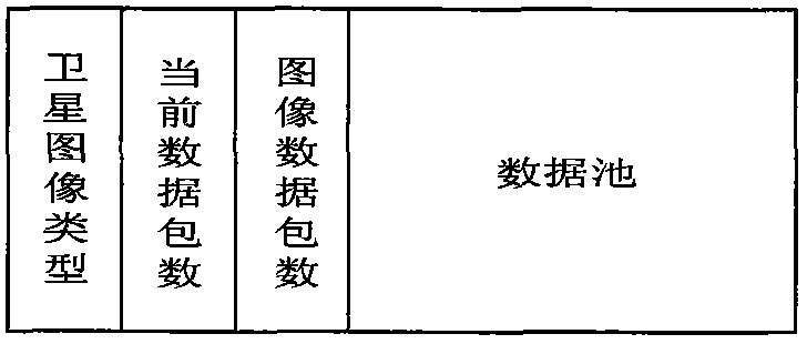
[0032] Step A data reception. The system initializes according to the set number of satellite image types. The range of the set satellite type number is [1, 16]. According to the set value, the same number of received satellite image data packet linked lists and package threads are initialized, and different linked lists are initialized. into different threads, where each thread handles a linked list. After initialization, it waits and receives data packets on...
PUM
 Abstract
Description
Claims
Application Information
 - R&D
- Intellectual Property
- Life Sciences
- Materials
- Tech Scout
- Unparalleled Data Quality
- Higher Quality Content
- 60% Fewer Hallucinations
Browse by: Latest US Patents, China's latest patents, Technical Efficacy Thesaurus, Application Domain, Technology Topic, Popular Technical Reports.
© 2025 PatSnap. All rights reserved.Legal|Privacy policy|Modern Slavery Act Transparency Statement|Sitemap|About US| Contact US: help@patsnap.com


