Slope fitting method based on DEM (dynamic effect model) data
A data and slope technology, applied in the field of visual navigation, can solve problems such as failure to judge obstacles, excessive calculation, and poor ability to resist gross errors
- Summary
- Abstract
- Description
- Claims
- Application Information
AI Technical Summary
Problems solved by technology
Method used
Image
Examples
Embodiment Construction
[0024] 1) 3D terrain data input. The 3D terrain data is directly output by the 3D imaging sensor. The sensor can be a laser imaging radar. The output format is "point set", denoted as U, and each point is in the format (X, Y, Z) representing three coordinate values , X, Y are the horizontal and vertical coordinates of the plane, and Z is the elevation coordinate.
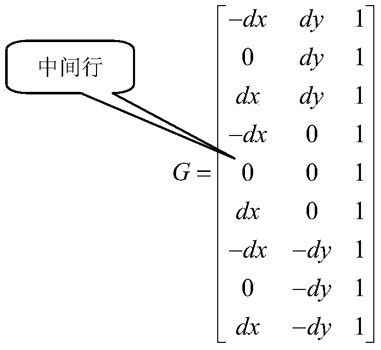
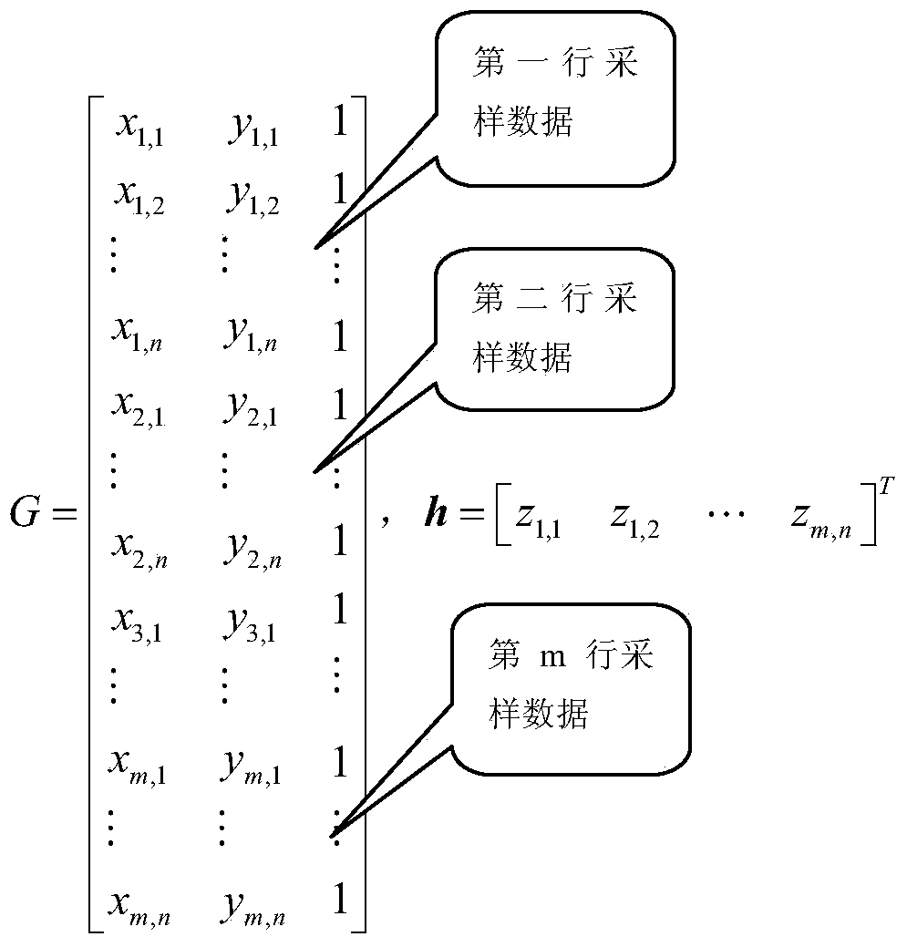
[0025] 2) Fitting data acquisition, due to the large number of points output by the sensor, considering the requirements of fast calculation, it is necessary to sample the point set at a certain interval (the interval dx in the X direction, and the interval dy in the Y direction). Generally, an odd matrix is selected for acquisition, and the number of rows It is recorded as m, and the number of columns is recorded as n, such as 3×3, 5×5, 7×7, and it is recorded as (x i,j ,y i,j z i,j ), i and j are the row number and column number of the elements of the collection matrix respectively, i∈[1 m], j∈[1 n]. .
[0...
PUM
 Abstract
Description
Claims
Application Information
 - R&D
- Intellectual Property
- Life Sciences
- Materials
- Tech Scout
- Unparalleled Data Quality
- Higher Quality Content
- 60% Fewer Hallucinations
Browse by: Latest US Patents, China's latest patents, Technical Efficacy Thesaurus, Application Domain, Technology Topic, Popular Technical Reports.
© 2025 PatSnap. All rights reserved.Legal|Privacy policy|Modern Slavery Act Transparency Statement|Sitemap|About US| Contact US: help@patsnap.com


