River basin water resource planning and utilization method
A technology of water resources and river basins, applied in data processing applications, instruments, climate change adaptation, etc., can solve the problems of factor degradation, lack of planning and management methods, etc.
- Summary
- Abstract
- Description
- Claims
- Application Information
AI Technical Summary
Problems solved by technology
Method used
Image

Examples
Embodiment 1
[0089] Below, the Ziya River Basin is taken as the research area, 2008 is selected as the base year, and the above steps are taken as an example to further illustrate the method of the present invention.
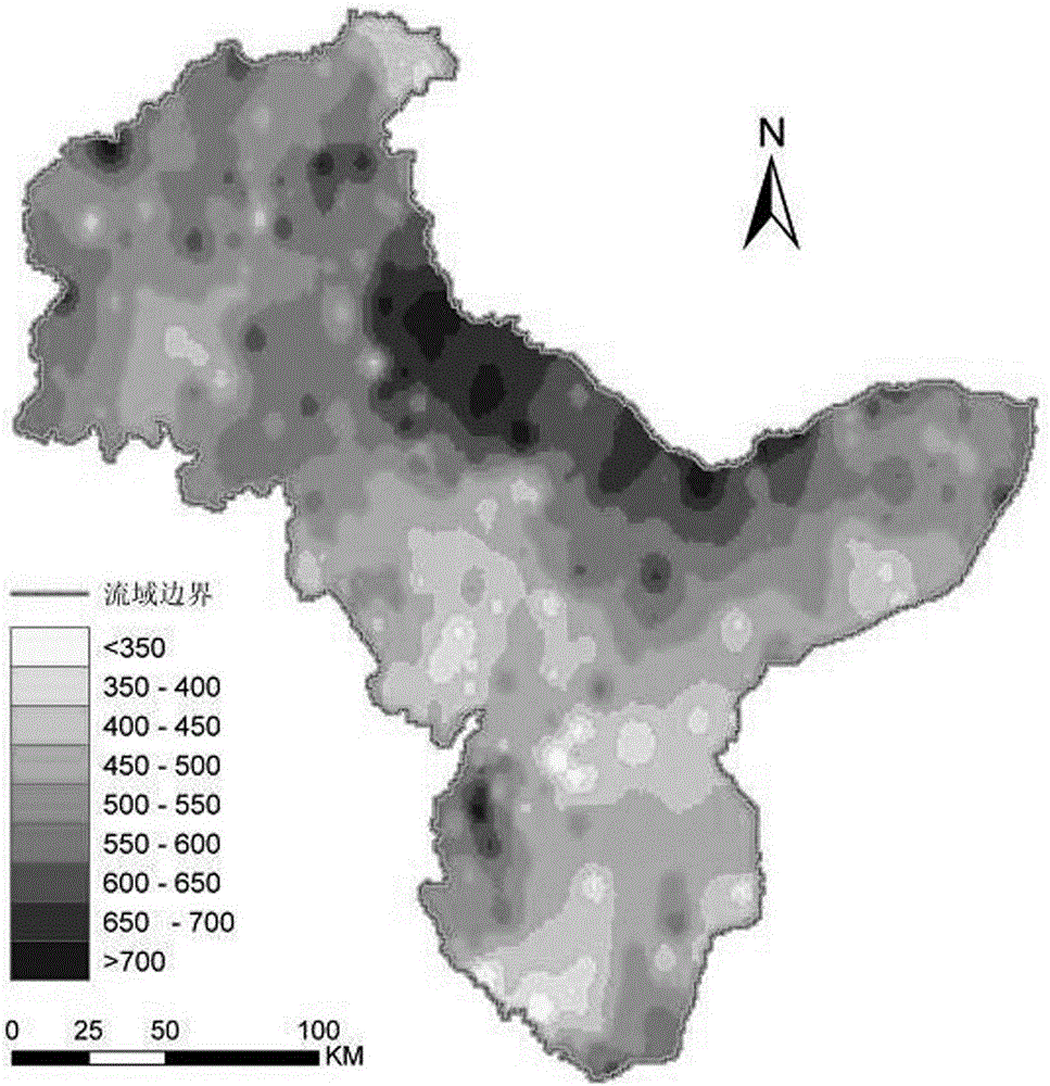
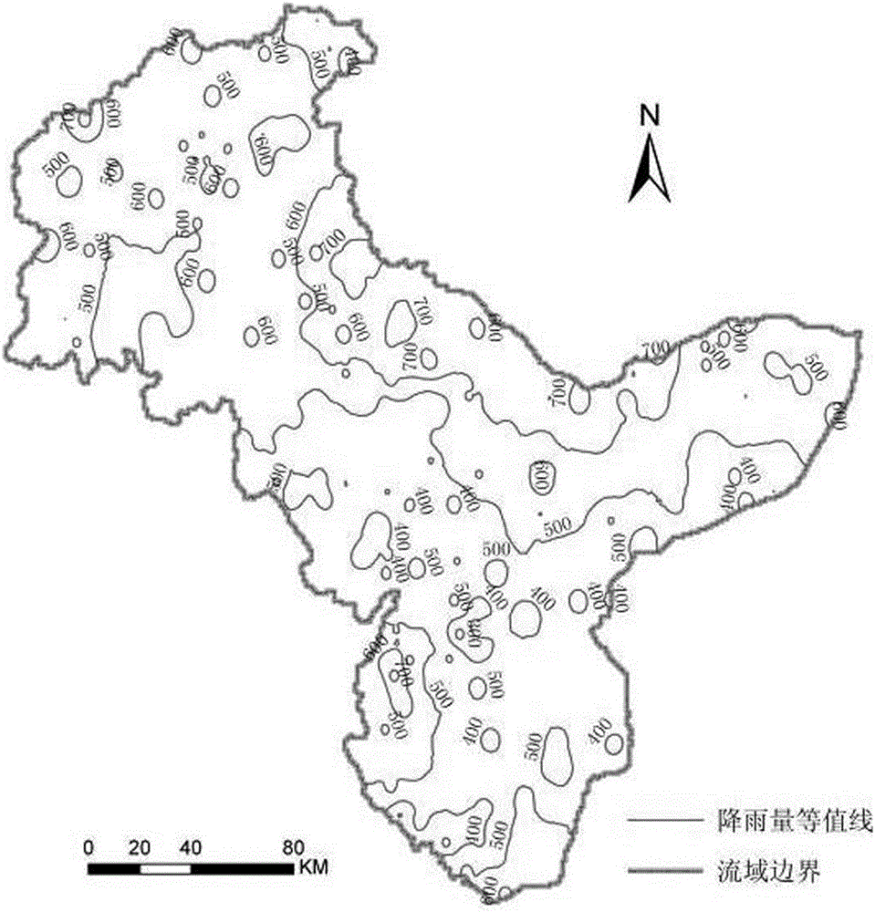
[0090] According to the precipitation values obtained from 409 precipitation stations in and around the Ziya River Basin, the inverse distance weighted interpolation method (IDW) was used to interpolate the precipitation in the Ziya River Basin to obtain the precipitation distribution map (see figure 1 ) and contour plots (see figure 2 ), taking precipitation as the total water resource P of the basin.
[0091] Obtain latent heat of vaporization, maximum air temperature, minimum air temperature, saturated water vapor pressure, canopy surface net radiation, air density, soil heat flux, specific heat of air at constant pressure, canopy conductance, saturated water vapor pressure, and actual water vapor in the river basin pressure, aerodynamic conductance, leaf area index, ...
PUM
 Abstract
Description
Claims
Application Information
 - R&D
- Intellectual Property
- Life Sciences
- Materials
- Tech Scout
- Unparalleled Data Quality
- Higher Quality Content
- 60% Fewer Hallucinations
Browse by: Latest US Patents, China's latest patents, Technical Efficacy Thesaurus, Application Domain, Technology Topic, Popular Technical Reports.
© 2025 PatSnap. All rights reserved.Legal|Privacy policy|Modern Slavery Act Transparency Statement|Sitemap|About US| Contact US: help@patsnap.com