
Multispectral satellite remote sensing image fusion method

A multi-spectral image and image fusion technology, applied in the field of multi-spectral satellite remote sensing image fusion, can solve the problems of missing images, inconveniently improving the spatial geometric resolution of multi-spectral images, and taking a long time, so as to increase quality and improve space Effect of geometric resolution, improved accuracy and detection rate

Pending Publication Date: 2022-01-04
北京和德宇航技术有限公司
View PDF7 Cites 1 Cited by
  • Summary
  • Abstract
  • Description
  • Claims
  • Application Information

AI Technical Summary

Problems solved by technology

[0003] At present, there are still some problems in the existing multispectral satellite remote sensing image fusion methods: it is inconvenient to improve the spatial geometric resolution of multispectral images, and at the same time, the traditional method is prone to the problem of missing images, and image fusion is performed on remote sensing images with a large amount of data Usually takes a long time to process

Method used


Image

  • Multispectral satellite remote sensing image fusion method
  • Multispectral satellite remote sensing image fusion method
  • Multispectral satellite remote sensing image fusion method

Examples


Embodiment

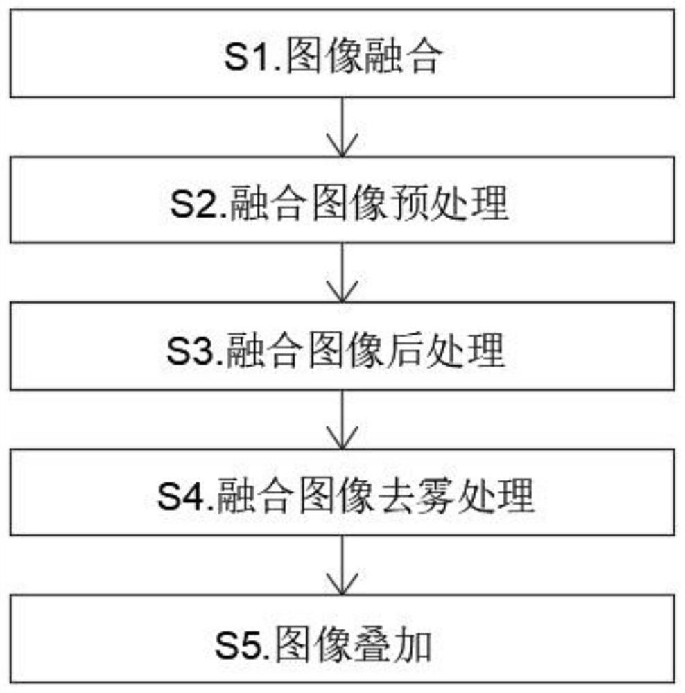
[0036] see figure 1 , the present invention provides a technical solution: a multi-spectral satellite remote sensing image fusion method, S1. Image fusion, based on compressed sensing theory to fuse satellite remote sensing images;

[0037] S2. Fusion image preprocessing, through radiation correction and orthorectification, cuts the fusion image, and selects the required image area;

[0038] S3. Fusion image post-processing, reducing image noise interference and filtering out spikes through geometric constraints and morphological processing;

[0039] S4. Fusion image defogging processing, using the visible light image and the millimeter wave image to establish a foggy image degradation model, using the foggy image degradation model to defog the fused image to obtain a defogged image;

[0040] S5. Image superposition, project the dehazed image processed in S4 and the target electronic map into the same coordinate system, then perform hierarchical slice coding, and finally supe...


PUM


Abstract

The invention discloses a multispectral satellite remote sensing image fusion method. The method comprises the following steps: S1, fusing an image; S2, preprocessing the fused image, cutting the fused image through radiation correction and ortho-rectification, and selecting a required image area; S3, post-processing the fused image, and reducing noise interference of the image and filtering spurs through geometric constraint and morphological processing; S4, defogging the fused image, establishing a foggy day image degradation model by using the visible light image and the millimeter wave image, and defogging the fused image by using the foggy day image degradation model to obtain a defogged image; and S5, carrying out image superposition. The satellite remote sensing images are fused based on the compressive sensing theory, the spatial geometric resolution of the multispectral images can be improved by using the multispectral images and the panchromatic images with the same spatial resolution, and in addition, by fusing the high-spatial-resolution panchromatic grayscale images and the low-spatial-resolution multispectral color images, image resolution can be improved, and the fused image has colors.

Description

technical field [0001] The invention belongs to the technical field of image fusion, and in particular relates to a multispectral satellite remote sensing image fusion method. Background technique [0002] With the rapid development of remote sensing technology and the continuous emergence of new sensors, people's ability to obtain remote sensing image data is constantly improving. However, most satellites still only provide high spatial resolution full-color grayscale images and low spatial resolution multispectral color images, which limits the analysis of data information. Simple and most commonly used remote sensing image fusion methods include IHS color transformation method, principal component analysis method, Gram-Schmidt transformation method, etc. The fusion process mainly includes three steps: first, transform the spectral channel of the remote sensing multispectral image to realize the separation of brightness information and color information; secondly, replace...

Claims


Application Information

Patent Timeline
Patent Type & Authority Applications(China)
IPC IPC(8): G06T5/00G06T5/50G06T7/90
CPCG06T5/50G06T7/90G06T2207/10032G06T5/80G06T5/73
Inventor 华力丰
Owner 北京和德宇航技术有限公司
Learn More