Underground operators ultrasonic location system and method thereof

A technology for operators and positioning systems, applied in directions such as beacon systems using ultrasonic/sonic/infrasonic waves, it can solve the problems of non-linear and statistical relationship between signal strength and distance between base stations, positioning accuracy errors, errors, etc., to achieve positioning accuracy The effect of improving, high real-time, and improving work reliability

Inactive Publication Date: 2007-03-07
HEFEI WEITU INFORMATION TECH
View PDF2 Cites 20 Cited by
  • Summary
  • Abstract
  • Description
  • Claims
  • Application Information

AI Technical Summary

Problems solved by technology

[0004] Another method is the radio frequency signal strength calculation method announced by the patent document CN1694569A. Two-way communication of radio frequency signals is carried out between the mobile node and the base station. The distance between the personnel and the base station is combined with the position information of the base station itself to achieve positioning. The positioning accuracy of this device depends on the strength of the radio frequency signal received by the base station. Due to the multiple reflections and diffractions of electromagnetic waves in the roadway, the movement The signal strength received by the nodes and the distance between the base stations are not linear and statistically related, resulting in a large error. The positioning accuracy error of this method can reach more than 15 meters, which can only provide limited help for rescue work, and the distance is still practical. difference

Method used


Image

  • Underground operators ultrasonic location system and method thereof
  • Underground operators ultrasonic location system and method thereof
  • Underground operators ultrasonic location system and method thereof

Examples


Embodiment Construction

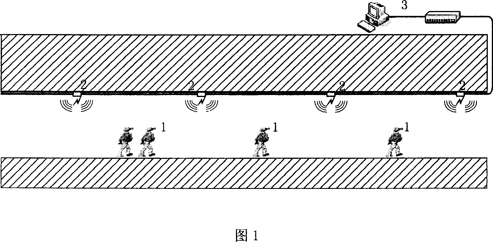
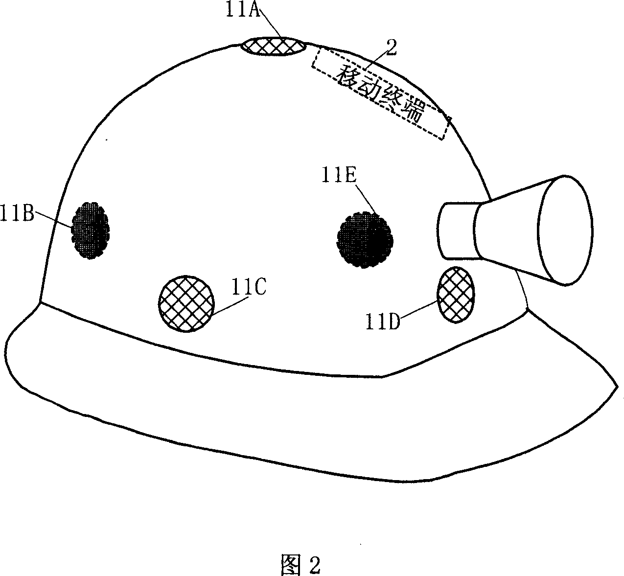
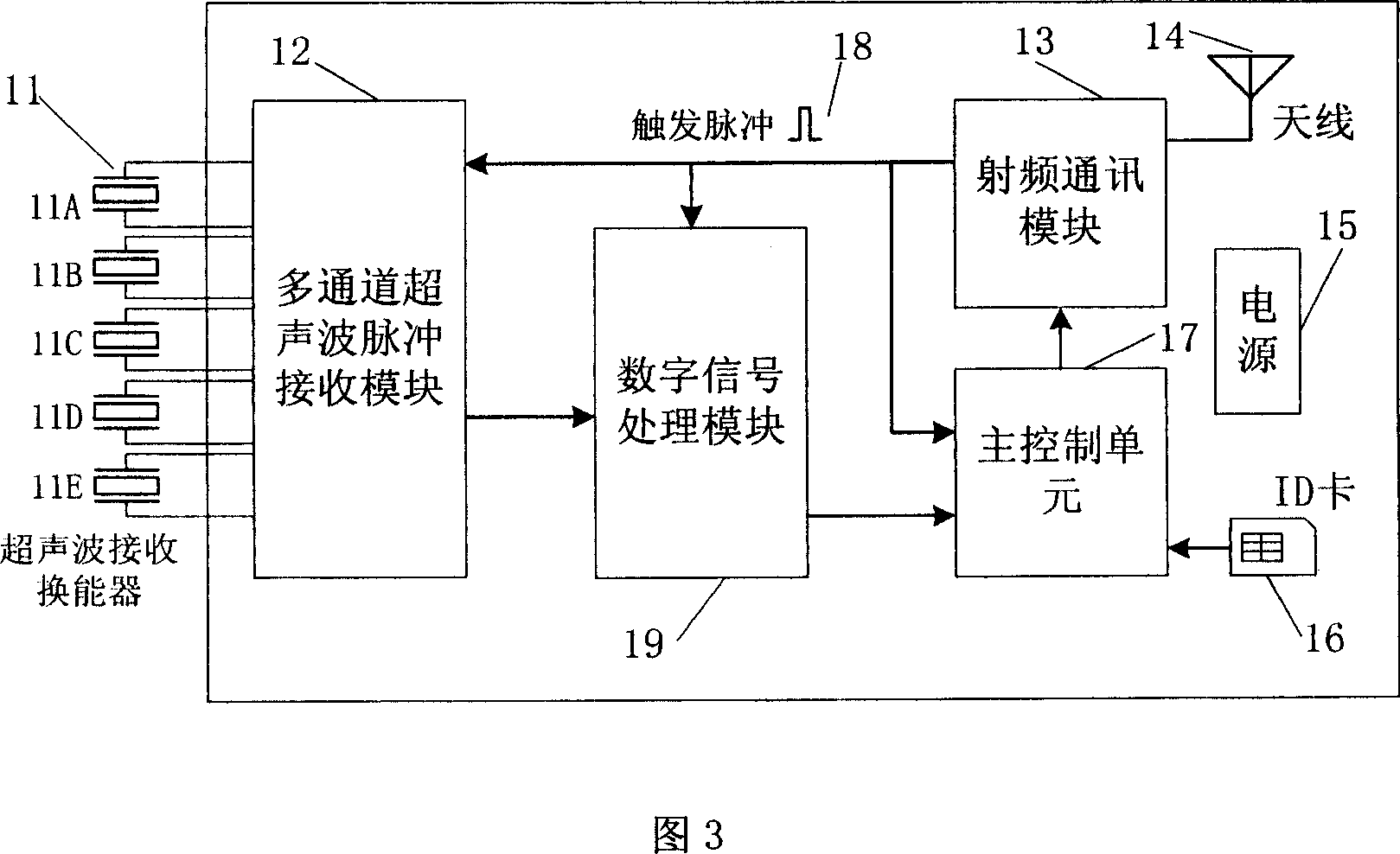
[0029] Referring to FIG. 1 , the system in this embodiment consists of a mobile terminal 1 embedded in a helmet, a base station 2 and a network management center 3 connected by wire. The base station and the mobile terminal use wireless radio frequency channel communication, the base station is connected through a wired network, and the network management center is composed of computers, network equipment and management software running on the environment. The network management center can exchange positioning information data with the base station, and can perform parameter setting and timing alignment on the base station, and set all base stations on the network to transmit trigger pulses through the radio frequency channel at a certain interval at the same time. The base station transmits the frequencies modulated by the m-sequence representing the unique identity of the base station along the front and rear directions of the roadway through the ultrasonic transmitting modul...


PUM


Abstract

This invention relates to downhole operation hypersonic positioning system and its method, which comprises safety hat movable terminal, street base station and network connection management center, wherein, the management center sets base station parameter with certain distance to send one impulse trigger signal and one hypersonic impulse sequence; the movable terminal recording the trigger signal and receiving the hypersonic impulse signal time interval; getting the distance between the movable terminal and base station according the known time; sending the information of terminal, distance, direction and codes to the radio communication channel and to the management center to display operation person position.

Description

Technical field: [0001] The invention relates to the field of mine safety monitoring, in particular to a system and method for accurately locating underground operators. technical background: [0002] The underground working environment of the mine is complex. The mine tunnels stretch for tens of kilometers in length and width. Scheduling, it is also difficult to assess the time and whereabouts of the operators. Once a fire, flood, gas, coal dust explosion and other accidents occur underground, due to the inability to accurately locate the location and distribution of personnel before the accident, large mechanical equipment cannot be used for rescue work, which often delays the best time for rescue and causes irreparable damage. loss. If the position of the underground personnel before the accident can be accurately located, the rescue speed can be greatly accelerated and the loss can be minimized. [0003] At present, there are mainly two methods for underground positio...

Claims


Application Information

Patent Timeline
Patent Type & Authority Applications(China)
IPC IPC(8): G01S1/76
Inventor 顾宇周康源哈章
Owner HEFEI WEITU INFORMATION TECH
Why Eureka
Try Eureka