
Environment analysis system and method for indoor wireless location

a wireless location and environment analysis technology, applied in the field of environment analysis system and method, can solve the problems of inability to continuously provide location information for gps receivers, inability to study the development of environment analysis tools for providing reliable indoor location services, and inability to continuously propagate signals. to achieve the effect of accurate environment analysis and improved indoor environment for indoor location

Inactive Publication Date: 2010-12-23
ELECTRONICS & TELECOMM RES INST
View PDF20 Cites 21 Cited by
  • Summary
  • Abstract
  • Description
  • Claims
  • Application Information

AI Technical Summary

Benefits of technology

[0021]The present invention provides a simulation result on location accuracies in order to overcome limits of an indoor environment in which access points are already installed, and to provide reliable location information to a user by using wireless communications systems such as WLAN, Bluetooth, UWB, or the like. And also, the present invention provides a simulation result according to relocations and / or additional installations of the access points in order to provide an improved indoor environment for indoor location to the user.
[0022]Further, the present invention can correct simulation errors of a software tool by using a hardware tool, thereby providing more accurate environment analysis for indoor wireless location.

Problems solved by technology

However, there are drawbacks that the GPS receiver cannot provide location information continuously because it happens that the GPS receiver cannot receive a GPS satellite signal fully or partially in a room, a tunnel, an underground parking lot, a downtown area, etc.
However, in the indoor wireless communications systems, since transmit powers of signals are restricted to prevent interferences therebeween, propagation distances of signals cannot be long.
However, since APs already installed are located appropriately only for communications, relocations or additional installations of the APs are required for wireless location in a specific room.
Moreover, conventional studies on indoor location techniques are mainly focused on distance measurements for indoor location using wireless communications signals, location algorithms, error reduction methods, and the like; but developments of environment analysis tools for providing reliable indoor location services have not been studied yet.

Method used


Image

  • Environment analysis system and method for indoor wireless location
  • Environment analysis system and method for indoor wireless location
  • Environment analysis system and method for indoor wireless location

Examples


Embodiment Construction

[0028]Hereinafter, preferred embodiments of the present invention will be described in detail with reference to the accompanying drawings.

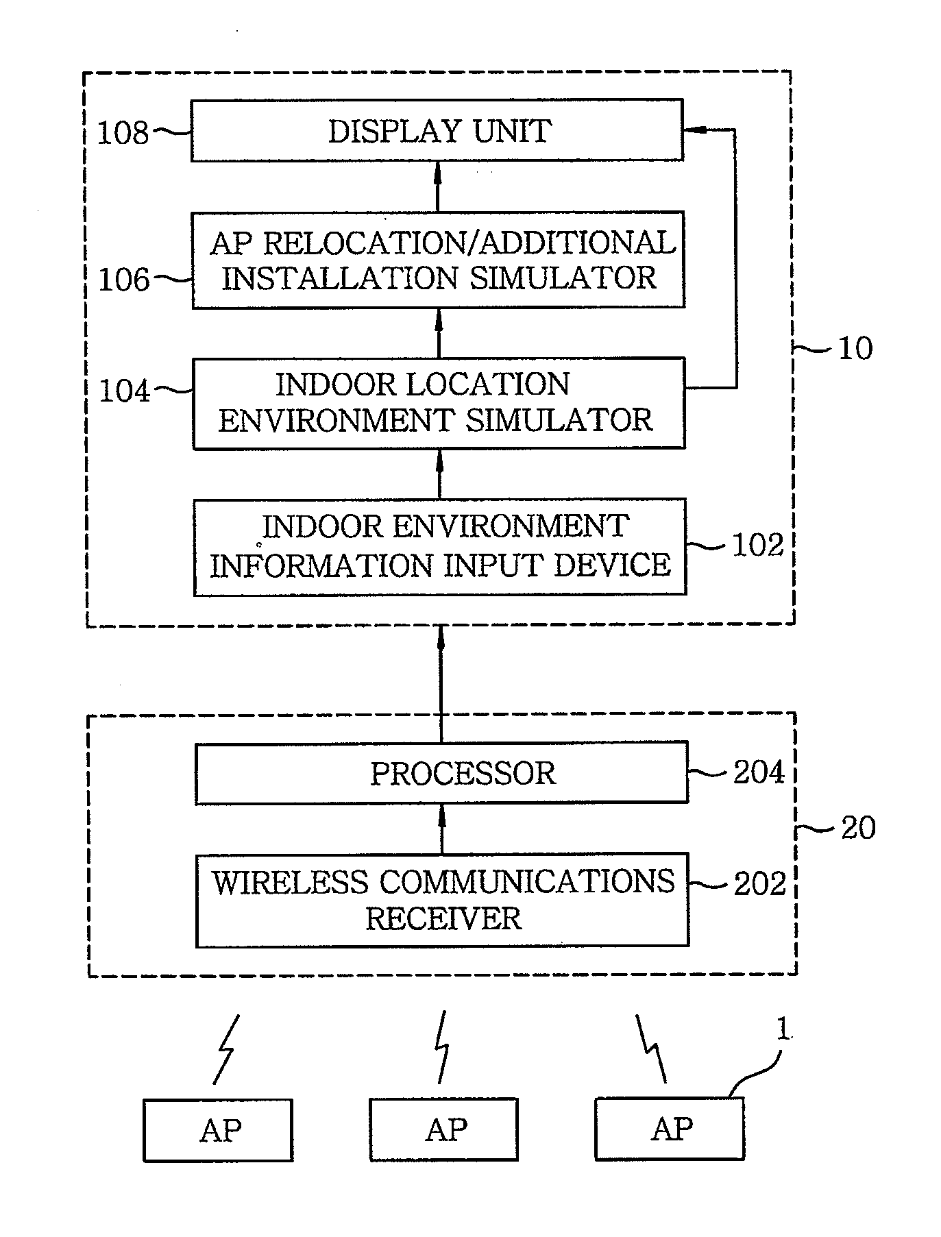
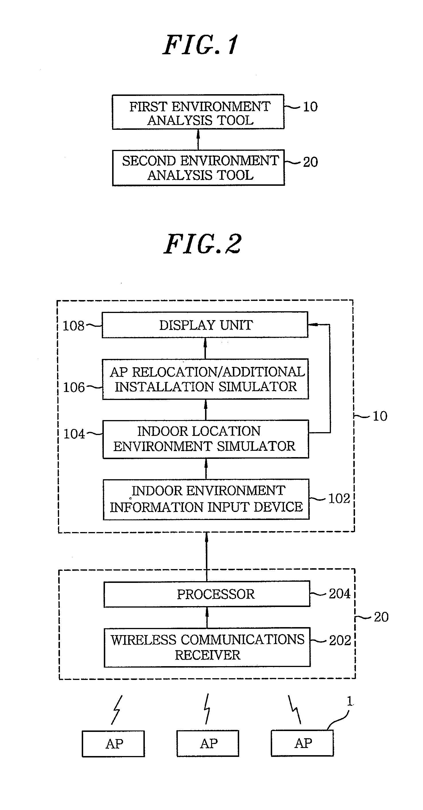
[0029]FIG. 1 is a schematic view showing a configuration of an environment analysis system for indoor wireless location in accordance with an embodiment of the present invention.

[0030]As shown in FIG. 1, the environment analysis system for indoor wireless location includes a first environment analysis tool 10 and a second environment analysis tool 20. Preferably, the first environment analysis tool 10 is a software tool and the second environment analysis tool 20 is a hardware tool.

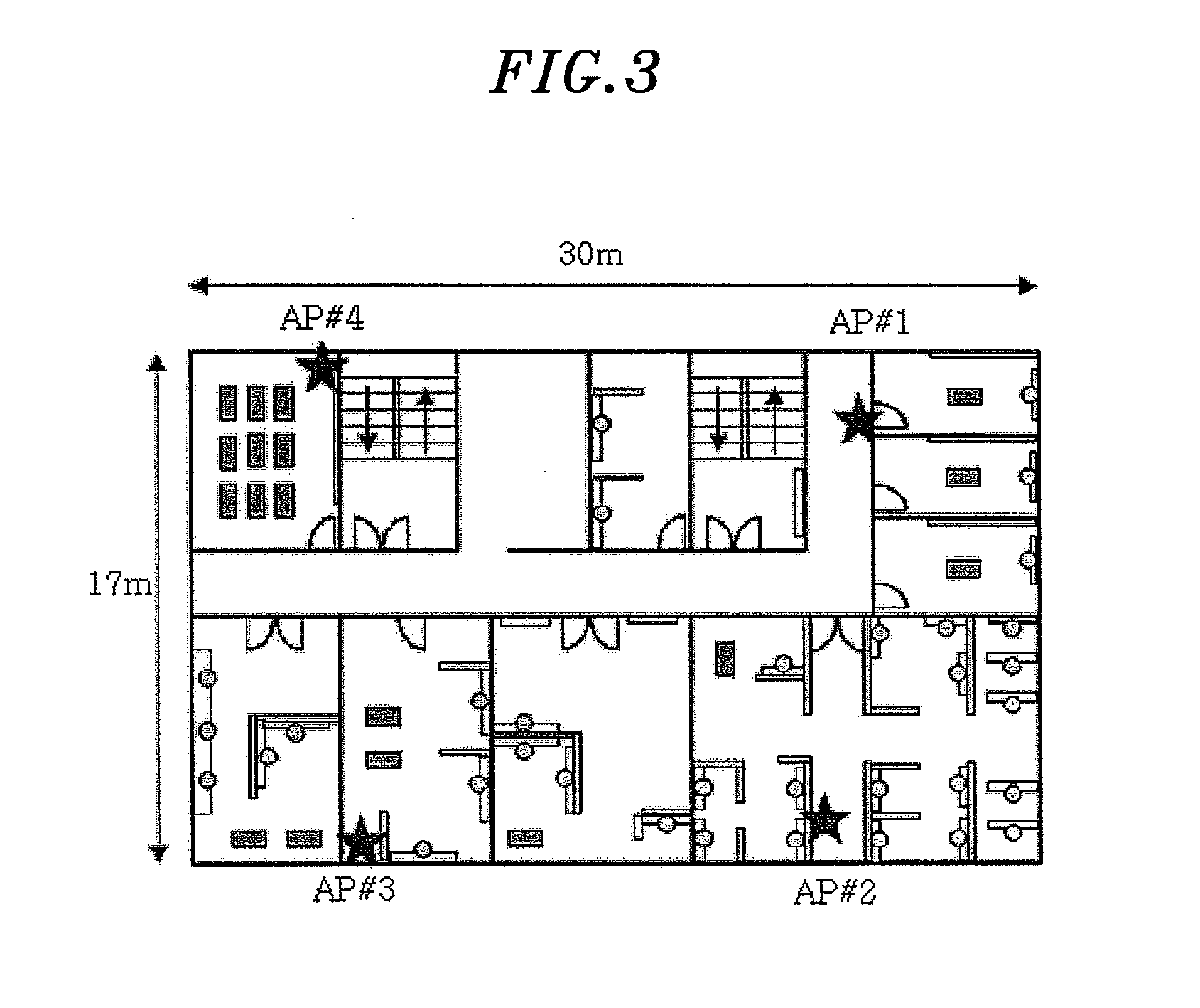
[0031]The first environment analysis tool 10 receives indoor environment information which includes indoor map information, indoor wall information, and location information of access points, in order to analyze indoor environments appropriate for indoor wireless location by using wireless communications systems (e.g., WLAN, Bluetooth, UWB, and the like). Under conditio...


PUM


Abstract

An environment analysis system for indoor wireless location by using locations of a plurality of access points (AP) includes, a first environment analysis tool (10) for receiving indoor environment information for indoor wireless location, performing a simulation for calculating location accuracies, performing a simulation for relocating and / or additionally installing the access points (AP), and displaying results of the simulation; and a second environment analysis tool (20) for receiving wireless communications signals from the access points (AP), calculating distances from the second environment analysis tool (20) to the access points (AP), calculating a location of the second environment analysis tool (20), calculating errors in the distances and in the location calculated, and providing the errors calculated to the first environment analysis tool (10). The first environment analysis tool (10) corrects errors in the simulations performed thereby by using the errors received from the second environment analysis tool (20), and then repeats the simulations and the displaying process.

Description

TECHNICAL FIELD[0001]The present invention relates to an environment analysis system and method; and, more particularly, to an environment analysis system and method for indoor wireless location, wherein the system and the method are for understanding construction status of indoor location infrastructure by using wireless communications systems such as WLAN (Wireless Local Area Network), Bluetooth, UWB (Ultra Wideband), and the like and for ensuring location reliability.BACKGROUND ART[0002]Since its development, a GPS (Global Positioning System) has been widely used as a location sensor in commercial car navigation systems. To be specific, by using location information of the car obtained via the GPS receiver, a variety of LBS (Location Based Services), e.g., a traffic guide, a location based information providing, and the like, is now provided.[0003]However, there are drawbacks that the GPS receiver cannot provide location information continuously because it happens that the GPS re...

Claims


Application Information

Patent Timeline
Patent Type & Authority Applications(United States)
IPC IPC(8): H04L12/26G01S5/02H04W16/20H04W16/22H04W24/02
CPCG01S5/021H04L12/66H04W24/02H04W16/225H04W16/20
Inventor CHO, SEONG YUNCHOI, WAN SIKKIM, BYUNG DOOCHO, YOUNG-SUPARK, JONG-HYUN
Owner ELECTRONICS & TELECOMM RES INST
Learn More