Method of measurement, processing and use of the data of the digital terrain model for objective evaluation of geometric parameters of measured object surfaces of the constructional parts and measuring device for performing the method
a technology of geometric parameters and digital terrain model, applied in the direction of instruments, process and machine control, can solve the problems of affecting the measurement accuracy of unpaved terrain, using at unpaved terrain, and eliminating the effect of measurement operator's error, so as to reduce the cost of construction, eliminate disputes, and accurately define and objectively measure characteristics
- Summary
- Abstract
- Description
- Claims
- Application Information
AI Technical Summary
Benefits of technology
Problems solved by technology
Method used
Image
Examples
example 1
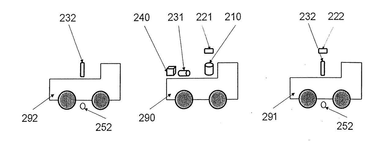
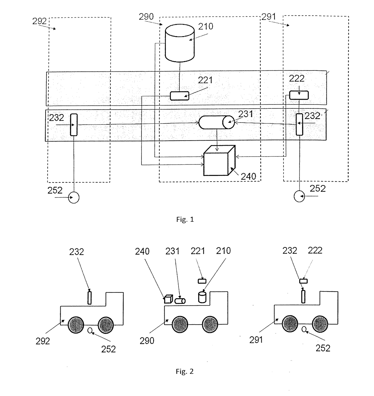
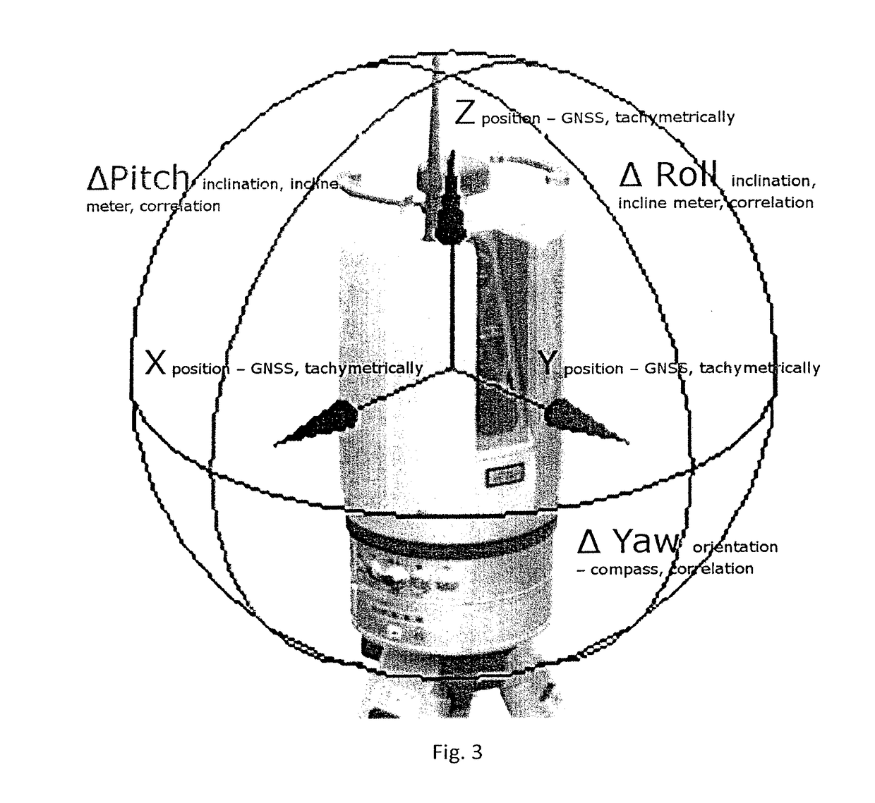
[0082]The surveying of the road using the Stop&go laser scanning method at the road construction of the Jino{hacek over (c)}anská connecting road, Prague 5. The capital city of Prague—the City Investor Department was the construction investor. The measurement was performed on 24 Sep. 2013 and it was connected to the setting-out network supplied by the investor. The detailed measurement was performed with the Riegl VZ-400 laser scanner, the scanner position was determined by the GNSS Trimble R5800, 4700 (Base-Rover). The approximate scanner levelling was performed with the internal sensor of the Riegl VZ-400 scanner. The approximate orientation was performed with an external compass. The data accuracy improvement was performed based on identical points which were surveyed from the polygonal traverse performed with the Leica TRC 1103 total station, connected to the geodetic point field. The detailed point measurement was performed with the laser scanner placed on the personal vehicle,...
example 2
[0083]The surveying of the road using the Stop&go laser scanning method on the D47 motorway (353,185-359,639 km of the D1 motorway). The Road and Motorway Directorate of the Czech Republic was the construction investor. The measurement was performed on 30 Oct. 2013, 2 Nov. 2013 and it was connected to the setting-out network supplied by the investor. The detailed measurement was performed with the Riegl VZ-400 laser scanner, the scanner position was determined with the GNSS Trimble R8 (Base-CZPOST Ostrava). The approximate scanner levelling was performed with the internal sensor of the Riegl VZ-400 scanner, the approximate orientation was performed by means of the cloud correlation to the data from the surrounding scan-positions. The data accuracy improvement was performed based on the identical points, which were surveyed by the GNSS method in terms of position and by the accurate levelling connected to the setting-out network in terms of elevation. The detailed point measurement w...
example 3
[0084]The surveying of the hall in a warehouse in Sweden—Schenker, ARLANDA STAD, Stockholm by means of the static laser scanning method. The Arlanda Hall was the construction investor. The measurement was performed on 14 Nov. 2010 and it was connected to the local geodetic point field. The detailed measurement was performed with the Leica HDS 6100 laser scanner, the scanner position was determined with the Leica TCR 1203+ total station. The approximate laser scanner levelling and orientation was performed by means of the cloud correlation to the data from the surrounding scan-positions. The data accuracy improvement was performed based on the identical points, which were surveyed in terms of position by the trigonometric method with the Leica TCR 1203+ total station and in terms of elevation by the accurate levelling connected to the geodetic point field with the NA3003 device. The detailed point measurement was performed with the laser scanner placed on the tripod; the point cloud ...
PUM
 Abstract
Description
Claims
Application Information
 - R&D
- Intellectual Property
- Life Sciences
- Materials
- Tech Scout
- Unparalleled Data Quality
- Higher Quality Content
- 60% Fewer Hallucinations
Browse by: Latest US Patents, China's latest patents, Technical Efficacy Thesaurus, Application Domain, Technology Topic, Popular Technical Reports.
© 2025 PatSnap. All rights reserved.Legal|Privacy policy|Modern Slavery Act Transparency Statement|Sitemap|About US| Contact US: help@patsnap.com


