Multi-target multi-sensor information amalgamation method based on convex optimized algorithm

A convex optimization algorithm, multi-sensor technology, applied in the direction of instruments, navigation calculation tools, satellite radio beacon positioning systems, etc., can solve problems such as unsatisfactory practical application, poor Kalman filtering performance, and easy interference.

Active Publication Date: 2008-08-20
BEIHANG UNIV
View PDF0 Cites 26 Cited by
  • Summary
  • Abstract
  • Description
  • Claims
  • Application Information

AI Technical Summary

Problems solved by technology

Most of the existing integrated navigation research focuses on the kalman filter design of inertial/GPS integrated navigation. The navigation error is estimated through the Kalman filter, but the Kalman filter effect is poor due to the uncertainty of the model and noise. Although there are EKF, UKF and other improved methods, but still subject to too strong assumptions that make the actual application situation unsatisfactory
The GPS signal is unstable, susceptible to interference, and the GPS si

Method used


Image

  • Multi-target multi-sensor information amalgamation method based on convex optimized algorithm
  • Multi-target multi-sensor information amalgamation method based on convex optimized algorithm
  • Multi-target multi-sensor information amalgamation method based on convex optimized algorithm

Examples


Embodiment Construction

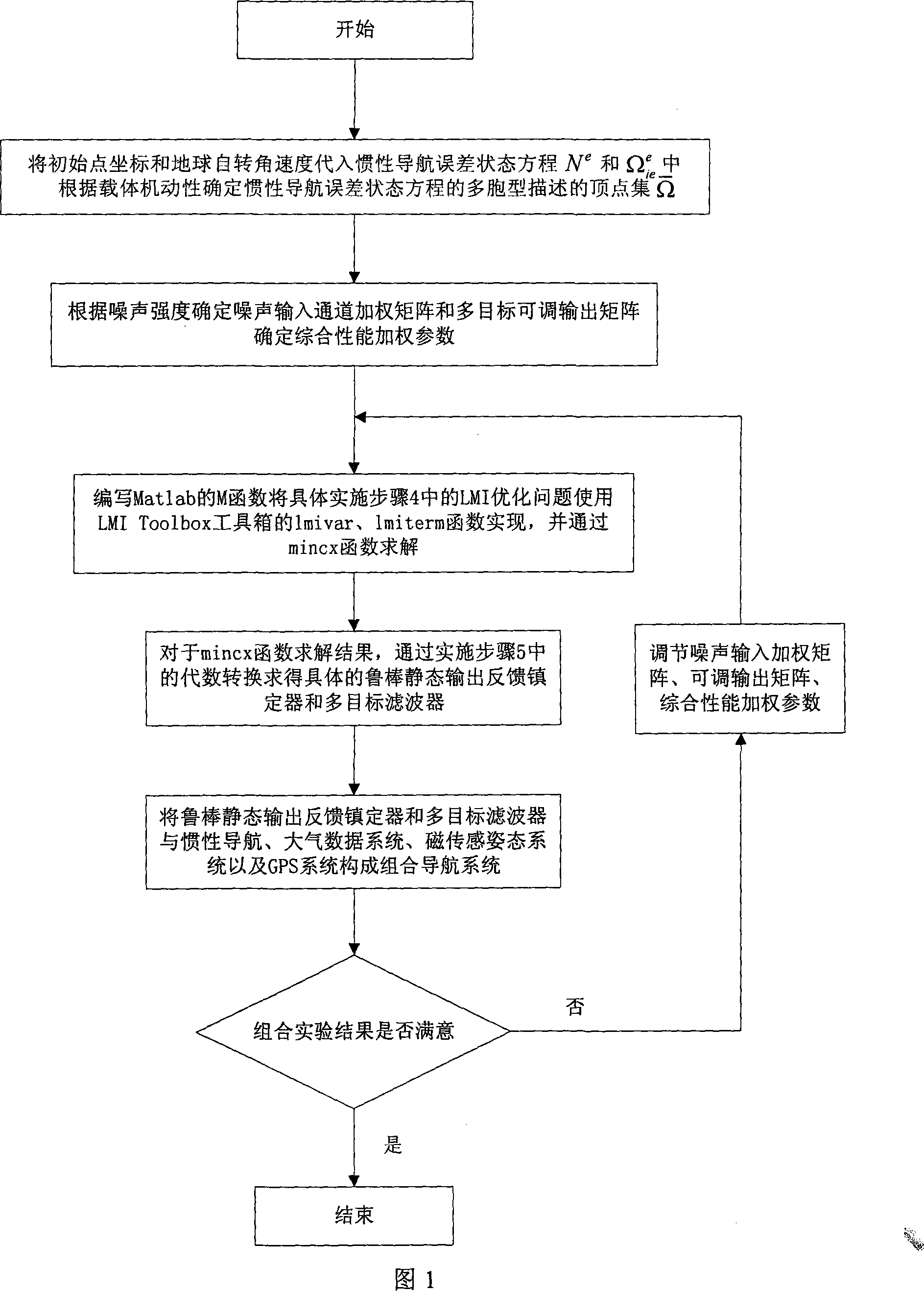
[0020] As shown in Figure 1, the specific implementation steps of the present invention are as follows:

[0021] 1. Take the change of parameters in the SINS error state equation in the earth coordinate system as the uncertainty of the system, and use the multicellular model of the uncertain system to describe the SINS error state equation in the Earth coordinate system.

[0022] Among them, the polymorphic description of establishing the error state equation of the strapdown inertial navigation system is as follows:

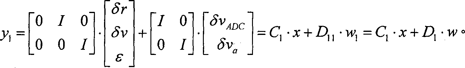
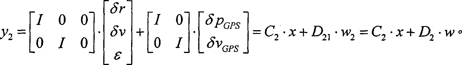
[0023] (1) Discretized earth coordinate system strapdown inertial navigation error state equation:

[0024] x(k+1)=A·x(k)+B 1 ·w 1 (k)=A·x(k)+B·w(k)

[0025] A = I + T 2 N e ...


PUM


Abstract

The invention discloses an information fusion method which has multiple targets and multiple sensors and is based on a convex optimization algorithm, and relates to an information fusion method of a combined navigation system of strapdown inertia, a GPS, an atmospheric data computer and a three-shaft magnetometer. Firstly, the information fusion method uses the speed and posture data of the atmospheric data computer and the three-shaft magnetometer for stabilizing an inertia navigation system, thus forming a combined internal navigation system of the strapdown inertia, the atmospheric data computer and the three-shaft magnetometer with high reliability and high independence; secondly, according to the optimal control idea of the modern control theory, the information fusion method uses the convex optimization algorithm for designing a robust multi-target filter for the fusion of high-precision position of the GPS and speed measurement information, thus forming an external system to implement the hybrid H2/H infinity/performance guarantee multi-target filtering on the internal system, thus improving the navigation precision of the whole system. The information fusion method completely exerts high reliability and usability of traditional navigation means and high precision of satellite navigation, and finally achieves the combined navigation technique with high reliability and high precision based on multiple sensors.

Description

technical field [0001] The invention relates to a multi-objective multi-sensor information fusion method, in particular to a multi-objective multi-sensor information fusion method based on a convex optimization algorithm, which is applicable to the technical field of aviation navigation, applicable to aircraft multi-sensor navigation, and also applicable to air navigation. Base and sea-based navigation and positioning. Background technique [0002] With the development of the national economy, navigation and positioning technology has increasingly become an indispensable technical means in traffic control, disaster relief, logistics management, land survey, survey and other fields; the realization of the efficiency of weapon launch platforms in the military field and the precise strike of fire weapons Rely on high-precision, high-reliability navigation means. At present, there are many navigation means, but none of them can meet the requirements alone. Combining multiple te...

Claims


Application Information

Patent Timeline
IPC IPC(8): G01C21/00G01C21/20G01C21/26G01S5/02G01S19/49
Inventor 郭雷王利学房建成
Owner BEIHANG UNIV
Why Eureka
Try Eureka