

Remote-sensing wild automatic monitoring system and method for shallow lakes
An automatic monitoring and lake technology, applied in open-air water source surveys, photogrammetry/video surveying, measurement devices, etc., can solve problems such as synchronization effects, satellite data atmospheric correction errors, interference, etc., to achieve system security, stability and guarantee. Stable operation and improved resistance
- Summary
- Abstract
- Description
- Claims
- Application Information
AI Technical Summary
Problems solved by technology
Method used
Image

Examples
Embodiment 1
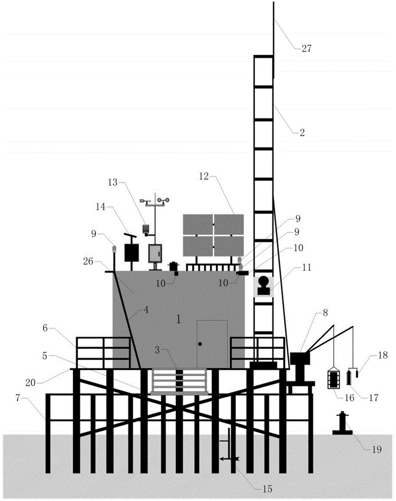
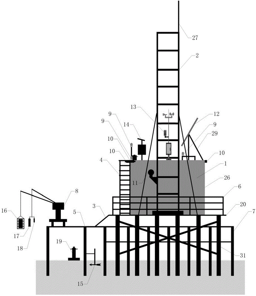
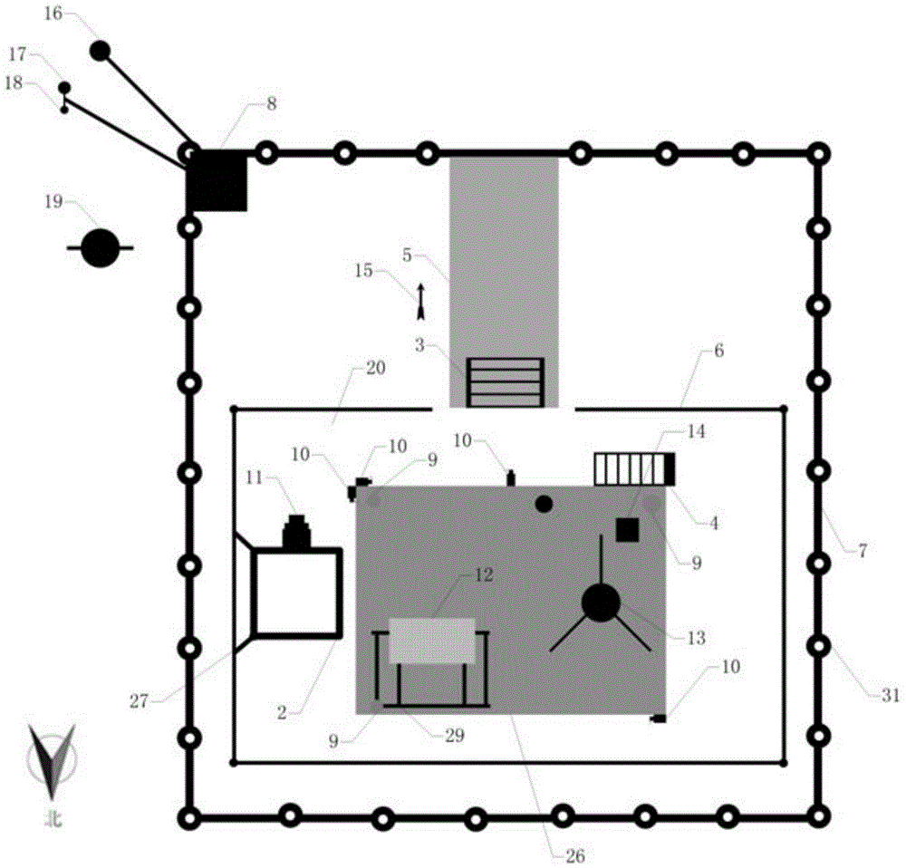
[0078] Figure 1a , 1b, 1c and 1d are schematic diagrams of the structure of the present invention, as shown in the figure, a remote sensing field automatic monitoring system for shallow lakes, the system includes a support platform, a power supply system, a data acquisition system, a data transmission system, and a data center.
[0079] The supporting platform must be 1m higher than the historical highest water level in the water area where it is located. It is supported by a total of 48 pipe piles, each of which is 8m long and driven into the bottom of the lake about 3m. A rainproof instrument room 26 is set up, and at the same time, in order to facilitate platform operations, a stainless steel ladder 4 is welded on one side of the instrument room 2 to reach the roof, and the maintenance of the roof weather station system 13 and solar panel system 12 is carried out, and the imaging spectrometer on the other side The observation tower 2 is provided with a small operating platf...
Embodiment 2
[0088] figure 2It is a flowchart of the present invention, as shown in the figure, a lake water color remote sensing field automatic monitoring method using the lake remote sensing field automatic monitoring system described in Embodiment 1, the method includes the following steps:
[0089] (1) Use the solar battery pack 12 to convert solar energy into electrical energy and store it in the storage battery pack 28 on sunny days; 18. The power source of the water surface imaging spectrum acquisition system 11, the underwater spectrometer 19 and the backscattering instrument 16, light absorption meter 17 and communication module 22 of the underwater light field synchronous monitoring system;
[0090] (2) Use the camera 10 to collect video images of the water surface within a radius of 500m; then, according to the characteristics of algal blooms or water color changes on the surface of the lake, extract and transmit the water color change information in the image to the data cent...
PUM
 Abstract
Description
Claims
Application Information