

Method for establishing and analyzing drought index based on gravity satellite
A drought index and analysis method technology, applied in the interdisciplinary field, can solve the problems such as the drought index has not been reported, cannot well represent the overall situation of the region, and lacks the measured data of soil water content in the basin.
- Summary
- Abstract
- Description
- Claims
- Application Information
AI Technical Summary
Problems solved by technology
Method used
Image

Examples
Embodiment approach
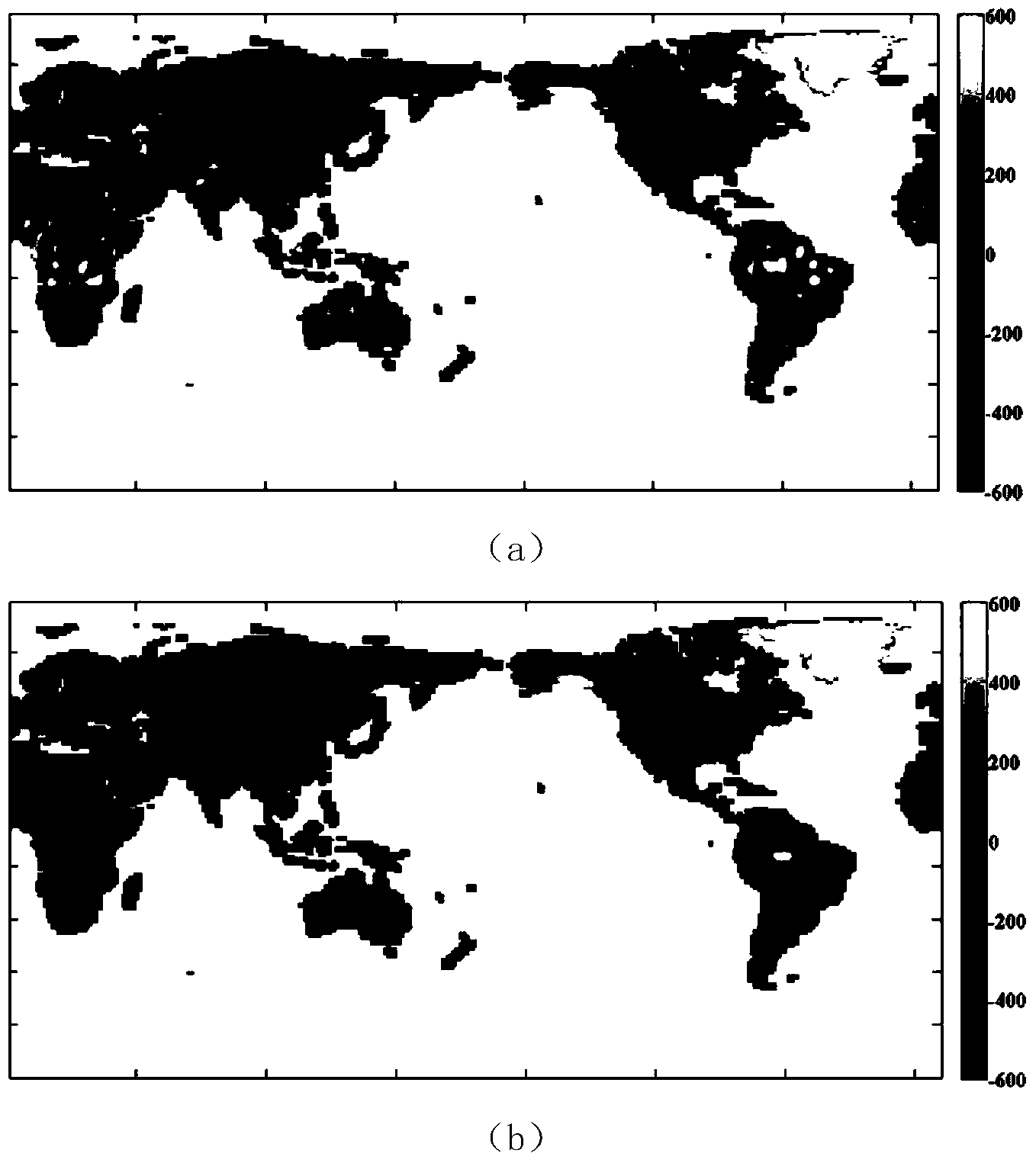
[0063] control figure 2 ,Such as figure 2 As shown in (a), the total land water volume signal retrieved from the unpreprocessed GRACE gravity satellite data is covered by the south-north direction strip noise and high-order term noise, and it is difficult to identify the effective total land water volume change signal. C obtained by satellite laser ranging observation 20 term to C of the GRACE gravity potential model 20 The term has been replaced; use a 5th order polynomial to perform polynomial fitting on the coefficients of each order above 8 in each month's gravity field model to remove the relevant errors of the higher order term; and use an isotropic Gaussian smoothing filter with a smoothing radius of 200km to remove the GRACE Effects of errors in higher-order terms of a gravity field model. Such as figure 2 As shown in (b), the noise of the total land water volume retrieved by the preprocessed GRACE gravity field model is greatly reduced, and the hydrological sig...
PUM
 Abstract
Description
Claims
Application Information