
Robot positioning method based on wireless sensor network and geomagnetic map
A wireless sensor and robot positioning technology, which is applied to instruments, ground navigation, surveying and navigation, etc., can solve the problems of strong data randomness and data loss
Patent Information
- Authority / Receiving Office
- CN · China
- Patent Type
- Applications(China)
- Current Assignee / Owner
- Publication Date
- 2016-11-16
- Estimated Expiration
- Not applicable · inactive patent
Smart Images
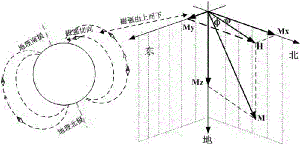
Figure 1 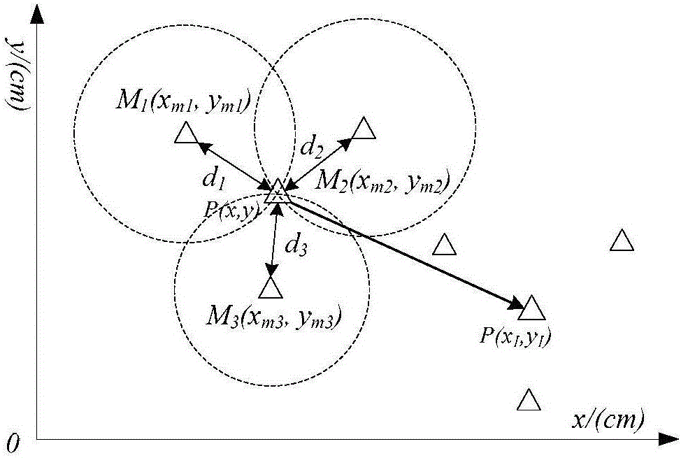
Figure 2 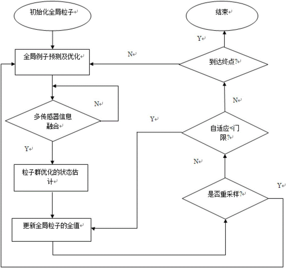
Figure 3
Abstract
Description
technical field
[0001] The patent of the present invention relates to the field of indoor positioning of mobile robots, in particular to a robot positioning method based on a wireless sensor network and a geomagnetic map. Background technique
[0002] With the continuous development of modern technology in our country, robot technology has developed rapidly, and the application of robots has become more and more extensive. At present, the existing robot positioning system has high complexity of positioning calculation, low real-time effectiveness, positioning error, and the increase of relative observation is not proportional to the positioning accuracy. Real-time positioning in a wireless sensor network (WSN) environment is a key technology in the field of mobile robot navigation. The advantage of introducing robot positioning into WSN is that sensor network nodes can be used as specific signs for robot positioning, which simplifies the traditional SLAM (simultaneous Local...
Examples
Embodiment Construction
[0066] In order to make the above-mentioned purposes, features and advantages of the present invention more obvious and understandable, the following comparison Figure 1-5 The robot positioning method based on wireless sensor network and geomagnetic map of the present invention is described in detail:
[0067] The overall process of the robot positioning method based on the wireless sensor network and the geomagnetic map implemented according to the present invention is as follows: Figure 5 . It is characterized in that comprising the steps of:
[0068] Step S1: Use the geomagnetic acquisition module MPU6050 to collect geomagnetic data in the indoor area, and save it to the robot SQLserver database, where the interval between the collection points is 1m, which forms a Geomagnetic data is collected at the vertices of the grid, and each point is stored in the database in the form of geomagnetic data + position coordinates to prepare for the geomagnetic matching process when...