

Sponge city construction underlying surface nested remote sensing refined drawing method
A sponge city, refined technology, applied in the application field of geographic information and remote sensing technology, can solve the problems of the same object with different spectrum or the same spectrum foreign object, big difference, many types of artificial building materials, etc., to achieve high classification accuracy, low cost, application strong effect
- Summary
- Abstract
- Description
- Claims
- Application Information
AI Technical Summary
Problems solved by technology
Method used
Image

Examples
Embodiment Construction
[0033] The present invention will be described in detail below in conjunction with the accompanying drawings and embodiments.
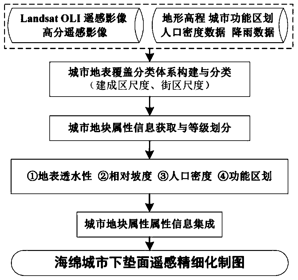
[0034] like figure 1 As shown, a kind of sponge city construction underlying surface nested type remote sensing refined mapping method of the present invention can be illustrated by the following implementation examples.
[0035] The first step is to collect and sort out all kinds of data required for fine mapping and intelligent calculation of the underlying surface of the sponge city construction.
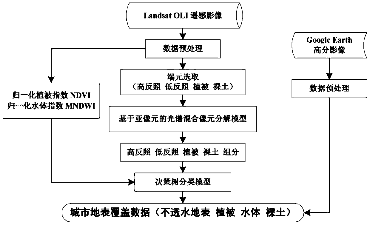
[0036] Specifically, the data required for fine mapping and intelligent calculation of the underlying surface of the sponge city construction include LandsatOLI remote sensing image data, high-resolution remote sensing image data, terrain elevation data, urban functional zoning data, and precipitation data to form a fine-grained underlying surface of the sponge city. Mapping and intelligent computing database.
[0037] The second step is to construct a...
PUM
 Abstract
Description
Claims
Application Information