Point, line and plane obstacle model construction-based station real-time emergency response path planning method

A path planning and obstacle technology, which is applied in the field of station real-time emergency path planning based on the point-line-plane obstacle model, can solve the problems of heavy data modification workload, high computational complexity, and inability to build maps, etc., to increase practicality Sexuality and innovation, ensuring safety, and improving office efficiency

Inactive Publication Date: 2019-06-18
HEBEI UNIV OF TECH
View PDF5 Cites 16 Cited by
  • Summary
  • Abstract
  • Description
  • Claims
  • Application Information

AI Technical Summary

Problems solved by technology

[0004] For the current indoor path planning algorithms such as the D-K algorithm, the workload of data modification in the early stage is large, the indoor road network needs to extract a large amount of information from the data used by the improved A* algorithm, and the genetic algorithm and ant colony algorithm of the intelligent bionic algorithm are used in practical applications. The computational complexity in the existing path planning method is too high, the traditional path planning method su

Method used


Image

  • Point, line and plane obstacle model construction-based station real-time emergency response path planning method
  • Point, line and plane obstacle model construction-based station real-time emergency response path planning method
  • Point, line and plane obstacle model construction-based station real-time emergency response path planning method

Examples


Embodiment 1

[0085] The real-time emergency route planning method for stations constructed based on the point, line and surface obstacle model in this embodiment includes the following steps:

[0086] Step 1: Establish an environmental map of station security personnel:

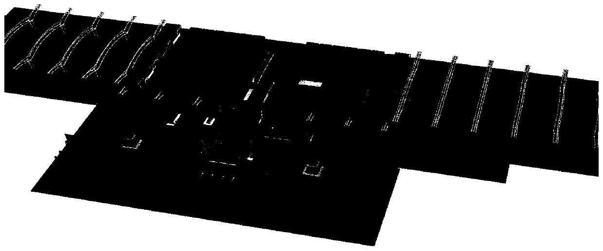
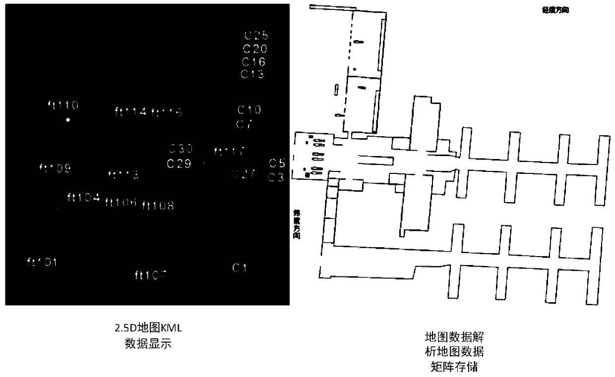
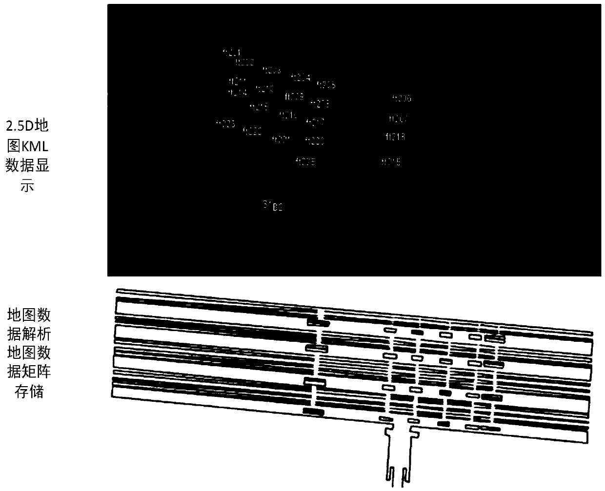
[0087] 1-1. Data collection: Take a three-story railway station in China as an example. The first floor is mainly the ticket hall, the second floor platform, and the third floor waiting room. figure 1 , The point cloud data of the station to be planned collected by the laser scanner is converted to 3ds format and imported into 3dmax; the localspace software is used to draw a rough outline, and the buildings and equipment related to path planning are marked in advance whether they are passing or up and down Line attributes, floor information, the buildings and equipment refer to elevators, artificial escalators, exit passages, security personnel’s special escalators, etc., to assist in completing the storage of map information, ...


PUM


Abstract

The invention relates to a point, line and plane obstacle model construction-based station real-time emergency response path planning method. With the method adopted, it can be ensured that an algorithm can calculate a three-dimensional optimal path in real time after a station emergency event without losing the position information of fixed obstacles in indoor environments. According to the coreidea of the method, before path planning, data processing is performed on the overall architectural design planar graph of a station in advance; obstacle map construction work in an entire area is completed; information is recorded in a server, so that system operation time can be shortened; with special conditions such as a condition that some escalators inside the station move upwards and downwards, and a condition that some escalators from a waiting room to a platform can only go downwards, and passengers can only go upwards through stairs, are considered, upward movement and downward movement attribute information and other attribute information are added to path cost, and therefore, a planed path can be in line with actual and situations; and by means of accurate and real-time path planning, station security personnel are guided to complete handling work in an emergency efficiently.

Description

Technical field [0001] The invention belongs to the field of intelligent security technology, and specifically relates to a real-time emergency route planning method for a station based on a point, line and surface obstacle model. Background technique [0002] In modern life, with the continuous penetration of the Internet and smart media, it has greatly facilitated people's travel. We are more and more inseparable from the help of the navigation system when we are away from home. The outdoor navigation system technology is quite mature, but there is still room for development in indoor navigation. The key point is the selection of the best indoor positioning solution, the modeling of indoor maps, and the Research on optimization of indoor navigation algorithm performance. At present, indoor navigation has yet to be further developed. So far, there is no uniform industry standard, and it is only designed for specific environments. Liu Xiaoxiao of China University of Mining and ...

Claims


Application Information

Patent Timeline
IPC IPC(8): G01C21/20
Inventor 郭欣孙连浩王红豆
Owner HEBEI UNIV OF TECH
Why Eureka
Try Eureka