Vegetation height analysis method and system based on satellite remote sensing stereo imaging pair
A technology of three-dimensional imaging and satellite remote sensing, applied in image analysis, image enhancement, image data processing, etc., can solve the problem of difficult to achieve vegetation height analysis in large areas, and achieve the effect of convenient data update and strong timeliness
- Summary
- Abstract
- Description
- Claims
- Application Information
AI Technical Summary
Problems solved by technology
Method used
Image
Examples
Embodiment 1
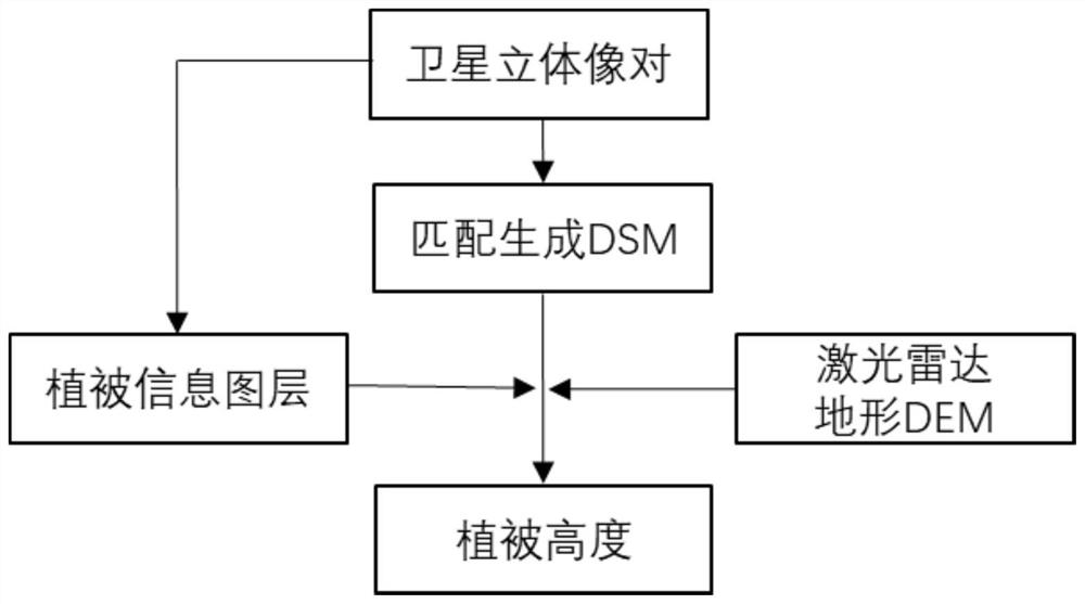
[0069] In order to overcome the high cost of obtaining original images in the existing technology, it is greatly affected by weather and airspace, the production period is long, and the data update is inconvenient, the timeliness cannot be guaranteed, and it is difficult to estimate the vegetation height in large areas , for forests with high vegetation coverage density, it is difficult to obtain the shadow of standing trees on the ground in the image, and it cannot be used for the extraction of height information of dense forest stands. This embodiment provides a vegetation image based on satellite remote sensing stereo imaging The height analysis method, its overall flow chart is as follows figure 1 shown. This method is implemented by:
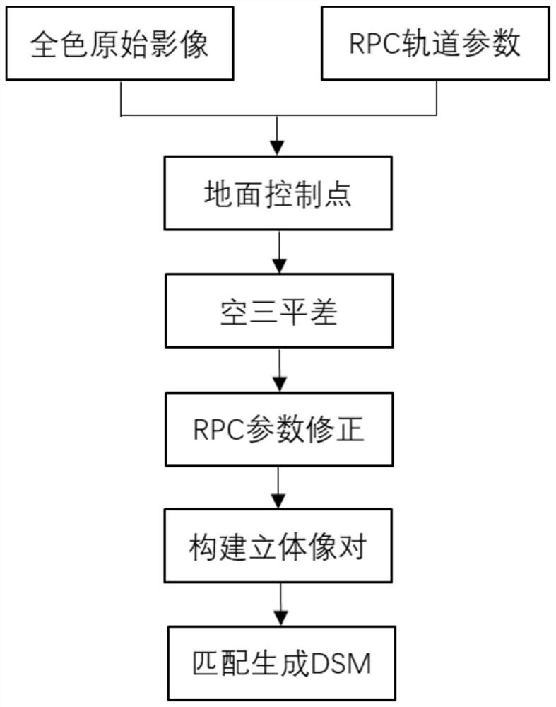
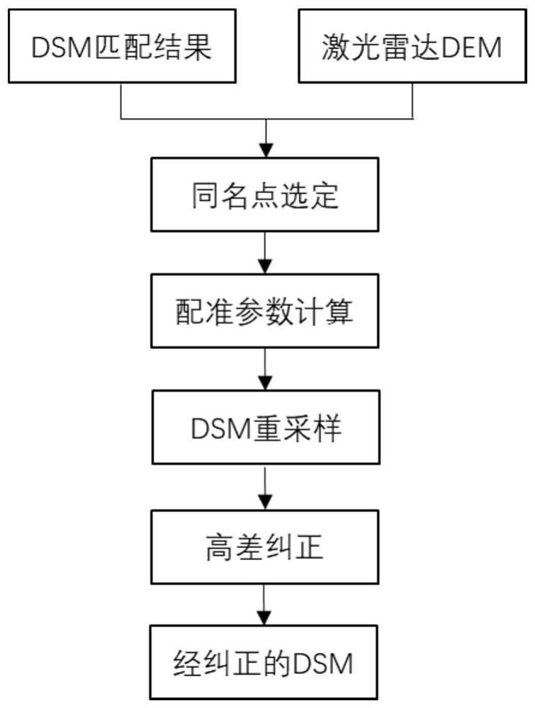
[0070] Step 1: Obtain the original satellite image and the satellite stereo image pair file, construct the stereo image pair, and use the stereo image pair to generate a digital surface model. The production process of the digital surface ...
Embodiment 2
[0102] A vegetation height analysis system based on satellite remote sensing stereo imaging pairs, comprising:
[0103] The data collection module is used to collect satellite original images and satellite stereo imaging pair files;
[0104] Stereo image pair construction module, used for constructing stereo image pair according to satellite original image and satellite stereo imaging pair file;
[0105] A digital surface model generating module, configured to generate a digital surface model using the stereo pair matching;
[0106] A configuration module, configured to register the digital surface model and the digital elevation model, and eliminate the elevation reference difference between the digital surface model and the digital elevation model;
[0107] A data preprocessing module, configured to process the original satellite image to obtain a standard satellite image;
[0108] A training sample selection module, configured to select training samples from the standard sa...
PUM
 Abstract
Description
Claims
Application Information
 - R&D
- Intellectual Property
- Life Sciences
- Materials
- Tech Scout
- Unparalleled Data Quality
- Higher Quality Content
- 60% Fewer Hallucinations
Browse by: Latest US Patents, China's latest patents, Technical Efficacy Thesaurus, Application Domain, Technology Topic, Popular Technical Reports.
© 2025 PatSnap. All rights reserved.Legal|Privacy policy|Modern Slavery Act Transparency Statement|Sitemap|About US| Contact US: help@patsnap.com


