[0009] In accordance with the present invention, systems and methods are described for acquiring marine seismic data that may provide improved resolution seismic imaging and greater re-position accuracy compared with presently employed systems and methods. The systems and methods of the invention are particularly well-suited for collecting 4-D marine seismic data, although they may also be used for 3-D seismic data collection.
[0018] In certain embodiments the spread may be deployed and retrieved by stand-by vessels and supply vessels available for charter or supplied by the
client, therefore saving some of the expense of tailor made seismic vessels. The spread
handling system may be containerized, and the size of the spread may be limited by the capacity of the containerized
handling system.
[0021] Yet other systems of the invention allow placement of seismic acoustic receivers in positions that reduce
ghosting (the unwanted
seismic wave field reflected off the sea surface). Designing systems of the invention that sense the direction of propagation in the
vertical plane of the
wave field will improve the frequency content of the
signal and importantly also allow for operating the
recording system deeper and away from the sea surface. Ghost
elimination may also be achieved by allowing for a floating
recording system wherein the sensors sit on the sea surface. In some embodiments, hydrophones may be placed with a
vertical distance between them. If the required
vertical distance is small this may be dealt with in the design of a sensor mounting, where two vertically spaced hydrophones are mounted in the same housing. If the required distance is larger, the systems may employ a 3-D grid, such as a
tensegrity grid. In other embodiments, hydrophones and accelerometers are combined in a sensor mounting, where the hydrophones measure the pressure pulse and the
accelerometer determines the direction of the wave wield. These embodiments have the
advantage that they may be operated at depths further away from the sea surface than traditional systems, hence increasing the weather window often limited by swell noise. In yet other embodiments, the
system is placed at the sea surface and
water particle velocity is measured at the free surface using either an
accelerometer or other instruments suitable for this purpose. In yet other embodiments a
system of the invention may be placed on the sea floor, and
ghosting may be eliminated entirely by positioning the system on the sea surface.
[0023] Certain embodiments of the invention may employ
tensegrity structures as the instrument support, for the controlled boundary, or both. The
tensegrity concept appeared as a structural art form about half a century ago and was invented by Buckminster Fuller and Kenneth Snelson (see for example www.kennethsnelson.net / ). The concept comprises a combination of tension members like ropes, wires, etc, and compression members. Combining these two member types one can build up large lightweight rigid and semi-rigid structures, and by controlling the length of some or all of the tension members one is able to dramatically alter the shape of the whole structure. Currently the concept is used to design fish farms that can be designed to alter shape in accordance with
wave loading.
[0029] Systems of the invention for acquiring marine seismic data may utilize sequential source shooting or, alternatively, two or more sources may be shot simultaneously, with the sources being encoded so that they may be distinguished during
data interpretation. For the same nominal
shot point interval, firing two or more sources simultaneously may reduce the shot time interval on each source line compared with sequential shooting.
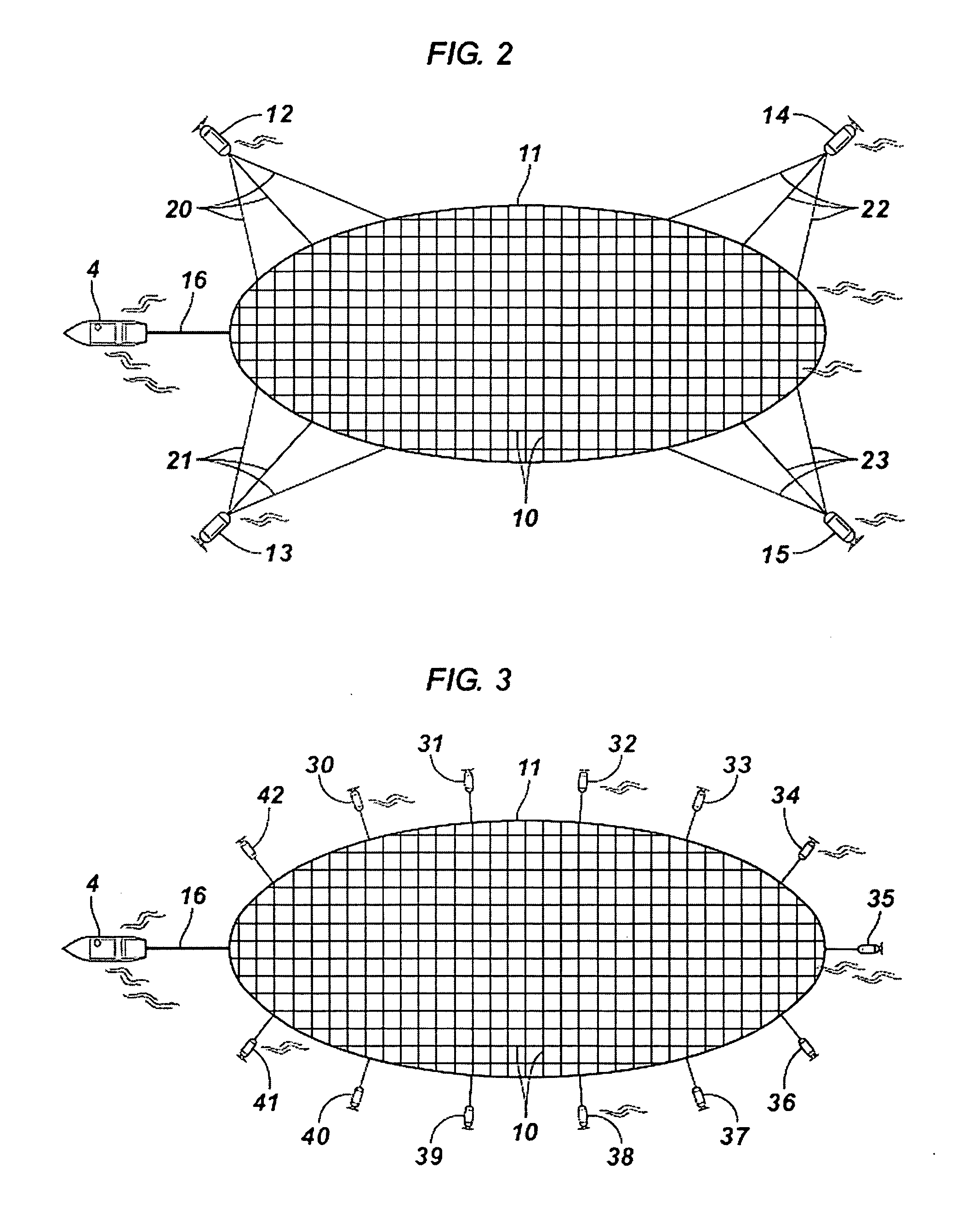
[0033] Methods of the invention include those wherein the surveying includes controlling the boundary to shift the spread laterally to the next recording line. During this operation (shifting to the next line)
data recording may continue. While systems and methods of the invention largely eliminate the need to perform turns as in towed seismic streamer data acquisition in order to position the spread for the next line, systems of the invention could be used in this way as well. Controlling the boundary properly should, however, eliminate the need for turning. Methods of the invention include positioning the controllable boundary to acquire wide- and / or full
azimuth seismic surveys.

